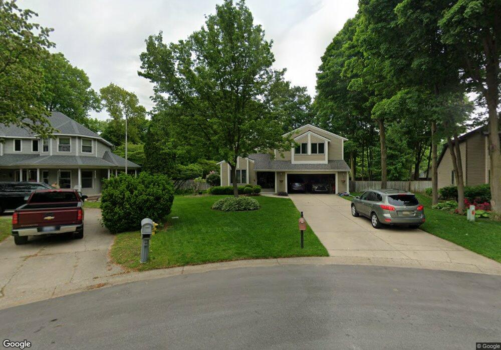
7199 Gettysburg Dr Hudsonville, MI 49426
Estimated Value: $462,926 - $513,000
3
Beds
4
Baths
1
Sq Ft
$481,232/Sq Ft
Est. Value
About This Home
This home is located at 7199 Gettysburg Dr, Hudsonville, MI 49426 and is currently estimated at $481,232, approximately $481,232 per square foot. 7199 Gettysburg Dr is a home located in Ottawa County with nearby schools including Bauer Elementary School, Baldwin Street Middle School, and Hudsonville Freshman Campus.
Ownership History
Date
Name
Owned For
Owner Type
Purchase Details
Closed on
Nov 21, 2020
Sold by
Scholten William H
Bought by
Simmons Raymond C and Simmons Sandra R
Current Estimated Value
Home Financials for this Owner
Home Financials are based on the most recent Mortgage that was taken out on this home.
Original Mortgage
$155,000
Outstanding Balance
$137,928
Interest Rate
2.8%
Mortgage Type
New Conventional
Estimated Equity
$343,304
Create a Home Valuation Report for This Property
The Home Valuation Report is an in-depth analysis detailing your home's value as well as a comparison with similar homes in the area
Home Values in the Area
Average Home Value in this Area
Purchase History
| Date | Buyer | Sale Price | Title Company |
|---|---|---|---|
| Simmons Raymond C | -- | None Available |
Source: Public Records
Mortgage History
| Date | Status | Borrower | Loan Amount |
|---|---|---|---|
| Open | Simmons Raymond C | $155,000 |
Source: Public Records
Tax History Compared to Growth
Tax History
| Year | Tax Paid | Tax Assessment Tax Assessment Total Assessment is a certain percentage of the fair market value that is determined by local assessors to be the total taxable value of land and additions on the property. | Land | Improvement |
|---|---|---|---|---|
| 2025 | $4,066 | $234,700 | $0 | $0 |
| 2024 | $3,519 | $231,800 | $0 | $0 |
| 2023 | $3,361 | $223,500 | $0 | $0 |
| 2022 | $3,693 | $205,000 | $0 | $0 |
| 2021 | $3,235 | $165,700 | $0 | $0 |
| 2020 | $3,201 | $155,900 | $0 | $0 |
| 2019 | $3,206 | $145,600 | $0 | $0 |
| 2018 | $2,988 | $126,500 | $0 | $0 |
| 2017 | $2,934 | $125,100 | $0 | $0 |
| 2016 | $2,917 | $119,900 | $0 | $0 |
| 2015 | $2,784 | $116,400 | $0 | $0 |
| 2014 | $2,784 | $108,500 | $0 | $0 |
Source: Public Records
Map
Nearby Homes
- 6950 Meadowcreek Dr
- 6863 Bridgeport Dr
- 6821 Bridgeport Dr
- 4101 Blair St
- 4106 Blair St
- 4087 Baldwin St
- 0 Baldwin St
- 3617 Teton Dr
- 4663 Hidden Ridge Dr Unit lot 38
- 7918 Westside Dr
- 3528 Tearose Dr
- 4672 Lexem Dr
- 4717 Lexem Dr Unit Lot 41
- 7318 Alycia Dr
- 4699 Lexem Dr
- 6584 Moss Lake Dr
- 3544 Nobb Hill Dr
- 6561 Van Dam Ave
- 6530 Van Dam Ave Unit 3
- 3808 Port Sheldon St
- 7195 Gettysburg Dr
- 7194 Gettysburg Dr
- 4290 Yorkshire Dr
- 4300 Yorkshire Dr
- 7172 Georgetown Ave
- 4278 Yorkshire Dr
- 7189 Gettysburg Dr
- 7188 Gettysburg Dr
- 4318 Glen Hollow Dr
- 4302 Glen Hollow Dr
- 7164 Georgetown Ave
- 7178 Georgetown Ave
- 4334 Glen Hollow Dr
- 4306 Yorkshire Dr
- 7185 Gettysburg Dr
- 4266 Yorkshire Dr
- 7162 Gettysburg Dr
- 4350 Glen Hollow Dr
- 7154 Georgetown Ave
- 7132 Gettysburg Dr