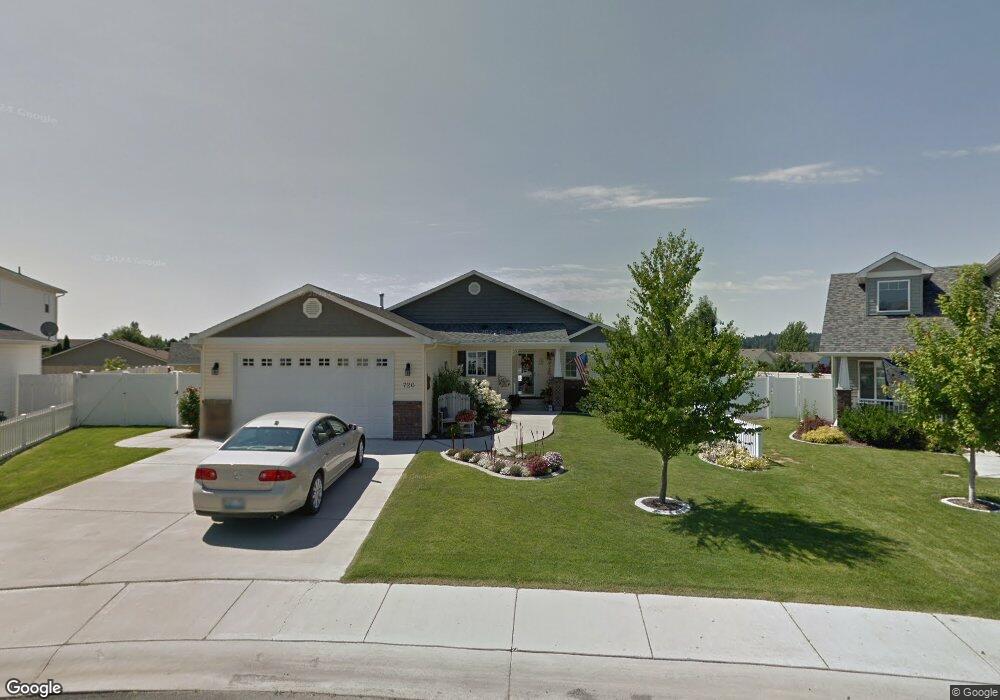
720 E Carrie Dr Medical Lake, WA 99022
Estimated Value: $394,000 - $423,000
3
Beds
2
Baths
1,400
Sq Ft
$289/Sq Ft
Est. Value
About This Home
This home is located at 720 E Carrie Dr, Medical Lake, WA 99022 and is currently estimated at $403,980, approximately $288 per square foot. 720 E Carrie Dr is a home located in Spokane County with nearby schools including Medical Lake High School.
Ownership History
Date
Name
Owned For
Owner Type
Purchase Details
Closed on
Aug 28, 2007
Sold by
Markham Homes Inc
Bought by
Patterson Donna
Current Estimated Value
Home Financials for this Owner
Home Financials are based on the most recent Mortgage that was taken out on this home.
Original Mortgage
$167,200
Outstanding Balance
$106,778
Interest Rate
6.74%
Mortgage Type
Purchase Money Mortgage
Estimated Equity
$297,202
Create a Home Valuation Report for This Property
The Home Valuation Report is an in-depth analysis detailing your home's value as well as a comparison with similar homes in the area
Home Values in the Area
Average Home Value in this Area
Purchase History
| Date | Buyer | Sale Price | Title Company |
|---|---|---|---|
| Patterson Donna | $209,000 | Transnation Title Ins Co |
Source: Public Records
Mortgage History
| Date | Status | Borrower | Loan Amount |
|---|---|---|---|
| Open | Patterson Donna | $167,200 |
Source: Public Records
Tax History Compared to Growth
Tax History
| Year | Tax Paid | Tax Assessment Tax Assessment Total Assessment is a certain percentage of the fair market value that is determined by local assessors to be the total taxable value of land and additions on the property. | Land | Improvement |
|---|---|---|---|---|
| 2025 | $3,450 | $370,500 | $90,000 | $280,500 |
| 2024 | $3,450 | $369,700 | $85,000 | $284,700 |
| 2023 | $3,103 | $384,300 | $80,000 | $304,300 |
| 2022 | $3,036 | $369,300 | $65,000 | $304,300 |
| 2021 | $2,805 | $258,100 | $40,000 | $218,100 |
| 2020 | $2,330 | $222,600 | $35,000 | $187,600 |
| 2019 | $2,077 | $198,900 | $35,000 | $163,900 |
| 2018 | $2,024 | $178,900 | $35,000 | $143,900 |
| 2017 | $1,797 | $163,300 | $35,000 | $128,300 |
| 2016 | $1,864 | $161,200 | $35,000 | $126,200 |
| 2015 | $1,991 | $166,600 | $36,000 | $130,600 |
| 2014 | -- | $166,600 | $36,000 | $130,600 |
| 2013 | -- | $0 | $0 | $0 |
Source: Public Records
Map
Nearby Homes
- 1027 N Stanley St
- 805 E Justin Ave S
- 730 E Kathy Lee Ave
- 931 N Stanley St
- 7709 S Keene Rd
- 614 N Grant Ave
- xxx W Brooks Rd
- 12000 S Meadow Rd Unit approx address
- 18307 W Barker Rd
- 403 N Jefferson St
- 1212 S Brooks Rd
- 716 W 6th St
- XXX W Thorpe Ave
- 1228 E Lake St
- 122 E Lake St
- 500 E Campbell St Unit 35
- 204 E Campbell St
- 423 S Brower St
- 520 S Stanley St
- 522 S Stanley St
- 722 E Carrie Dr
- 1103 N Carrie Dr
- 719 E Tara Lee Ave
- 717 E Tara Lee Ave
- 721 E Tara Lee Ave
- 715 E Tara Lee Ave
- 724 E Carrie Dr
- 723 E Tara Lee Ave
- 713 E Tara Lee Ave
- 725 E Tara Lee Ave
- 721 E Carrie Dr
- 1105 N Carrie Dr
- 723 E Carrie Dr
- 726 E Carrie Dr
- 711 E Tara Lee Ave
- 727 E Tara Lee Ave
- 1109 N Carrie Dr
- 725 E Carrie Dr
- 709 E Tara Lee Ave
- 729 E Tara Lee Ave