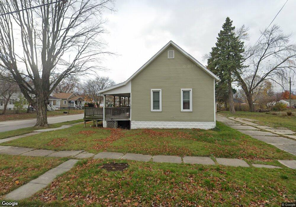
721 15th St Port Huron, MI 48060
Estimated Value: $63,000 - $208,000
--
Bed
--
Bath
--
Sq Ft
6,534
Sq Ft Lot
About This Home
This home is located at 721 15th St, Port Huron, MI 48060 and is currently estimated at $139,667. 721 15th St is a home located in St. Clair County with nearby schools including Michigamme Elementary School, Central Middle School, and Port Huron High School.
Ownership History
Date
Name
Owned For
Owner Type
Purchase Details
Closed on
Dec 1, 2022
Sold by
Property Management Wolf
Bought by
Prater John
Current Estimated Value
Purchase Details
Closed on
Apr 12, 2016
Sold by
Martin Christopher Wade
Bought by
Rogers Antoinette
Purchase Details
Closed on
Nov 11, 2010
Sold by
County Of St Clair
Bought by
Martin Christopher Wade
Purchase Details
Closed on
Feb 16, 2007
Sold by
Moeller Larry John
Bought by
Scott Moelle Llc
Purchase Details
Closed on
Jun 8, 2006
Sold by
Moeller Larry J and Moeller Stephanie L M
Bought by
Citizens First Savings Bank
Create a Home Valuation Report for This Property
The Home Valuation Report is an in-depth analysis detailing your home's value as well as a comparison with similar homes in the area
Home Values in the Area
Average Home Value in this Area
Purchase History
| Date | Buyer | Sale Price | Title Company |
|---|---|---|---|
| Prater John | $8,000 | -- | |
| Rogers Antoinette | -- | None Available | |
| Rogers Antoinette | -- | Ata National Title | |
| Martin Christopher Wade | -- | None Available | |
| Scott Moelle Llc | $5,000 | None Available | |
| Citizens First Savings Bank | $9,290 | None Available |
Source: Public Records
Tax History Compared to Growth
Tax History
| Year | Tax Paid | Tax Assessment Tax Assessment Total Assessment is a certain percentage of the fair market value that is determined by local assessors to be the total taxable value of land and additions on the property. | Land | Improvement |
|---|---|---|---|---|
| 2025 | $847 | $5,700 | $0 | $0 |
| 2024 | $281 | $5,000 | $0 | $0 |
| 2023 | $288 | $5,400 | $0 | $0 |
| 2022 | $308 | $4,900 | $0 | $0 |
| 2021 | $337 | $5,400 | $0 | $0 |
| 2020 | $384 | $6,100 | $6,100 | $0 |
| 2019 | $378 | $6,400 | $0 | $0 |
| 2018 | $412 | $6,400 | $0 | $0 |
| 2017 | $364 | $6,200 | $0 | $0 |
| 2016 | $329 | $6,200 | $0 | $0 |
| 2015 | $269 | $6,100 | $6,100 | $0 |
| 2014 | $269 | $5,000 | $5,000 | $0 |
| 2013 | -- | $5,000 | $0 | $0 |
Source: Public Records
Map
Nearby Homes