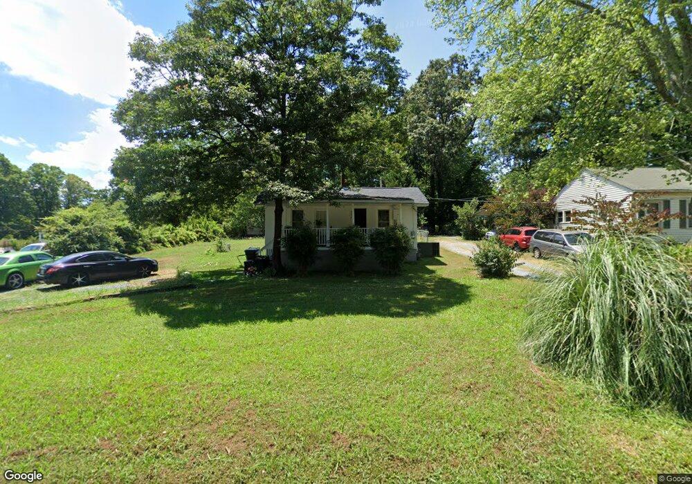
721 Lincoln Ave Asheboro, NC 27205
Estimated Value: $99,497 - $163,000
--
Bed
1
Bath
912
Sq Ft
$153/Sq Ft
Est. Value
About This Home
This home is located at 721 Lincoln Ave, Asheboro, NC 27205 and is currently estimated at $139,374, approximately $152 per square foot. 721 Lincoln Ave is a home located in Randolph County with nearby schools including Charles W. McCrary Elementary School, North Asheboro Middle School, and Asheboro High School.
Ownership History
Date
Name
Owned For
Owner Type
Purchase Details
Closed on
Jun 26, 2024
Sold by
Trips One Investments Llc
Bought by
Trips One Investments Ii Llc
Current Estimated Value
Purchase Details
Closed on
Aug 20, 2018
Sold by
Davidson And Norris Rentals Llc
Bought by
Trips One Investments Llc
Purchase Details
Closed on
Jul 29, 1997
Bought by
Davidson And Norris Rentals Llc
Purchase Details
Closed on
May 11, 1990
Bought by
Davidson And Norris Rentals Llc
Create a Home Valuation Report for This Property
The Home Valuation Report is an in-depth analysis detailing your home's value as well as a comparison with similar homes in the area
Home Values in the Area
Average Home Value in this Area
Purchase History
| Date | Buyer | Sale Price | Title Company |
|---|---|---|---|
| Trips One Investments Ii Llc | -- | None Listed On Document | |
| Trips One Investments Llc | -- | None Available | |
| Davidson And Norris Rentals Llc | $34,000 | -- | |
| Davidson And Norris Rentals Llc | $18,000 | -- |
Source: Public Records
Tax History Compared to Growth
Tax History
| Year | Tax Paid | Tax Assessment Tax Assessment Total Assessment is a certain percentage of the fair market value that is determined by local assessors to be the total taxable value of land and additions on the property. | Land | Improvement |
|---|---|---|---|---|
| 2025 | $584 | $75,360 | $21,090 | $54,270 |
| 2024 | $577 | $75,360 | $21,090 | $54,270 |
| 2023 | $577 | $75,360 | $21,090 | $54,270 |
| 2022 | $496 | $53,520 | $16,480 | $37,040 |
| 2021 | $496 | $53,520 | $16,480 | $37,040 |
| 2020 | $485 | $53,520 | $16,480 | $37,040 |
| 2019 | $485 | $53,520 | $16,480 | $37,040 |
| 2018 | $416 | $44,570 | $17,770 | $26,800 |
| 2016 | $411 | $44,568 | $17,770 | $26,798 |
| 2015 | $408 | $44,568 | $17,770 | $26,798 |
| 2014 | -- | $44,568 | $17,770 | $26,798 |
Source: Public Records
Map
Nearby Homes
- 1110 Park Dr
- 866 Mountain Rd
- 0 Highwood Dr
- 627 Oakmont Dr
- 0000 Little Gate Dr
- 1011 Westmont Dr
- 1025 Neely Dr
- TBD Oakland Ave
- 435 Peachtree St
- 1582 Westmont Dr
- 516 and 518 Peachtree St
- 1407 Oakland Ave
- 1142 Westover Terrace
- 923 Arnold St
- 0 Amity Rd
- 330 W Presnell St Unit 37
- 330 13 W Presnell St
- 1263 Winslow Ave Unit A, B & C
- 914 Tamworth Rd
- 255 Liberty St
- 727 Lincoln Ave
- 717 Lincoln Ave
- 737 Lincoln Ave
- 824 Corwith St
- 724 Lincoln Ave
- 716 Lincoln Ave
- 730 Lincoln Ave
- 753 Lincoln Ave
- 738 Lincoln Ave
- 707 Wilson St
- 0 Wilson St
- 664 Lincoln Ave
- 847 Corwith St
- 827 Corwith St
- 750 Lincoln Ave
- 763 Lincoln Ave
- 657 Lincoln Ave
- 657 Lincoln Ave
- 1121 Park Dr
- 811 Corwith St