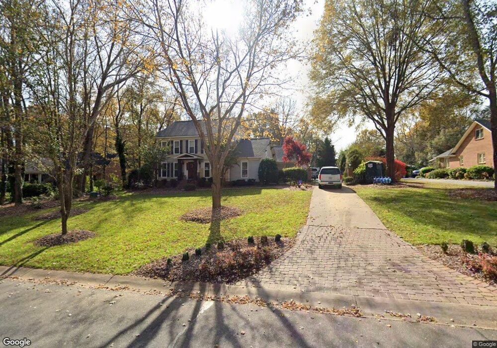
7210 Ashbourne Ln Mint Hill, NC 28227
Estimated Value: $522,000 - $624,000
5
Beds
4
Baths
2,698
Sq Ft
$215/Sq Ft
Est. Value
About This Home
This home is located at 7210 Ashbourne Ln, Mint Hill, NC 28227 and is currently estimated at $579,962, approximately $214 per square foot. 7210 Ashbourne Ln is a home located in Mecklenburg County with nearby schools including Bain Elementary, Mint Hill Middle School, and Independence High.
Ownership History
Date
Name
Owned For
Owner Type
Purchase Details
Closed on
Jul 7, 2000
Sold by
Wayne Tucker Stephen and Secrest Marsha
Bought by
James Eric D and James Pamela G
Current Estimated Value
Home Financials for this Owner
Home Financials are based on the most recent Mortgage that was taken out on this home.
Original Mortgage
$199,500
Outstanding Balance
$73,408
Interest Rate
8.63%
Mortgage Type
Purchase Money Mortgage
Estimated Equity
$506,554
Create a Home Valuation Report for This Property
The Home Valuation Report is an in-depth analysis detailing your home's value as well as a comparison with similar homes in the area
Home Values in the Area
Average Home Value in this Area
Purchase History
| Date | Buyer | Sale Price | Title Company |
|---|---|---|---|
| James Eric D | $210,000 | -- |
Source: Public Records
Mortgage History
| Date | Status | Borrower | Loan Amount |
|---|---|---|---|
| Open | James Eric D | $199,500 |
Source: Public Records
Tax History Compared to Growth
Tax History
| Year | Tax Paid | Tax Assessment Tax Assessment Total Assessment is a certain percentage of the fair market value that is determined by local assessors to be the total taxable value of land and additions on the property. | Land | Improvement |
|---|---|---|---|---|
| 2025 | $3,436 | $478,250 | $80,000 | $398,250 |
| 2024 | $3,436 | $478,250 | $80,000 | $398,250 |
| 2023 | $3,383 | $478,250 | $80,000 | $398,250 |
| 2022 | $2,714 | $306,800 | $43,700 | $263,100 |
| 2021 | $2,714 | $306,800 | $43,700 | $263,100 |
| 2020 | $2,714 | $306,800 | $43,700 | $263,100 |
| 2019 | $2,708 | $306,800 | $43,700 | $263,100 |
| 2018 | $2,476 | $224,000 | $50,000 | $174,000 |
| 2017 | $2,456 | $224,000 | $50,000 | $174,000 |
| 2016 | $2,452 | $224,000 | $50,000 | $174,000 |
| 2015 | $2,449 | $224,000 | $50,000 | $174,000 |
| 2014 | $2,447 | $243,600 | $50,000 | $193,600 |
Source: Public Records
Map
Nearby Homes
- 18217 Middle Springs Ln
- 18209 Middle Springs Ln
- 17049 Malone Ln
- Newell Plan at Whitley Preserve - Enclave Collection
- Lemley Plan at Whitley Preserve - Park Collection
- Wyngate Plan at Whitley Preserve - Park Collection
- 12025 Mariner Dr
- Trailwind Plan at Whitley Preserve - Enclave Collection
- Goldrush Plan at Whitley Preserve - Park Collection
- Teasdale Plan at Whitley Preserve - Park Collection
- Whitetail Plan at Whitley Preserve - Enclave Collection
- 5926 Long Stirrup Ln
- 5827 Long Stirrup Ln
- 6005 Long Stirrup Ln
- 12017 Mariner Dr
- 12314 Lawyers Rd
- 11917 Shady Oak Ct
- 4246 Piaffe Ave
- 13216 Lawyers Rd
- 11903 Canter Dr
- 7218 Ashbourne Ln
- 7122 Ashbourne Ln
- 12001 Lawyers Rd
- 11919 Lawyers Rd
- 7110 Ashbourne Ln
- 7215 Ashbourne Ln
- 7205 Ashbourne Ln
- 7223 Ashbourne Ln
- 12013 Lawyers Rd
- 7100 Ashbourne Ln
- 7119 Ashbourne Ln
- 12025 Lawyers Rd
- 7109 Ashbourne Ln
- 7101 Ashbourne Ln
- 7101 Ashbourne Ln Unit 14
- 7228 Ashbourne Ln
- 12119 Lawyers Rd
- 7230 Ashbourne Ln
- 11826 Lawyers Rd
- 12127 Lawyers Rd