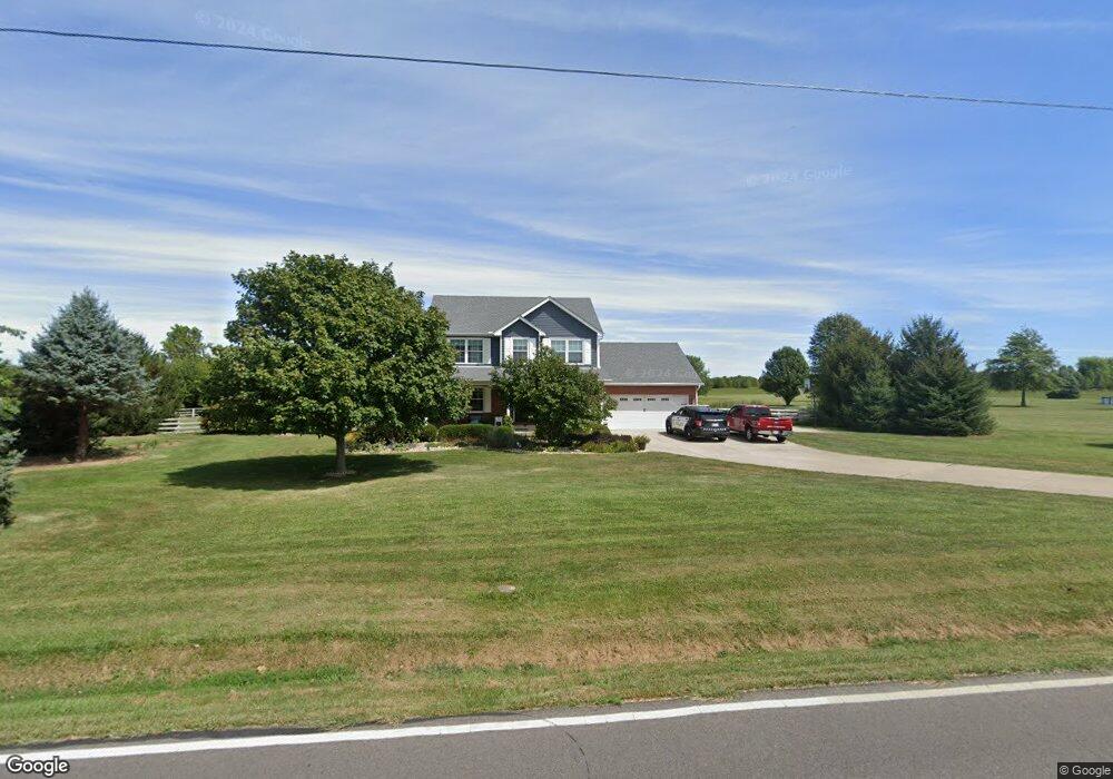
7210 Ringwood Rd Oxford, OH 45056
Estimated Value: $419,000 - $474,000
3
Beds
3
Baths
2,137
Sq Ft
$208/Sq Ft
Est. Value
About This Home
This home is located at 7210 Ringwood Rd, Oxford, OH 45056 and is currently estimated at $445,118, approximately $208 per square foot. 7210 Ringwood Rd is a home located in Butler County with nearby schools including Talawanda Middle School, Talawanda High School, and Mcguffey Montessori School.
Ownership History
Date
Name
Owned For
Owner Type
Purchase Details
Closed on
Jun 19, 2002
Sold by
Countrytyme Lebanon Ltd
Bought by
King David L and King Kari A
Current Estimated Value
Home Financials for this Owner
Home Financials are based on the most recent Mortgage that was taken out on this home.
Original Mortgage
$146,600
Outstanding Balance
$62,511
Interest Rate
6.93%
Mortgage Type
Construction
Estimated Equity
$382,607
Create a Home Valuation Report for This Property
The Home Valuation Report is an in-depth analysis detailing your home's value as well as a comparison with similar homes in the area
Home Values in the Area
Average Home Value in this Area
Purchase History
| Date | Buyer | Sale Price | Title Company |
|---|---|---|---|
| King David L | $37,000 | -- |
Source: Public Records
Mortgage History
| Date | Status | Borrower | Loan Amount |
|---|---|---|---|
| Open | King David L | $146,600 |
Source: Public Records
Tax History Compared to Growth
Tax History
| Year | Tax Paid | Tax Assessment Tax Assessment Total Assessment is a certain percentage of the fair market value that is determined by local assessors to be the total taxable value of land and additions on the property. | Land | Improvement |
|---|---|---|---|---|
| 2024 | $4,270 | $117,020 | $18,210 | $98,810 |
| 2023 | $4,247 | $117,020 | $18,210 | $98,810 |
| 2022 | $3,231 | $78,010 | $18,210 | $59,800 |
| 2021 | $3,082 | $78,010 | $18,210 | $59,800 |
| 2020 | $3,218 | $78,010 | $18,210 | $59,800 |
| 2019 | $5,989 | $73,040 | $20,130 | $52,910 |
| 2018 | $3,176 | $73,040 | $20,130 | $52,910 |
| 2017 | $3,110 | $73,040 | $20,130 | $52,910 |
| 2016 | $2,931 | $66,690 | $20,130 | $46,560 |
| 2015 | $2,976 | $66,690 | $20,130 | $46,560 |
| 2014 | $4,321 | $66,690 | $20,130 | $46,560 |
| 2013 | $4,321 | $65,880 | $20,130 | $45,750 |
Source: Public Records
Map
Nearby Homes
- 6529 Todd Rd
- 7870 Contreras Rd
- 215 Country Club Dr
- 4 Olde Stone Ct
- 141 Prevalent Dr
- 111 Prevalent Dr
- 9 Angela Ct
- 107 Melanee Dr
- 5285 College Corner Pike
- 6200 Hester Rd
- 5400 Hester Rd
- 7755 Fairfield Rd
- 5280 Hester Rd
- 843 Dufour Ln
- 5700 Forest Ridge Dr
- 5395 Brookville Pike
- 5706 Forest Ridge Dr
- 80 Great Horned Dr
- 74 Great Horned Dr
- 65 Great Horned Dr
- 7230 Ringwood Rd
- 7178 Ringwood Rd
- 7254 Ringwood Rd
- 7276 Ringwood Rd
- 7253 Ringwood Rd
- 7298 Ringwood Rd
- 7098 Ringwood Rd
- 7088 Ringwood Rd
- 7322 Ringwood Rd
- 7076 Ringwood Rd
- 0 Ringwood Rd Unit 1417558
- 0 Ringwood Rd Unit Lot 9 1471367
- 0 Ringwood Rd Unit 1515381
- 0 Ringwood Rd Unit 907207
- 0 Ringwood Rd Unit 701775
- 0 Ringwood Rd Unit 822844
- 0 Ringwood Rd
- 7018 Ringwood Rd
- 7255 Ringwood Rd
- 7000 Ringwood Rd