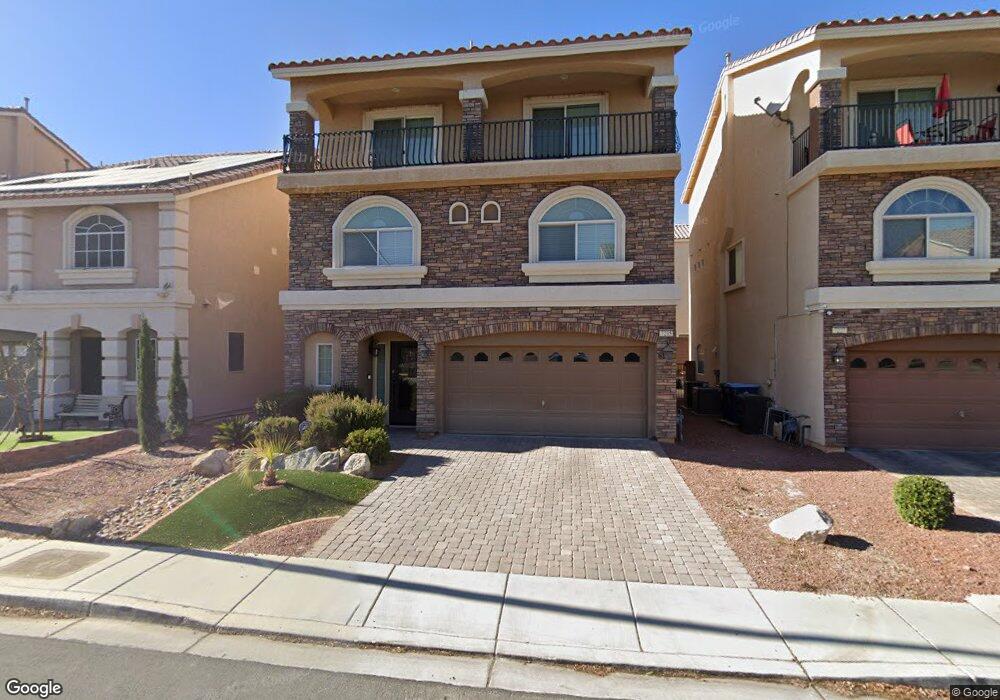
7235 S Bronco St Las Vegas, NV 89118
Coronado Ranch NeighborhoodEstimated Value: $557,344 - $644,000
4
Beds
4
Baths
2,751
Sq Ft
$221/Sq Ft
Est. Value
About This Home
This home is located at 7235 S Bronco St, Las Vegas, NV 89118 and is currently estimated at $607,836, approximately $220 per square foot. 7235 S Bronco St is a home with nearby schools including Lawrence & Heidi Canarelli Middle School, Sierra Vista High School, and Amplus Rainbow.
Ownership History
Date
Name
Owned For
Owner Type
Purchase Details
Closed on
Apr 20, 2015
Sold by
Pate Sammi
Bought by
Pate Timothy W
Current Estimated Value
Purchase Details
Closed on
Apr 13, 2015
Sold by
Southbrook 1 Llc
Bought by
Pate Timothy W
Purchase Details
Closed on
Jan 6, 2015
Sold by
Long Term Land Holdings Inc
Bought by
Southbrook 1 Llc
Purchase Details
Closed on
Dec 19, 2014
Sold by
Canarelli Family Land Llc
Bought by
Long Term Land Holdings Inc
Create a Home Valuation Report for This Property
The Home Valuation Report is an in-depth analysis detailing your home's value as well as a comparison with similar homes in the area
Home Values in the Area
Average Home Value in this Area
Purchase History
| Date | Buyer | Sale Price | Title Company |
|---|---|---|---|
| Pate Timothy W | -- | First American Title Centra | |
| Pate Timothy W | $330,500 | First American Title Centra | |
| Southbrook 1 Llc | -- | Accommodation | |
| Long Term Land Holdings Inc | $2,066,420 | Accommodation |
Source: Public Records
Tax History Compared to Growth
Tax History
| Year | Tax Paid | Tax Assessment Tax Assessment Total Assessment is a certain percentage of the fair market value that is determined by local assessors to be the total taxable value of land and additions on the property. | Land | Improvement |
|---|---|---|---|---|
| 2025 | $4,463 | $175,342 | $40,250 | $135,092 |
| 2024 | $4,463 | $175,342 | $40,250 | $135,092 |
| 2023 | $4,463 | $166,435 | $40,250 | $126,185 |
| 2022 | $4,132 | $146,176 | $31,500 | $114,676 |
| 2021 | $3,826 | $133,173 | $32,550 | $100,623 |
| 2020 | $3,550 | $133,972 | $32,550 | $101,422 |
| 2019 | $3,327 | $118,742 | $24,500 | $94,242 |
| 2018 | $3,175 | $108,248 | $23,450 | $84,798 |
| 2017 | $3,406 | $116,118 | $23,450 | $92,668 |
| 2016 | $3,334 | $113,403 | $12,250 | $101,153 |
| 2015 | $3,326 | $0 | $0 | $0 |
Source: Public Records
Map
Nearby Homes
- 7252 Puffer Lake Ct
- 7293 Puffer Lake Ct
- 6283 Lapilli Ave
- 7243 Shannon Ridge Ct
- 6303 Scree Ct
- 6016 Sombria Ridge Ave
- 7451 Grizzly Giant St
- 7221 Atascadero Creek Ct
- 7463 Grizzly Giant St
- 6263 Oread Ave
- 7066 Switchback Ridge Ct
- 6250 W Arby Ave Unit 145
- 6250 W Arby Ave Unit 125
- 6250 W Arby Ave Unit 168
- 6255 W Arby Ave Unit 255
- 6255 W Arby Ave Unit 241
- 6255 W Arby Ave Unit 183
- 7478 Coastal Ledge St
- 7024 Adler Falls St
- 6315 Anticline Ave Unit 1
- 7227 S Bronco St
- 7243 S Bronco St
- 7219 S Bronco St
- 7251 S Bronco St
- 7236 Puffer Lake Ct
- 7228 Puffer Lake Ct
- 7244 Puffer Lake Ct
- 7211 S Bronco St
- 7259 S Bronco St
- 7244 S Bronco St
- 7238 S Bronco St
- 7250 S Bronco St
- 7232 S Bronco St
- 7212 Puffer Lake Ct
- 7260 Puffer Lake Ct
- 7256 S Bronco St
- 7267 S Bronco St
- 7226 S Bronco St
- 7262 S Bronco St
- 7268 Puffer Lake Ct