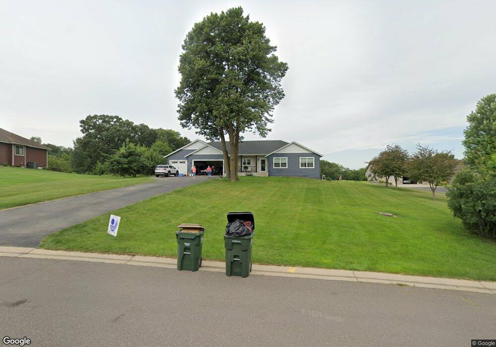
726 6th St NW Richmond, MN 56368
Estimated Value: $581,000 - $723,000
4
Beds
4
Baths
3,048
Sq Ft
$212/Sq Ft
Est. Value
About This Home
This home is located at 726 6th St NW, Richmond, MN 56368 and is currently estimated at $645,940, approximately $211 per square foot. 726 6th St NW is a home located in Stearns County with nearby schools including Rocori Senior High School and Saints Peter & Paul Catholic School.
Ownership History
Date
Name
Owned For
Owner Type
Purchase Details
Closed on
Oct 28, 2021
Sold by
Schultz John and Schultz Kelsey
Bought by
Noska Matthew J and Stark Shauna L
Current Estimated Value
Purchase Details
Closed on
Dec 26, 2017
Sold by
Gertken Alvin S and Gertken Linda L
Bought by
Schultz John and Schultz Kelsey
Purchase Details
Closed on
Apr 19, 2012
Sold by
Steil Family 2008 Revocable Trust
Bought by
Gertken Alvin S and Gertken Linda L
Purchase Details
Closed on
Apr 21, 2006
Sold by
Rich River Llc
Bought by
Steil Thomas
Create a Home Valuation Report for This Property
The Home Valuation Report is an in-depth analysis detailing your home's value as well as a comparison with similar homes in the area
Home Values in the Area
Average Home Value in this Area
Purchase History
| Date | Buyer | Sale Price | Title Company |
|---|---|---|---|
| Noska Matthew J | $565,000 | Misc Company | |
| Schultz John | $83,000 | -- | |
| Gertken Alvin S | $80,000 | -- | |
| Steil Thomas | $120,000 | -- |
Source: Public Records
Tax History Compared to Growth
Tax History
| Year | Tax Paid | Tax Assessment Tax Assessment Total Assessment is a certain percentage of the fair market value that is determined by local assessors to be the total taxable value of land and additions on the property. | Land | Improvement |
|---|---|---|---|---|
| 2025 | $7,062 | $561,200 | $131,100 | $430,100 |
| 2024 | $7,062 | $530,800 | $131,100 | $399,700 |
| 2023 | $5,720 | $516,800 | $131,100 | $385,700 |
| 2022 | $5,692 | $385,000 | $82,400 | $302,600 |
| 2021 | $5,446 | $385,000 | $82,400 | $302,600 |
| 2020 | $5,604 | $366,200 | $82,400 | $283,800 |
| 2019 | $748 | $358,700 | $82,400 | $276,300 |
| 2018 | $746 | $71,300 | $71,300 | $0 |
| 2017 | $1,084 | $89,200 | $89,200 | $0 |
| 2016 | $1,066 | $0 | $0 | $0 |
| 2015 | $1,120 | $0 | $0 | $0 |
| 2014 | -- | $0 | $0 | $0 |
Source: Public Records
Map
Nearby Homes
- 101 Barry Loop NW
- 577 Main St W
- 261 Main St W
- 148 Main St W
- 205 Grant Ave SW
- 21107 State Highway 23
- 153 Central Ave S
- 20734 Black Cherry Dr
- 232 Main St E
- XXX Eastfield Dr
- 448 1st St NE
- 22296 Hall Ave SW
- 464 Main St E
- 22579 Fordham Rd
- 21312 State Highway 22 #4
- 21312 State Highway 22 Unit 20
- 21312 State Highway 22 Unit 25
- 22213 Big Lake Ct
- 22225 Big Lake Ct
- 21488 Big Lake Rd