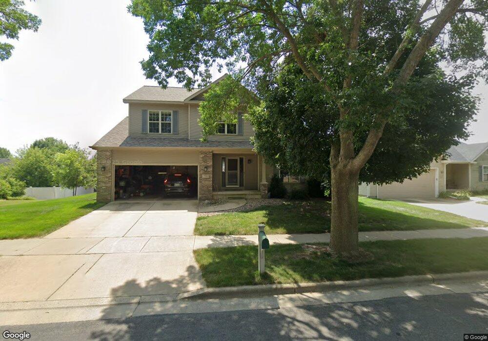
729 Aztalan Dr Madison, WI 53718
East Madison NeighborhoodEstimated Value: $502,000 - $532,000
3
Beds
4
Baths
2,997
Sq Ft
$174/Sq Ft
Est. Value
About This Home
This home is located at 729 Aztalan Dr, Madison, WI 53718 and is currently estimated at $522,565, approximately $174 per square foot. 729 Aztalan Dr is a home located in Dane County with nearby schools including Kennedy Elementary School, Whitehorse Middle School, and La Follette High School.
Ownership History
Date
Name
Owned For
Owner Type
Purchase Details
Closed on
Feb 21, 2008
Sold by
Durst Brian R and Durst Kay
Bought by
Barber David A and Barber Andrea K L
Current Estimated Value
Home Financials for this Owner
Home Financials are based on the most recent Mortgage that was taken out on this home.
Original Mortgage
$210,000
Interest Rate
5.93%
Mortgage Type
Purchase Money Mortgage
Create a Home Valuation Report for This Property
The Home Valuation Report is an in-depth analysis detailing your home's value as well as a comparison with similar homes in the area
Home Values in the Area
Average Home Value in this Area
Purchase History
| Date | Buyer | Sale Price | Title Company |
|---|---|---|---|
| Barber David A | $292,000 | None Available |
Source: Public Records
Mortgage History
| Date | Status | Borrower | Loan Amount |
|---|---|---|---|
| Previous Owner | Barber David A | $210,000 |
Source: Public Records
Tax History Compared to Growth
Tax History
| Year | Tax Paid | Tax Assessment Tax Assessment Total Assessment is a certain percentage of the fair market value that is determined by local assessors to be the total taxable value of land and additions on the property. | Land | Improvement |
|---|---|---|---|---|
| 2024 | $16,109 | $474,900 | $83,200 | $391,700 |
| 2023 | $7,772 | $448,000 | $78,500 | $369,500 |
| 2021 | $7,121 | $349,300 | $65,900 | $283,400 |
| 2020 | $7,202 | $332,700 | $62,800 | $269,900 |
| 2019 | $6,988 | $323,000 | $61,000 | $262,000 |
| 2018 | $7,184 | $330,800 | $61,000 | $269,800 |
| 2017 | $6,929 | $306,300 | $61,000 | $245,300 |
| 2016 | $6,763 | $291,700 | $61,000 | $230,700 |
| 2015 | $6,652 | $283,200 | $59,200 | $224,000 |
| 2014 | $6,652 | $283,200 | $59,200 | $224,000 |
| 2013 | $6,550 | $283,200 | $58,300 | $224,900 |
Source: Public Records
Map
Nearby Homes
- 7032 Havenswood Dr
- 425 E Hill Pkwy
- 704 Herndon Dr Unit 201
- 409 Wyalusing Dr
- 302 E Hill Pkwy
- Lot 4 Wyalusing Dr
- Lot 2 Wyalusing Dr
- Lot 3 Wyalusing Dr
- Lot 5 Wyalusing Dr
- Lot 1 Wyalusing Dr
- 620 Malvern Hill Dr
- 710 Malvern Hill Dr
- 6317 Buford Dr
- 502 Traveler Ln
- 402 Jubilee Ln
- 212 E Hill Pkwy
- 718 Traveler Ln
- 722 Traveler Ln
- 6725 Reston Heights Dr Unit 1
- 239 Shady Leaf Rd
- 733 Aztalan Dr
- 721 Aztalan Dr
- 754 Highcliff Trail
- 758 Highcliff Trail
- 746 Highcliff Trail
- 730 Aztalan Dr
- 737 Aztalan Dr
- 722 Aztalan Dr
- 734 Aztalan Dr
- 717 Aztalan Dr
- 742 Highcliff Trail
- 714 Aztalan Dr
- 717 Amnicon Trail
- 738 Aztalan Dr
- 721 Amnicon Trail
- 734 Highcliff Trail
- 6925 Mill Bluff Dr
- 713 Amnicon Trail
- 6929 Mill Bluff Dr
- 6921 Mill Bluff Dr