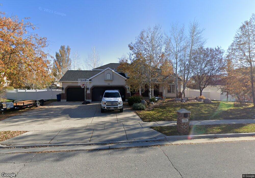
729 Mill Shadow Dr Kaysville, UT 84037
West Kaysville NeighborhoodEstimated Value: $682,000 - $850,000
4
Beds
3
Baths
3,766
Sq Ft
$206/Sq Ft
Est. Value
About This Home
This home is located at 729 Mill Shadow Dr, Kaysville, UT 84037 and is currently estimated at $774,669, approximately $205 per square foot. 729 Mill Shadow Dr is a home located in Davis County with nearby schools including Kaysville Elementary School, Farmington High, and Centennial Junior High School.
Ownership History
Date
Name
Owned For
Owner Type
Purchase Details
Closed on
Jan 6, 2021
Sold by
Burt Oliver Dallin
Bought by
Burt Oliver D and Burt Angela Simpson
Current Estimated Value
Home Financials for this Owner
Home Financials are based on the most recent Mortgage that was taken out on this home.
Original Mortgage
$233,000
Outstanding Balance
$169,134
Interest Rate
2.7%
Mortgage Type
New Conventional
Estimated Equity
$605,535
Purchase Details
Closed on
Sep 21, 2012
Sold by
Barker Linda Alder
Bought by
Burt Oliver D and Burt Angela Simpson
Home Financials for this Owner
Home Financials are based on the most recent Mortgage that was taken out on this home.
Original Mortgage
$226,725
Interest Rate
3.55%
Mortgage Type
New Conventional
Purchase Details
Closed on
Jan 9, 2008
Sold by
Barker Linda Alder
Bought by
Barker Linda Alder
Home Financials for this Owner
Home Financials are based on the most recent Mortgage that was taken out on this home.
Original Mortgage
$352,000
Interest Rate
6.05%
Mortgage Type
New Conventional
Purchase Details
Closed on
Aug 22, 2002
Sold by
Nokes Travis V and Nokes Lisa
Bought by
Nokes Travis and Nokes Annelisa
Home Financials for this Owner
Home Financials are based on the most recent Mortgage that was taken out on this home.
Original Mortgage
$202,300
Interest Rate
6.43%
Purchase Details
Closed on
May 28, 1999
Sold by
Gmw Development Inc
Bought by
Nokes Travis and Nokes Lisa
Home Financials for this Owner
Home Financials are based on the most recent Mortgage that was taken out on this home.
Original Mortgage
$205,000
Interest Rate
6.86%
Purchase Details
Closed on
Feb 15, 1999
Sold by
Princeton Development Llc
Bought by
Gmw Development Inc
Create a Home Valuation Report for This Property
The Home Valuation Report is an in-depth analysis detailing your home's value as well as a comparison with similar homes in the area
Home Values in the Area
Average Home Value in this Area
Purchase History
| Date | Buyer | Sale Price | Title Company |
|---|---|---|---|
| Burt Oliver D | -- | North American Title | |
| Burt Oliver D | -- | North American Title | |
| Burt Oliver D | -- | Bonneville Superior | |
| Barker Linda Alder | -- | Heritage West Title Ins | |
| Nokes Travis | -- | Bonneville Title Company Inc | |
| Nokes Travis | -- | Bonneville Title Company Inc | |
| Gmw Development Inc | -- | Bonneville Title Company Inc |
Source: Public Records
Mortgage History
| Date | Status | Borrower | Loan Amount |
|---|---|---|---|
| Open | Burt Oliver D | $233,000 | |
| Closed | Burt Oliver D | $226,725 | |
| Previous Owner | Barker Linda Alder | $352,000 | |
| Previous Owner | Nokes Travis | $202,300 | |
| Previous Owner | Nokes Travis | $205,000 |
Source: Public Records
Tax History Compared to Growth
Tax History
| Year | Tax Paid | Tax Assessment Tax Assessment Total Assessment is a certain percentage of the fair market value that is determined by local assessors to be the total taxable value of land and additions on the property. | Land | Improvement |
|---|---|---|---|---|
| 2025 | $3,228 | $357,500 | $225,324 | $132,176 |
| 2024 | $3,228 | $340,450 | $216,036 | $124,414 |
| 2023 | $3,186 | $595,000 | $379,020 | $215,980 |
| 2022 | $3,192 | $334,400 | $206,655 | $127,745 |
| 2021 | $3,242 | $509,000 | $250,011 | $258,989 |
| 2020 | $2,923 | $447,000 | $214,475 | $232,525 |
| 2019 | $2,797 | $420,000 | $211,596 | $208,404 |
| 2018 | $2,792 | $418,000 | $180,183 | $237,817 |
| 2016 | $2,493 | $196,185 | $84,598 | $111,587 |
| 2015 | $2,526 | $188,705 | $84,598 | $104,107 |
| 2014 | $2,507 | $190,665 | $66,921 | $123,744 |
| 2013 | -- | $166,100 | $54,782 | $111,318 |
Source: Public Records
Map
Nearby Homes
- 1087 Barnes Dr
- 48 S Flint St
- 203 S Larkin Ln
- 454 S Jay St W
- 52 S Grandison Ct E Unit 83-R
- 1346 W Blackbird Ln Unit 3
- 109 S Rock Loft Ridge Dr Unit 56-R
- 159 S Rock Loft Ridge Dr Unit 59-R
- 209 N Rock Loft Ridge E Unit 32-R
- 180 S Rock Loft Ridge Dr E Unit 7-R
- 246 N Rock Loft Ridge Dr Unit 36-R
- 22 S Rock Loft Ridge Dr Unit 16-R
- 34 S Rock Loft Ridge Dr Unit 85-R
- 190 N Rock Loft Ridge Dr Unit 40-R
- 75 S Grandison Ct E Unit 69-R
- 93 S Rock Loft Ridge Dr Unit 55-R
- 167 S Grandison E Unit 74-R
- 127 S Rock Loft Ridge Dr Unit 57-R
- 28 N Rock Loft Ridge Dr Unit 46-R
- 96 S Rock Loft Ridge Dr Unit 12-R
- 715 Mill Shadow Dr
- 743 Mill Shadow Dr
- 757 Mill Shadow Dr
- 726 Mill Shadow Dr
- 701 Mill Shadow Dr
- 57 N 700 W
- 748 Mill Shadow Dr
- 701 Mill Shadow Dr
- 668 Old Mill Ln
- 771 Mill Shadow Dr
- 772 Mill Shadow Dr
- 73 N 700 W
- 54 N 700 W
- 769 Chester Ln
- 724 Old Mill Ln
- 791 Chester Ln
- 68 N 700 W
- 785 Mill Shadow Dr
- 790 Mill Shadow Dr
- 743 Chester Ln