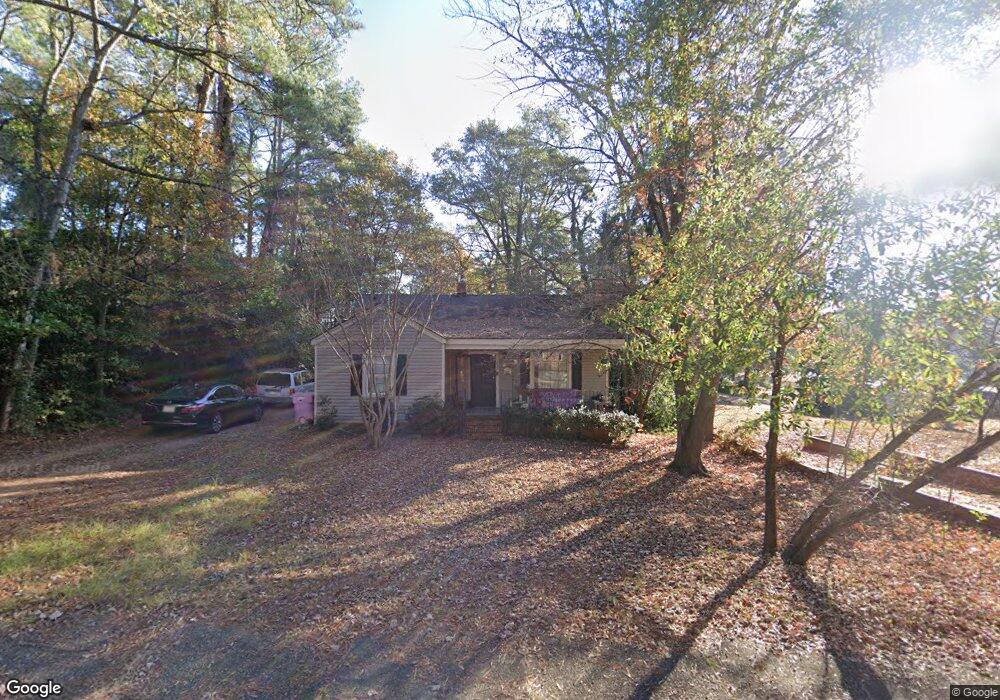
730 Greenland Dr Fayetteville, NC 28305
Terry Sanford NeighborhoodEstimated Value: $195,927 - $222,000
3
Beds
1
Bath
1,156
Sq Ft
$177/Sq Ft
Est. Value
About This Home
This home is located at 730 Greenland Dr, Fayetteville, NC 28305 and is currently estimated at $204,732, approximately $177 per square foot. 730 Greenland Dr is a home located in Cumberland County with nearby schools including Alma O Easom Elementary, Vanstory Hills Elementary School, and R. Max Abbott Middle School.
Ownership History
Date
Name
Owned For
Owner Type
Purchase Details
Closed on
Jun 2, 2011
Sold by
Hays John M
Bought by
Snyder Memorial Baptist Church
Current Estimated Value
Purchase Details
Closed on
Nov 17, 2008
Sold by
Hays John M
Bought by
Hays John M
Home Financials for this Owner
Home Financials are based on the most recent Mortgage that was taken out on this home.
Original Mortgage
$105,800
Interest Rate
6.01%
Mortgage Type
New Conventional
Purchase Details
Closed on
Mar 15, 2006
Sold by
Sealey David L
Bought by
Hays John M
Home Financials for this Owner
Home Financials are based on the most recent Mortgage that was taken out on this home.
Original Mortgage
$105,214
Interest Rate
6.19%
Mortgage Type
VA
Create a Home Valuation Report for This Property
The Home Valuation Report is an in-depth analysis detailing your home's value as well as a comparison with similar homes in the area
Home Values in the Area
Average Home Value in this Area
Purchase History
| Date | Buyer | Sale Price | Title Company |
|---|---|---|---|
| Snyder Memorial Baptist Church | $115,000 | -- | |
| Hays John M | -- | -- | |
| Hays John M | $103,000 | -- |
Source: Public Records
Mortgage History
| Date | Status | Borrower | Loan Amount |
|---|---|---|---|
| Previous Owner | Hays John M | $105,800 | |
| Previous Owner | Hays John M | $105,214 |
Source: Public Records
Tax History Compared to Growth
Tax History
| Year | Tax Paid | Tax Assessment Tax Assessment Total Assessment is a certain percentage of the fair market value that is determined by local assessors to be the total taxable value of land and additions on the property. | Land | Improvement |
|---|---|---|---|---|
| 2024 | $2,428 | $111,317 | $55,000 | $56,317 |
| 2023 | $2,218 | $111,317 | $55,000 | $56,317 |
| 2022 | $2,088 | $111,317 | $55,000 | $56,317 |
| 2021 | $2,088 | $111,317 | $55,000 | $56,317 |
| 2019 | $2,053 | $133,600 | $55,000 | $78,600 |
| 2018 | $2,053 | $133,600 | $55,000 | $78,600 |
| 2017 | $1,950 | $133,600 | $55,000 | $78,600 |
| 2016 | $1,686 | $125,000 | $55,000 | $70,000 |
| 2015 | $1,670 | $125,000 | $55,000 | $70,000 |
| 2014 | $1,663 | $125,000 | $55,000 | $70,000 |
Source: Public Records
Map
Nearby Homes
- 725 Greenland Dr
- 626 Cape Fear Ave
- 714 Westmont Dr
- 717 Glenwood Dr
- 1416 Briarcliff Dr Unit 1, 2, 3
- 1412, 1414 Briarcliff Dr
- 816 Pilot Ave
- 703 Glenwood Dr
- 1404 Briarcliff Dr Unit 1404, 1406, 1408, 14
- 1400 & 1402 Briarcliff Dr Unit 1400 A/B, 1402
- 704 Glenwood Dr
- 933 Creek Side Run
- 719 Kooler Cir
- 523 Westmont Dr
- 610 Huske St
- 831 Anarine Rd
- 414 Park Ave
- 728 Greenland Dr
- 1515 Bragg Blvd
- 726 Greenland Dr
- 729 Greenland Dr
- 727 Greenland Dr
- 724 Greenland Dr
- 1512 Rockledge Ave
- 733 Greenland Dr
- 723 Greenland Dr
- 1510 Rockledge Ave
- 721 Greenland Dr
- 712 Greenland Dr
- 1602 Bragg Blvd
- 719 Greenland Dr
- 1621 Bragg Blvd
- 800 Greenland Dr
- 1508 Rockledge Ave
- 548 Pearl St
- 717 Greenland Dr
- 550 Pearl St