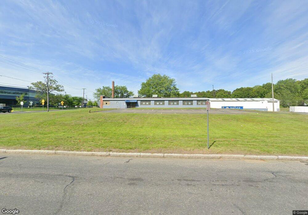
732 Cottage St (Cannabis Zoning) Springfield, MA 01105
East Springfield NeighborhoodEstimated Value: $612,890
--
Bed
1
Bath
6,840
Sq Ft
$90/Sq Ft
Est. Value
About This Home
This home is located at 732 Cottage St (Cannabis Zoning), Springfield, MA 01105 and is currently priced at $612,890, approximately $89 per square foot. 732 Cottage St (Cannabis Zoning) is a home located in Hampden County with nearby schools including Hiram L. Dorman Elementary, John F. Kennedy Academy, and Springfield Central High School.
Ownership History
Date
Name
Owned For
Owner Type
Purchase Details
Closed on
Apr 23, 2025
Sold by
Ddmns Realty Llc
Bought by
Jw Re Holdings Llc
Current Estimated Value
Home Financials for this Owner
Home Financials are based on the most recent Mortgage that was taken out on this home.
Original Mortgage
$486,000
Outstanding Balance
$483,404
Interest Rate
6.65%
Mortgage Type
Purchase Money Mortgage
Purchase Details
Closed on
May 20, 2024
Sold by
Mrowzinski Steven E and Mrowzinski M T
Bought by
Ddmns Realty Llc
Purchase Details
Closed on
Nov 22, 2020
Sold by
Mrowzinski Steven E and Mrowzinski M T
Bought by
Mrowzinski Travis-Mrowzinski M and Mrowzinski Steven E
Purchase Details
Closed on
Apr 12, 2019
Sold by
Jkms Llc
Bought by
Mrowzinski Steven E and Travis-Mrowzinsk Michelle
Purchase Details
Closed on
Nov 16, 2010
Sold by
Lyons Re Llc and Lyons
Bought by
Jkms Llc and Hicks
Home Financials for this Owner
Home Financials are based on the most recent Mortgage that was taken out on this home.
Original Mortgage
$450,000
Interest Rate
4.35%
Mortgage Type
Commercial
Purchase Details
Closed on
Apr 22, 2003
Sold by
Rfc Property 1 Inc
Bought by
Parent Rlty Corp
Create a Home Valuation Report for This Property
The Home Valuation Report is an in-depth analysis detailing your home's value as well as a comparison with similar homes in the area
Home Values in the Area
Average Home Value in this Area
Purchase History
| Date | Buyer | Sale Price | Title Company |
|---|---|---|---|
| Jw Re Holdings Llc | $475,000 | None Available | |
| Jw Re Holdings Llc | $475,000 | None Available | |
| Jw Re Holdings Llc | $475,000 | None Available | |
| Jw Re Holdings Llc | $475,000 | None Available | |
| Ddmns Realty Llc | $300,000 | None Available | |
| Ddmns Realty Llc | $300,000 | None Available | |
| Ddmns Realty Llc | $300,000 | None Available | |
| Ddmns Realty Llc | $300,000 | None Available | |
| Ddmns Realty Llc | $300,000 | None Available | |
| Ddmns Realty Llc | $300,000 | None Available | |
| Mrowzinski Travis-Mrowzinski M | -- | None Available | |
| Mrowzinski Travis-Mrowzinski M | -- | None Available | |
| Mrowzinski Travis-Mrowzinski M | -- | None Available | |
| Mrowzinski Travis-Mrowzinski M | -- | None Available | |
| Mrowzinski Travis-Mrowzinski M | -- | None Available | |
| Mrowzinski Travis-Mrowzinski M | -- | None Available | |
| Mrowzinski Steven E | $402,000 | -- | |
| Mrowzinski Steven E | $402,000 | -- | |
| Mrowzinski Steven E | $402,000 | -- | |
| Mrowzinski Steven E | $402,000 | -- | |
| Mrowzinski Steven E | $402,000 | -- | |
| Mrowzinski Steven E | $402,000 | -- | |
| Jkms Llc | $425,000 | -- | |
| Jkms Llc | $425,000 | -- | |
| Jkms Llc | $425,000 | -- | |
| Jkms Llc | $425,000 | -- | |
| Jkms Llc | $425,000 | -- | |
| Jkms Llc | $425,000 | -- | |
| Parent Rlty Corp | $260,000 | -- | |
| Parent Rlty Corp | $260,000 | -- | |
| Parent Rlty Corp | $260,000 | -- | |
| Parent Rlty Corp | $260,000 | -- | |
| Parent Rlty Corp | $260,000 | -- | |
| Parent Rlty Corp | $260,000 | -- | |
| Parent Rlty Corp | $260,000 | -- | |
| Parent Rlty Corp | $260,000 | -- |
Source: Public Records
Mortgage History
| Date | Status | Borrower | Loan Amount |
|---|---|---|---|
| Open | Jw Re Holdings Llc | $486,000 | |
| Closed | Jw Re Holdings Llc | $486,000 | |
| Previous Owner | Jkms Llc | $450,000 |
Source: Public Records
Tax History Compared to Growth
Tax History
| Year | Tax Paid | Tax Assessment Tax Assessment Total Assessment is a certain percentage of the fair market value that is determined by local assessors to be the total taxable value of land and additions on the property. | Land | Improvement |
|---|---|---|---|---|
| 2025 | $19,466 | $552,700 | $105,500 | $447,200 |
| 2024 | $17,064 | $481,900 | $105,500 | $376,400 |
| 2023 | $12,785 | $420,700 | $105,500 | $315,200 |
| 2022 | $12,785 | $363,200 | $106,300 | $256,900 |
| 2021 | $13,514 | $334,600 | $106,300 | $228,300 |
| 2020 | $12,785 | $325,900 | $106,300 | $219,600 |
| 2019 | $12,902 | $328,300 | $94,500 | $233,800 |
| 2018 | $12,609 | $321,000 | $88,500 | $232,500 |
| 2017 | $12,280 | $314,300 | $86,900 | $227,400 |
| 2016 | $11,719 | $303,600 | $86,900 | $216,700 |
| 2015 | $11,771 | $303,600 | $86,900 | $216,700 |
Source: Public Records
Map
Nearby Homes
- 732 Cottage St
- 41 Brookdale Dr
- 824 Berkshire Ave
- 807 Cottage St
- 844 Berkshire Ave
- 813 Berkshire Ave
- 854 Berkshire Ave
- 868 Berkshire Ave
- 720 Berkshire Ave
- 19 Babbin St
- 18 Babbin St
- 0 Harvey St
- 28 Cole St
- 24 Cole St
- 26 Babbin St
- 27 Babbin St
- 12 Fairhaven Dr
- 878 Berkshire Ave
- 20 Cole St
- 26 Fairhaven Dr