Estimated Value: $425,038 - $562,000
--
Bed
1
Bath
2,376
Sq Ft
$209/Sq Ft
Est. Value
About This Home
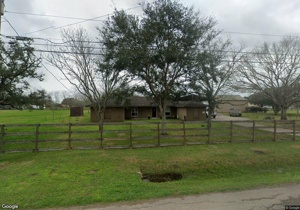
This home is located at 734 County Road 351, Alvin, TX 77511 and is currently estimated at $495,510, approximately $208 per square foot. 734 County Road 351 is a home located in Brazoria County with nearby schools including G.W. Harby Junior High School, Alvin High School, and Living Stones Christian School.
Ownership History
Date
Name
Owned For
Owner Type
Purchase Details
Closed on
Feb 27, 2003
Sold by
Milam Frank B and Milam Jeanne F
Bought by
Stuckman Donald Carl
Current Estimated Value
Home Financials for this Owner
Home Financials are based on the most recent Mortgage that was taken out on this home.
Original Mortgage
$119,000
Outstanding Balance
$51,083
Interest Rate
5.86%
Estimated Equity
$444,427
Create a Home Valuation Report for This Property
The Home Valuation Report is an in-depth analysis detailing your home's value as well as a comparison with similar homes in the area
Home Values in the Area
Average Home Value in this Area
Purchase History
| Date | Buyer | Sale Price | Title Company |
|---|---|---|---|
| Stuckman Donald Carl | -- | Alamo Title 4 |
Source: Public Records
Mortgage History
| Date | Status | Borrower | Loan Amount |
|---|---|---|---|
| Open | Stuckman Donald Carl | $119,000 | |
| Closed | Stuckman Donald Carl | $21,000 |
Source: Public Records
Tax History Compared to Growth
Tax History
| Year | Tax Paid | Tax Assessment Tax Assessment Total Assessment is a certain percentage of the fair market value that is determined by local assessors to be the total taxable value of land and additions on the property. | Land | Improvement |
|---|---|---|---|---|
| 2025 | $2,109 | $337,658 | $153,600 | $342,740 |
| 2023 | $2,109 | $279,056 | $122,880 | $337,000 |
| 2022 | $4,412 | $207,051 | $96,000 | $167,200 |
| 2021 | $4,177 | $212,850 | $66,240 | $146,610 |
| 2020 | $3,848 | $212,850 | $66,240 | $146,610 |
| 2019 | $3,601 | $155,560 | $18,000 | $137,560 |
| 2018 | $3,667 | $157,980 | $21,600 | $136,380 |
| 2017 | $3,477 | $148,000 | $20,700 | $127,300 |
| 2016 | $3,524 | $150,000 | $18,000 | $132,000 |
| 2014 | $3,047 | $145,750 | $17,250 | $128,500 |
Source: Public Records
Map
Nearby Homes
- 691 County Road 351
- 2112 Washington Ave
- 2126 County Road 367
- 609 County Road 351 Beers
- 860 Farm To Market Road 517
- 1176 Fm 517 Rd
- 3080 Megan Lynn Ln
- 664 Imperial Loop
- 662 Imperial Loop
- 658 Imperial Loop
- 656 Imperial Loop
- 659 Imperial Loop
- Plan 2130 Modeled at Imperial Forest
- Plan 1785 at Imperial Forest
- Plan 1675 at Imperial Forest
- Plan 1271 at Imperial Forest
- Plan 2314 at Imperial Forest
- 814 Imperial Loop
- 1300 Dickinson Rd
- 818 Imperial Loop
- 2513 County Road 357a
- 778 County Road 351
- 795 County Road 351
- 775 County Road 351
- 715 County Road 351
- 2516 County Road 357a
- 357A County Road 357a
- 367 County Road 367
- 2230 Washington Ave
- 2551 County Road 357a
- 2542 County Road 357a
- 2542 County Road 357-A
- 2145 Washington Ave
- 2142 County Road 367
- 2569 County Road 357a
- 684 County Road 351
- 126 Nancy St
- 711 County Road 351
- 674 County Road 351
- 2134 County Road 367