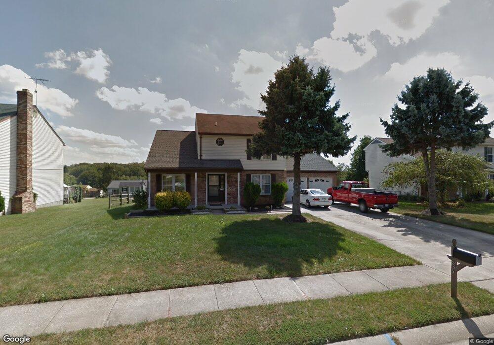
735 High Plain Dr Bel Air, MD 21014
Estimated Value: $450,000 - $540,000
--
Bed
3
Baths
1,882
Sq Ft
$253/Sq Ft
Est. Value
About This Home
This home is located at 735 High Plain Dr, Bel Air, MD 21014 and is currently estimated at $475,573, approximately $252 per square foot. 735 High Plain Dr is a home located in Harford County with nearby schools including Homestead-Wakefield Elementary School, Bel Air Middle School, and Bel Air High School.
Ownership History
Date
Name
Owned For
Owner Type
Purchase Details
Closed on
May 16, 2001
Sold by
Cicero Dominic
Bought by
Cicero Dominic
Current Estimated Value
Purchase Details
Closed on
Nov 5, 1991
Sold by
Manzelmann Michael D
Bought by
Cicero Dominic
Purchase Details
Closed on
Jun 22, 1988
Sold by
Thompson Jerry N
Bought by
Manzelmann Michael D
Home Financials for this Owner
Home Financials are based on the most recent Mortgage that was taken out on this home.
Original Mortgage
$127,300
Interest Rate
10.35%
Create a Home Valuation Report for This Property
The Home Valuation Report is an in-depth analysis detailing your home's value as well as a comparison with similar homes in the area
Home Values in the Area
Average Home Value in this Area
Purchase History
| Date | Buyer | Sale Price | Title Company |
|---|---|---|---|
| Cicero Dominic | -- | -- | |
| Cicero Dominic | $148,000 | -- | |
| Manzelmann Michael D | $134,000 | -- |
Source: Public Records
Mortgage History
| Date | Status | Borrower | Loan Amount |
|---|---|---|---|
| Previous Owner | Manzelmann Michael D | $127,300 |
Source: Public Records
Tax History Compared to Growth
Tax History
| Year | Tax Paid | Tax Assessment Tax Assessment Total Assessment is a certain percentage of the fair market value that is determined by local assessors to be the total taxable value of land and additions on the property. | Land | Improvement |
|---|---|---|---|---|
| 2025 | $3,943 | $386,200 | $93,700 | $292,500 |
| 2024 | $3,943 | $361,800 | $0 | $0 |
| 2023 | $3,677 | $337,400 | $0 | $0 |
| 2022 | $3,411 | $313,000 | $93,700 | $219,300 |
| 2021 | $3,451 | $306,033 | $0 | $0 |
| 2020 | $3,451 | $299,067 | $0 | $0 |
| 2019 | $3,371 | $292,100 | $112,300 | $179,800 |
| 2018 | $3,305 | $288,967 | $0 | $0 |
| 2017 | $3,269 | $292,100 | $0 | $0 |
| 2016 | -- | $282,700 | $0 | $0 |
| 2015 | $3,211 | $282,067 | $0 | $0 |
| 2014 | $3,211 | $281,433 | $0 | $0 |
Source: Public Records
Map
Nearby Homes
- 1055 Sansa Ct
- 638 Iron Gate Rd
- 726 Iron Gate Rd
- 804 Grady Ct
- 600 Harvest Ct
- 515 W Ring Factory Rd
- 412 Viola Ct N
- 608 Squire Ln Unit B
- 606 Squire Ln Unit 606-A
- 601 Thames Way Unit E
- 632 Camelot Dr
- 0 Winter Park Rd
- 600 Squire Ln Unit 2J
- 3 Forest Dr
- 1504 Houndslow Ct
- 298 Canterbury Rd Unit 298-D
- 204 Chaucer Ln Unit D
- 204 Chaucer Ln Unit O
- 231 E Belcrest Rd
- 304 Canterbury Rd Unit K
- 733 High Plain Dr
- 737 High Plain Dr
- 746 Danville Cir
- 744 Danville Cir
- 748 Danville Cir
- 731 High Plain Dr
- 739 High Plain Dr
- 742 Danville Cir
- 703 Deep Ridge Rd
- 740 High Plain Dr
- 738 High Plain Dr
- 742 High Plain Dr
- 729 High Plain Dr
- 705 Deep Ridge Rd
- 740 Danville Cir
- 736 High Plain Dr
- 744 High Plain Dr
- 749 Danville Cir
- 738 Danville Cir
- 727 High Plain Dr