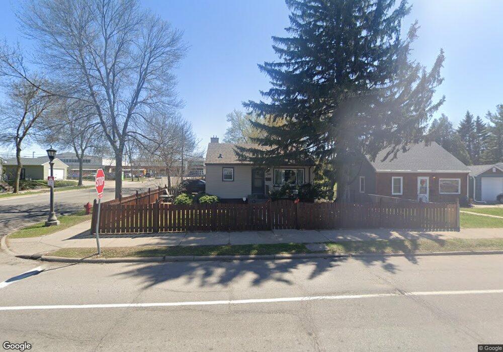
740 Maryland Ave W Saint Paul, MN 55117
Como Park NeighborhoodEstimated Value: $289,000 - $315,000
3
Beds
2
Baths
384
Sq Ft
$783/Sq Ft
Est. Value
About This Home
This home is located at 740 Maryland Ave W, Saint Paul, MN 55117 and is currently estimated at $300,652, approximately $782 per square foot. 740 Maryland Ave W is a home located in Ramsey County with nearby schools including Como Park Elementary School, Murray Middle School, and Como Park Senior High School.
Ownership History
Date
Name
Owned For
Owner Type
Purchase Details
Closed on
May 19, 2017
Sold by
Johnson Ron A and Johnson Nichole
Bought by
Sranton Sarah
Current Estimated Value
Home Financials for this Owner
Home Financials are based on the most recent Mortgage that was taken out on this home.
Original Mortgage
$186,057
Outstanding Balance
$154,644
Interest Rate
4.08%
Mortgage Type
New Conventional
Estimated Equity
$146,008
Create a Home Valuation Report for This Property
The Home Valuation Report is an in-depth analysis detailing your home's value as well as a comparison with similar homes in the area
Home Values in the Area
Average Home Value in this Area
Purchase History
| Date | Buyer | Sale Price | Title Company |
|---|---|---|---|
| Sranton Sarah | $195,850 | Trademark Title Serices Inc |
Source: Public Records
Mortgage History
| Date | Status | Borrower | Loan Amount |
|---|---|---|---|
| Open | Sranton Sarah | $186,057 |
Source: Public Records
Tax History Compared to Growth
Tax History
| Year | Tax Paid | Tax Assessment Tax Assessment Total Assessment is a certain percentage of the fair market value that is determined by local assessors to be the total taxable value of land and additions on the property. | Land | Improvement |
|---|---|---|---|---|
| 2025 | $4,882 | $294,100 | $54,000 | $240,100 |
| 2023 | $4,882 | $292,000 | $54,000 | $238,000 |
| 2022 | $4,454 | $268,900 | $54,000 | $214,900 |
| 2021 | $4,504 | $235,100 | $54,000 | $181,100 |
| 2020 | $3,852 | $238,400 | $54,000 | $184,400 |
| 2019 | $3,056 | $227,500 | $49,500 | $178,000 |
| 2018 | $2,870 | $194,200 | $49,500 | $144,700 |
| 2017 | $3,108 | $189,200 | $47,000 | $142,200 |
| 2016 | $2,586 | $0 | $0 | $0 |
| 2015 | $2,680 | $153,800 | $47,000 | $106,800 |
| 2014 | $2,562 | $0 | $0 | $0 |
Source: Public Records
Map
Nearby Homes
- 766 Maryland Ave W
- 1005 Como Blvd E
- 1222 Como Blvd E
- 740 Como Ave
- 696 Edgar Ave
- 705 Como Ave
- 1063 Dale St N
- 1084 Ryde St
- 1048 Dale St N
- 1342 Dale St N
- 989 Barrett St
- 1049 Kent St
- 744 Arlington Ave W
- 1083 Chatsworth St N
- 1094 Argyle St
- 895 Front Ave
- 1125 Argyle St
- 1300 Schletti St
- 569 Hatch Ave
- 352 Como Ave
- 744 Maryland Ave W
- 750 Maryland Ave W
- 736 Maryland Ave W
- 730 Maryland Ave W
- 758 Maryland Ave W
- 724 Maryland Ave W
- 1212 Grotto St N
- 729 Maryland Ave W
- 718 Maryland Ave W
- 772 Maryland Ave W
- 1216 Grotto St N
- 723 Maryland Ave W
- 712 Maryland Ave W
- 1220 Grotto St N
- 715 Maryland Ave W
- 715 715 Maryland Ave W
- 774 Maryland Ave W
- 708 Maryland Ave W
- 774 774 Maryland Ave W
- 1217 Alameda St