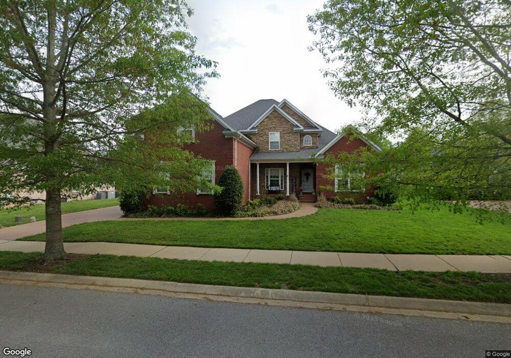
747 Nelms Dr Gallatin, TN 37066
Estimated Value: $719,000 - $763,000
--
Bed
5
Baths
3,259
Sq Ft
$227/Sq Ft
Est. Value
About This Home
This home is located at 747 Nelms Dr, Gallatin, TN 37066 and is currently estimated at $738,880, approximately $226 per square foot. 747 Nelms Dr is a home located in Sumner County with nearby schools including Howard Elementary School, Rucker Stewart Middle School, and Station Camp High School.
Ownership History
Date
Name
Owned For
Owner Type
Purchase Details
Closed on
Aug 5, 2013
Sold by
Thomas Jay Martin Jr Construction Llc
Bought by
Turner Nicholas Wade
Current Estimated Value
Home Financials for this Owner
Home Financials are based on the most recent Mortgage that was taken out on this home.
Original Mortgage
$308,750
Outstanding Balance
$229,972
Interest Rate
4.43%
Mortgage Type
New Conventional
Estimated Equity
$508,908
Purchase Details
Closed on
May 28, 2008
Sold by
Abbott Bruce K and Abbott Tamla D
Bought by
Thomas Jay Martin Jr Construction Llc
Home Financials for this Owner
Home Financials are based on the most recent Mortgage that was taken out on this home.
Original Mortgage
$362,746
Interest Rate
5.86%
Mortgage Type
FHA
Create a Home Valuation Report for This Property
The Home Valuation Report is an in-depth analysis detailing your home's value as well as a comparison with similar homes in the area
Home Values in the Area
Average Home Value in this Area
Purchase History
| Date | Buyer | Sale Price | Title Company |
|---|---|---|---|
| Turner Nicholas Wade | $325,000 | Realty Title & Escrow Co Inc | |
| Thomas Jay Martin Jr Construction Llc | $226,201 | None Available | |
| Abbott Bruce K | $374,900 | Cumberland Title |
Source: Public Records
Mortgage History
| Date | Status | Borrower | Loan Amount |
|---|---|---|---|
| Open | Turner Nicholas Wade | $308,750 | |
| Previous Owner | Abbott Bruce K | $362,746 |
Source: Public Records
Tax History Compared to Growth
Tax History
| Year | Tax Paid | Tax Assessment Tax Assessment Total Assessment is a certain percentage of the fair market value that is determined by local assessors to be the total taxable value of land and additions on the property. | Land | Improvement |
|---|---|---|---|---|
| 2024 | $2,473 | $174,050 | $25,000 | $149,050 |
| 2023 | $3,487 | $114,275 | $15,025 | $99,250 |
| 2022 | $3,188 | $114,275 | $15,025 | $99,250 |
| 2021 | $3,188 | $104,125 | $15,025 | $89,100 |
| 2020 | $3,188 | $104,125 | $15,025 | $89,100 |
| 2019 | $3,188 | $0 | $0 | $0 |
| 2018 | $2,754 | $0 | $0 | $0 |
| 2017 | $2,754 | $0 | $0 | $0 |
| 2016 | $1,973 | $0 | $0 | $0 |
| 2015 | $2,754 | $0 | $0 | $0 |
| 2014 | $2,754 | $0 | $0 | $0 |
Source: Public Records
Map
Nearby Homes
- 806 Warrington Ct
- 638 Wassil Dr
- 156 Hackney Ln
- 140 Hackney Ln
- 292 Grassy Glen Dr
- 281 Grassy Glen Dr
- 808 Walpole Dr
- 810 Walpole Dr
- 139 Buckingham Blvd
- 149 Putter Point Dr
- 376 Huntington Dr
- 294 Buckingham Blvd
- 3023 Duvall Dr
- 415 Buckingham Blvd
- 1182 Long Hollow Pike Unit G3
- 420 Dorchester Place
- The Caldwell Plan at Winston Place
- The Harrington Plan at Winston Place
- The Benson II Plan at Winston Place
- The Manchester II Plan at Winston Place