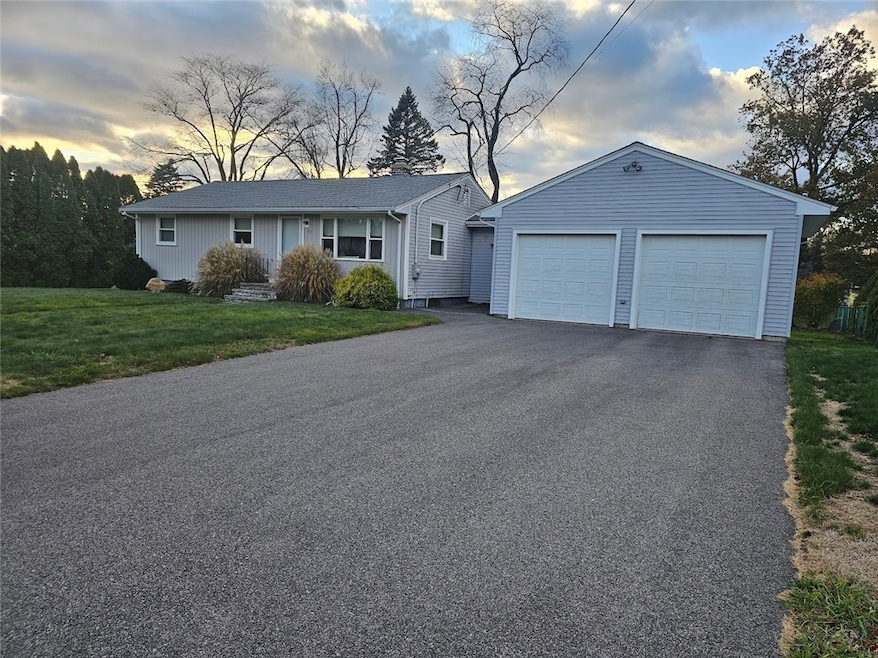

75 Buckwheat Ave Portsmouth, RI 02871
South Portsmouth NeighborhoodEstimated payment $4,090/month
Highlights
- Popular Property
- Wood Flooring
- Cooling Available
- Portsmouth High School Rated A-
- 2 Car Attached Garage
- Baseboard Heating
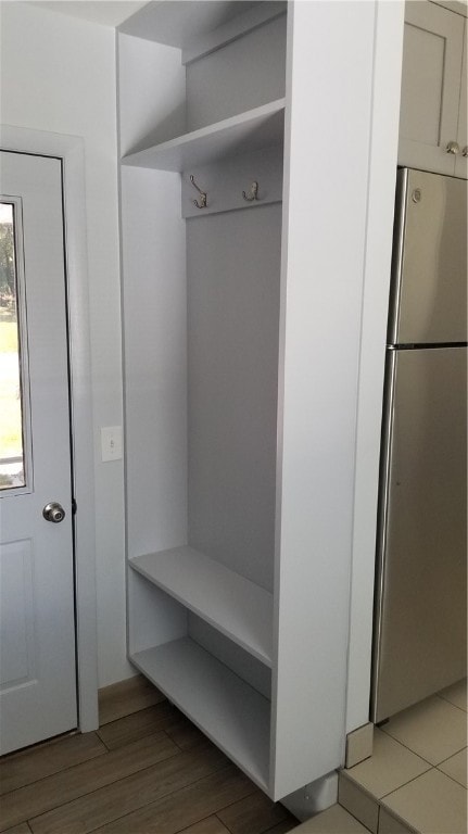
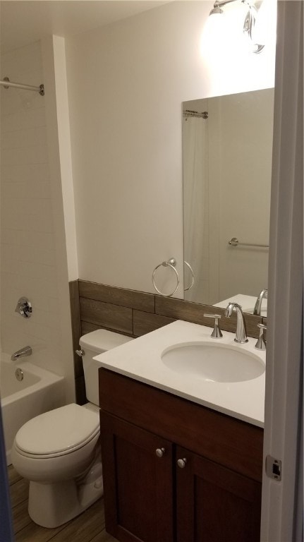
About This Home
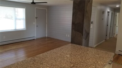
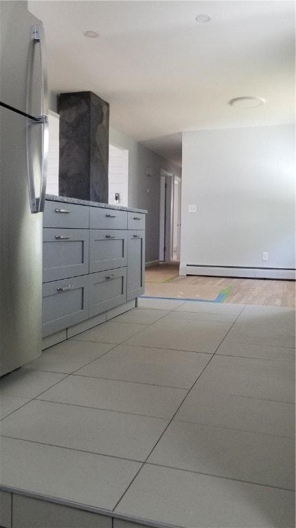
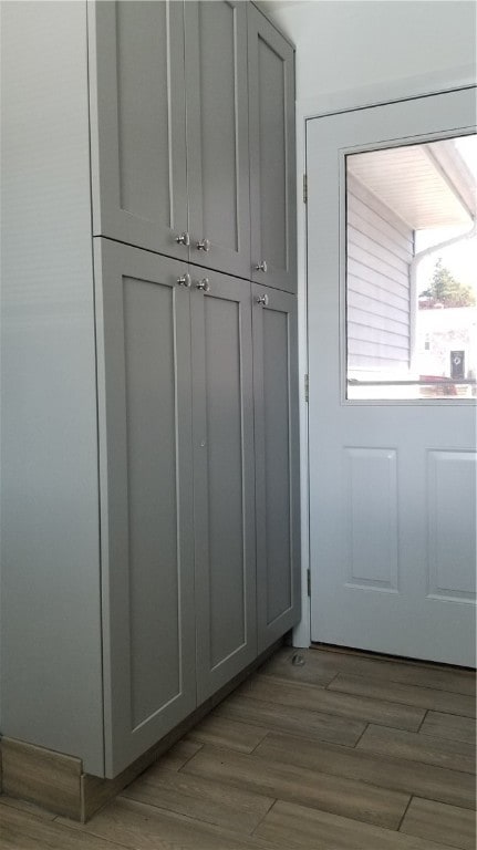
Completely REMODELED one-level Ranch for easy living, over-sized 2-car garage and some extra space available on lower level.
Rental option on yearly basis available. Seller Financing available to qualified buyer with SIZEABLE down payment and credit worthiness! Must see... For Sale or For Rent Options Available! Must close in 2026!
Home Details
Home Type
- Single Family
Est. Annual Taxes
- $4,894
Year Built
- Built in 1971
Lot Details
- 0.29 Acre Lot
Parking
- 2 Car Attached Garage
Home Design
- Vinyl Siding
- Concrete Perimeter Foundation
Interior Spaces
- 960 Sq Ft Home
- 1-Story Property
Flooring
- Wood
- Ceramic Tile
Bedrooms and Bathrooms
- 3 Bedrooms
- 1 Full Bathroom
Unfinished Basement
- Basement Fills Entire Space Under The House
- Interior and Exterior Basement Entry
Utilities
- Cooling Available
- Heating System Uses Oil
- Baseboard Heating
- 200+ Amp Service
- Oil Water Heater
- Septic Tank
Listing and Financial Details
- Tax Lot 153
- Assessor Parcel Number 75BUCKWHEATAVPORT
Map
Home Values in the Area
Average Home Value in this Area
Tax History
| Year | Tax Paid | Tax Assessment Tax Assessment Total Assessment is a certain percentage of the fair market value that is determined by local assessors to be the total taxable value of land and additions on the property. | Land | Improvement |
|---|---|---|---|---|
| 2025 | $4,894 | $368,500 | $179,300 | $189,200 |
| 2024 | $4,857 | $368,500 | $179,300 | $189,200 |
| 2023 | $4,709 | $368,500 | $179,300 | $189,200 |
| 2022 | $4,528 | $291,000 | $164,600 | $126,400 |
| 2021 | $4,455 | $291,000 | $164,600 | $126,400 |
| 2020 | $4,385 | $291,000 | $164,600 | $126,400 |
| 2019 | $3,700 | $225,600 | $122,100 | $103,500 |
| 2018 | $3,603 | $225,600 | $122,100 | $103,500 |
| 2017 | $3,479 | $225,600 | $122,100 | $103,500 |
| 2016 | $3,389 | $211,800 | $118,100 | $93,700 |
| 2015 | $3,346 | $211,800 | $118,100 | $93,700 |
| 2014 | $3,346 | $211,800 | $118,100 | $93,700 |
Property History
| Date | Event | Price | List to Sale | Price per Sq Ft | Prior Sale |
|---|---|---|---|---|---|
| 11/12/2025 11/12/25 | For Sale | $675,923 | 0.0% | $704 / Sq Ft | |
| 11/03/2025 11/03/25 | For Rent | $3,200 | 0.0% | -- | |
| 09/30/2016 09/30/16 | Sold | $160,000 | -17.9% | $167 / Sq Ft | View Prior Sale |
| 08/31/2016 08/31/16 | Pending | -- | -- | -- | |
| 07/07/2016 07/07/16 | For Sale | $195,000 | -- | $203 / Sq Ft |
Purchase History
| Date | Type | Sale Price | Title Company |
|---|---|---|---|
| Warranty Deed | $160,000 | -- |
Source: State-Wide MLS
MLS Number: 1399999
APN: PORT-000051-000000-000153
Disclaimer: Certain information contained herein is derived from information provided by parties other than Homes.com. All information provided is deemed reliable, but is not guaranteed to be accurate and should be independently verified.
![]() IDX information is provided exclusively for personal, non-commercial use, and may not be used for any purpose other than to identify prospective properties consumers may be interested in purchasing. Information is deemed reliable but not guaranteed.
IDX information is provided exclusively for personal, non-commercial use, and may not be used for any purpose other than to identify prospective properties consumers may be interested in purchasing. Information is deemed reliable but not guaranteed.
Copyright © 2025 State-Wide MLS, Inc. All rights reserved.
- 21 Cathy Cir
- 118 Pear St
- 5 Leland Point Dr
- 64 Martens Rd
- 249 Middle Rd
- 1533 E Main Rd
- 1994 E Main Rd
- 2040 E Main Rd
- 13 Vanderbilt Ln
- 63 Clearview Ave
- 121 King Charles Dr
- 43 Lawton Brook Ln
- 154 Mccorrie Ln Unit 156
- 30 Hamilton Dr
- 95 Devin Dr
- 129 Lawrence Dr
- 58 Stewart Dr
- 711 Union St
- 26 Westwood Dr
- 13 Karen St
- 0 Buckwheat Ave
- 57 Randolph Way
- 1 Leland Point Dr
- 19 Ethel Dr
- 1994 E Main Rd
- 45 Ethel Dr
- 43 Lawton Brook Ln
- 2121 W Main Rd
- 73 Bayside Ave
- 137 Prospect Ln
- 749 W Main Rd
- 90 Macomber Ln
- 3 Sylvania Rd Unit 3
- 155 Taylor Rd
- 2958 E Main Rd
- 20 Borden Farm Rd
- 9 Marshall Ln
- 12 Phillips Ave
- 1 Tower Dr Unit 1503
- 16 South Dr
