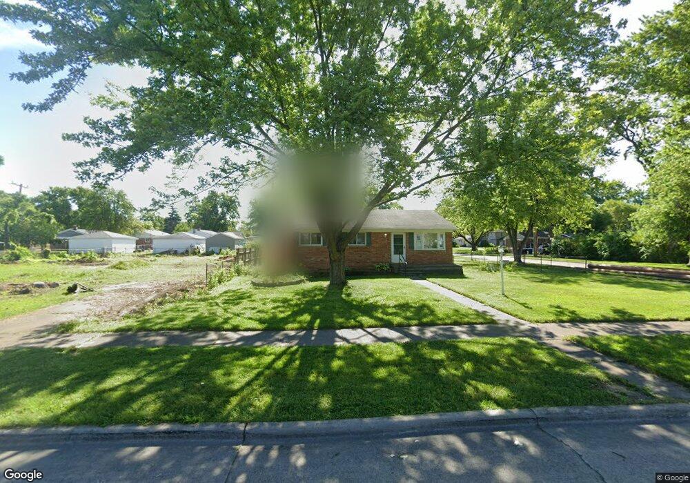
7506 Gilman St Westland, MI 48185
Estimated Value: $204,000 - $251,000
3
Beds
2
Baths
1,045
Sq Ft
$215/Sq Ft
Est. Value
About This Home
This home is located at 7506 Gilman St, Westland, MI 48185 and is currently estimated at $224,504, approximately $214 per square foot. 7506 Gilman St is a home located in Wayne County with nearby schools including Cleveland Elementary School, Cooper Upper Elementary School, and Emerson Middle School.
Ownership History
Date
Name
Owned For
Owner Type
Purchase Details
Closed on
Mar 31, 2021
Sold by
Anderson Linda G
Bought by
Anderson Linda G and Anderson Zachary K
Current Estimated Value
Purchase Details
Closed on
Apr 8, 2010
Sold by
Mickam Robert C
Bought by
Anderson Linda G
Purchase Details
Closed on
Jun 3, 2009
Sold by
Phillips Ronald and Phillips Kristy
Bought by
Wells Fargo Bank Na
Purchase Details
Closed on
Nov 13, 2006
Sold by
The Buchanan Family Trust
Bought by
Phillips Ronald
Purchase Details
Closed on
Jul 12, 2004
Sold by
Buchanan Rolland C and Buchanan Laureen G
Bought by
Veri L and Buchanan Family Trust
Purchase Details
Closed on
Jul 28, 2003
Sold by
Buchanan Rolland C and Buchanan Laureen G
Bought by
Buchanan Rolland C
Purchase Details
Closed on
Sep 20, 2001
Sold by
Johnson Laureen G
Bought by
Buchanan Rolland C
Create a Home Valuation Report for This Property
The Home Valuation Report is an in-depth analysis detailing your home's value as well as a comparison with similar homes in the area
Home Values in the Area
Average Home Value in this Area
Purchase History
| Date | Buyer | Sale Price | Title Company |
|---|---|---|---|
| Anderson Linda G | -- | None Available | |
| Anderson Linda G | -- | None Available | |
| Wells Fargo Bank Na | $20,500 | None Available | |
| Phillips Ronald | $180,000 | Wilson Title Agency Llc | |
| Veri L | -- | -- | |
| Buchanan Rolland C | -- | -- | |
| Buchanan Rolland C | -- | -- |
Source: Public Records
Tax History Compared to Growth
Tax History
| Year | Tax Paid | Tax Assessment Tax Assessment Total Assessment is a certain percentage of the fair market value that is determined by local assessors to be the total taxable value of land and additions on the property. | Land | Improvement |
|---|---|---|---|---|
| 2025 | $1,957 | $108,200 | $0 | $0 |
| 2024 | $1,957 | $103,900 | $0 | $0 |
| 2023 | $1,800 | $95,700 | $0 | $0 |
| 2022 | $2,036 | $85,500 | $0 | $0 |
| 2021 | $1,985 | $79,600 | $0 | $0 |
| 2020 | $1,964 | $71,300 | $0 | $0 |
| 2019 | $1,872 | $72,900 | $0 | $0 |
| 2018 | $3,095 | $66,300 | $0 | $0 |
| 2017 | $589 | $66,000 | $0 | $0 |
| 2016 | $1,777 | $66,900 | $0 | $0 |
| 2015 | $3,700 | $46,080 | $0 | $0 |
| 2013 | $3,584 | $39,600 | $0 | $0 |
| 2012 | $1,882 | $49,730 | $0 | $0 |
Source: Public Records
Map
Nearby Homes
- 7401 Floral St
- 7304 Gilman St
- 7367 Cavell St
- 7606 Cavell St
- 7048 Deering St
- 7029 Belton St
- 7641 N Inkster Rd
- 7350 N Inkster Rd
- 7350 N Inkster Rd Unit 17
- 28627 Bridge St
- 28730 Bridge St
- 6690 Deering St
- 27753 Trailbrooke Cir
- 27517 Windsor St
- 28912 Cambridge St
- 6567 Sterling Ct
- 29256 Brody Ave
- 27023 Clairview Dr
- 7370 Amboy St
- 8565 Cardwell St
- 7505 Floral St
- 7501 Floral St
- 7521 Floral St
- 7444 Gilman St
- 7525 Floral St
- 7544 Gilman St
- 7545 Floral St
- 7414 Gilman St
- 7447 Floral St
- 7521 Gilman St
- 7533 Gilman Ave
- 7505 Gilman St
- 7529 Gilman St
- 7560 Gilman St
- 7445 Gilman St
- 7569 Floral St
- 7400 Gilman St
- 7427 Gilman St
- 7537 Gilman St Unit Bldg-Unit
- 7537 Gilman St