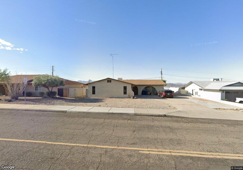
751 Thunderbolt Ave Lake Havasu City, AZ 86406
Estimated Value: $361,523 - $434,000
3
Beds
2
Baths
1,380
Sq Ft
$284/Sq Ft
Est. Value
About This Home
This home is located at 751 Thunderbolt Ave, Lake Havasu City, AZ 86406 and is currently estimated at $392,381, approximately $284 per square foot. 751 Thunderbolt Ave is a home located in Mohave County with nearby schools including Starline Elementary School, Thunderbolt Middle School, and Lake Havasu High School.
Ownership History
Date
Name
Owned For
Owner Type
Purchase Details
Closed on
Oct 4, 2007
Sold by
Baroni Frank J
Bought by
Acuesta Duane
Current Estimated Value
Purchase Details
Closed on
Jul 28, 2003
Sold by
Sherrill Jerry Dean and Sherrill Bobbie C
Bought by
Baroni Frank J and Baroni Esther B
Home Financials for this Owner
Home Financials are based on the most recent Mortgage that was taken out on this home.
Original Mortgage
$132,900
Interest Rate
4.12%
Mortgage Type
Unknown
Create a Home Valuation Report for This Property
The Home Valuation Report is an in-depth analysis detailing your home's value as well as a comparison with similar homes in the area
Home Values in the Area
Average Home Value in this Area
Purchase History
| Date | Buyer | Sale Price | Title Company |
|---|---|---|---|
| Acuesta Duane | $167,500 | Capital Title Agency Inc | |
| Baroni Frank J | $139,900 | Transnation Title Ins Co |
Source: Public Records
Mortgage History
| Date | Status | Borrower | Loan Amount |
|---|---|---|---|
| Previous Owner | Baroni Frank J | $132,900 |
Source: Public Records
Tax History Compared to Growth
Tax History
| Year | Tax Paid | Tax Assessment Tax Assessment Total Assessment is a certain percentage of the fair market value that is determined by local assessors to be the total taxable value of land and additions on the property. | Land | Improvement |
|---|---|---|---|---|
| 2026 | $541 | -- | -- | -- |
| 2025 | $1,097 | $28,434 | $0 | $0 |
| 2024 | $1,097 | $30,804 | $0 | $0 |
| 2023 | $1,097 | $25,017 | $0 | $0 |
| 2022 | $1,049 | $18,927 | $0 | $0 |
| 2021 | $1,208 | $17,188 | $0 | $0 |
| 2019 | $1,150 | $14,133 | $0 | $0 |
| 2018 | $1,113 | $13,072 | $0 | $0 |
| 2017 | $1,102 | $12,224 | $0 | $0 |
| 2016 | $1,003 | $10,861 | $0 | $0 |
| 2015 | $963 | $9,343 | $0 | $0 |
Source: Public Records
Map
Nearby Homes
- 3150 Star Dr
- 3135 Cotati Dr
- 3066 Star Dr
- 815 Rolling Hills Plaza N
- 2970 War Eagle Dr
- 691 Rolling Hills Dr
- 532 Roanoke Dr
- 3261 Thundercloud Dr
- 850 Thunderbolt Ave
- 700 Apache Dr
- 2910 Coconino Dr
- 2890 Yuma Dr
- 786 Powder Dr
- 3040 Gypsy Dr
- 680 Yosemite Dr
- 2820 Indian Springs Dr
- 3370 Thundercloud Dr
- 2951 Saddleback Dr
- 2997 Edgewood Dr
- 1051 Thunderbolt Ave
- 761 Thunderbolt Ave
- 731 Thunderbolt Ave
- 731 Thunderbolt Ave
- 3101 Star Dr
- 750 Thunderbolt Ave
- 760 Thunderbolt Ave
- 3091 Star Dr
- 740 Thunderbolt Ave
- 721 Thunderbolt Ave
- 3105 Star Dr
- 3304 Star Dr
- 3081 Star Dr
- 730 Thunderbolt Ave
- 3125 Star Dr
- 3130 Cotati Dr
- 3115 Star Dr
- 3071 Star Dr
- 3120 Star Dr
- 3110 Star Dr
- 3140 Cotati Dr