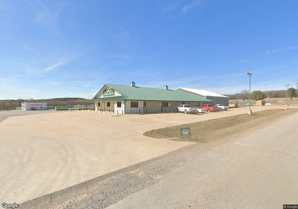
7519 E Highway 82 Oak Ridge, TX 76240
Estimated Value: $900,955
--
Bed
--
Bath
9,904
Sq Ft
$91/Sq Ft
Est. Value
About This Home
This home is located at 7519 E Highway 82, Oak Ridge, TX 76240 and is currently estimated at $900,955, approximately $90 per square foot. 7519 E Highway 82 is a home located in Cooke County with nearby schools including Callisburg Elementary School, Callisburg Middle School, and Callisburg High School.
Ownership History
Date
Name
Owned For
Owner Type
Purchase Details
Closed on
Jun 23, 2021
Sold by
V Barv Real Estate Partnership Lp
Bought by
Bradley J Holdings Llc
Current Estimated Value
Home Financials for this Owner
Home Financials are based on the most recent Mortgage that was taken out on this home.
Original Mortgage
$675,000
Outstanding Balance
$406,309
Interest Rate
2.9%
Mortgage Type
Purchase Money Mortgage
Estimated Equity
$494,646
Create a Home Valuation Report for This Property
The Home Valuation Report is an in-depth analysis detailing your home's value as well as a comparison with similar homes in the area
Home Values in the Area
Average Home Value in this Area
Purchase History
| Date | Buyer | Sale Price | Title Company |
|---|---|---|---|
| Bradley J Holdings Llc | -- | Providence Title Company |
Source: Public Records
Mortgage History
| Date | Status | Borrower | Loan Amount |
|---|---|---|---|
| Open | Bradley J Holdings Llc | $675,000 |
Source: Public Records
Tax History Compared to Growth
Tax History
| Year | Tax Paid | Tax Assessment Tax Assessment Total Assessment is a certain percentage of the fair market value that is determined by local assessors to be the total taxable value of land and additions on the property. | Land | Improvement |
|---|---|---|---|---|
| 2025 | $13,721 | $811,905 | $188,294 | $623,611 |
| 2024 | $13,721 | $877,811 | $254,200 | $623,611 |
| 2023 | $19,020 | $877,811 | $254,200 | $623,611 |
| 2022 | $10,604 | $629,962 | $179,800 | $450,162 |
| 2021 | $8,799 | $450,821 | $86,800 | $364,021 |
| 2020 | $11,089 | $535,721 | $86,800 | $448,921 |
| 2019 | $11,230 | $539,868 | $86,800 | $453,068 |
| 2018 | $10,417 | $493,036 | $86,800 | $406,236 |
| 2017 | $10,482 | $492,648 | $86,800 | $405,848 |
| 2015 | $11,035 | $527,023 | $86,800 | $440,223 |
| 2014 | $11,035 | $527,023 | $86,800 | $440,223 |
Source: Public Records
Map
Nearby Homes
- 457 Neals Hill Rd
- 240 1st St
- 248 1st St
- 455 Neals Hill Rd
- 2566 County Road 147
- 724 Rocky Ridge Flatts
- 716 & 724 Rocky Ridge Flatts Rd
- 716 Rocky Ridge Flatts
- 8016 U S Hwy 82
- 8016 U S 82
- TBD Lot 4 Cr-197
- TBD Lot 2 Cr-147
- TBD Lot 3 Cr-147
- TBD Lot 5 Cr-197
- 60 County Road 196
- 764 County Road 147
- 0000 County Road 121
- 3132 County Road 178
- 1448 County Road 123
- 1546 County Road 123
- 7519 E Highway 82
- 21298 N County Rd
- 7416 U S 82
- TBD County Road 147
- 7426 E Us Highway 82
- 1601 Paul Ln
- 2222 County Road 147
- 1202 Parkside Cir
- 1311 Parkside Cir
- 1210 Parkside Cir
- 1285 Parkside Cir
- 1218 Parkside Cir
- 1289 Parkside Cir
- 11695 U S 82
- 1201 Parkside Cir
- 1283 Parkside Cir
- 1211 Parkside Cir
- 1250 Parkside Cir
- 1235 Parkside Cir
- 1258 Parkside Cir