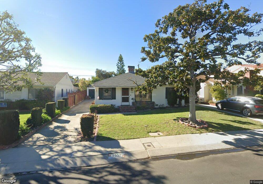
7537 Agnew Ave Los Angeles, CA 90045
Westchester NeighborhoodEstimated Value: $1,458,559 - $2,012,000
2
Beds
1
Bath
1,174
Sq Ft
$1,441/Sq Ft
Est. Value
About This Home
This home is located at 7537 Agnew Ave, Los Angeles, CA 90045 and is currently estimated at $1,691,890, approximately $1,441 per square foot. 7537 Agnew Ave is a home located in Los Angeles County with nearby schools including Cowan Avenue Elementary School, Wright Middle School STEAM Magnet, and Westchester Enriched Sciences Magnets.
Ownership History
Date
Name
Owned For
Owner Type
Purchase Details
Closed on
Dec 4, 2000
Sold by
Nelson James R
Bought by
Greer Phillip S and Greer Joanne
Current Estimated Value
Home Financials for this Owner
Home Financials are based on the most recent Mortgage that was taken out on this home.
Original Mortgage
$275,000
Outstanding Balance
$101,413
Interest Rate
7.71%
Estimated Equity
$1,590,477
Create a Home Valuation Report for This Property
The Home Valuation Report is an in-depth analysis detailing your home's value as well as a comparison with similar homes in the area
Home Values in the Area
Average Home Value in this Area
Purchase History
| Date | Buyer | Sale Price | Title Company |
|---|---|---|---|
| Greer Phillip S | $355,000 | Equity Title Company |
Source: Public Records
Mortgage History
| Date | Status | Borrower | Loan Amount |
|---|---|---|---|
| Open | Greer Phillip S | $275,000 | |
| Closed | Greer Phillip S | $44,401 |
Source: Public Records
Tax History Compared to Growth
Tax History
| Year | Tax Paid | Tax Assessment Tax Assessment Total Assessment is a certain percentage of the fair market value that is determined by local assessors to be the total taxable value of land and additions on the property. | Land | Improvement |
|---|---|---|---|---|
| 2025 | $6,420 | $534,908 | $427,932 | $106,976 |
| 2024 | $6,420 | $524,421 | $419,542 | $104,879 |
| 2023 | $6,299 | $514,139 | $411,316 | $102,823 |
| 2022 | $6,009 | $504,058 | $403,251 | $100,807 |
| 2021 | $5,929 | $494,176 | $395,345 | $98,831 |
| 2019 | $5,751 | $479,520 | $383,620 | $95,900 |
| 2018 | $5,686 | $470,119 | $376,099 | $94,020 |
| 2016 | $5,432 | $451,866 | $361,496 | $90,370 |
| 2015 | $5,352 | $445,079 | $356,066 | $89,013 |
| 2014 | $5,375 | $436,362 | $349,092 | $87,270 |
Source: Public Records
Map
Nearby Homes
- 7501 Agnew Ave
- 7456 Denrock Ave
- 7403 Stewart Ave
- 7841 Stewart Ave
- 7833 Denrock Ave
- 7713 Anise Ave
- 7809 Mcconnell Ave
- 12655 Bluff Creek Dr Unit 129
- 8000 Westlawn Ave
- 7831 Beland Ave
- 7920 Anise Ave Unit 1
- 8015 Dunbarton Ave
- 7825 Cowan Ave
- 5904 Village Dr
- 7733 Henefer Ave
- 6606 W 80th Place
- 8044 Cowan Ave
- 6427 Hedding St
- 7449 Kentwood Ave
- 12923 Bluff Creek Dr
- 7541 Agnew Ave
- 7531 Agnew Ave
- 7527 Agnew Ave
- 7547 Agnew Ave
- 7540 Dunbarton Ave
- 7546 Dunbarton Ave
- 7534 Dunbarton Ave
- 7530 Dunbarton Ave
- 7550 Dunbarton Ave
- 7521 Agnew Ave
- 7536 Agnew Ave
- 7542 Agnew Ave
- 7530 Agnew Ave
- 7524 Dunbarton Ave
- 7548 Agnew Ave
- 7524 Agnew Ave
- 7517 Agnew Ave
- 7701 Agnew Ave
- 7518 Dunbarton Ave
- 7518 Agnew Ave