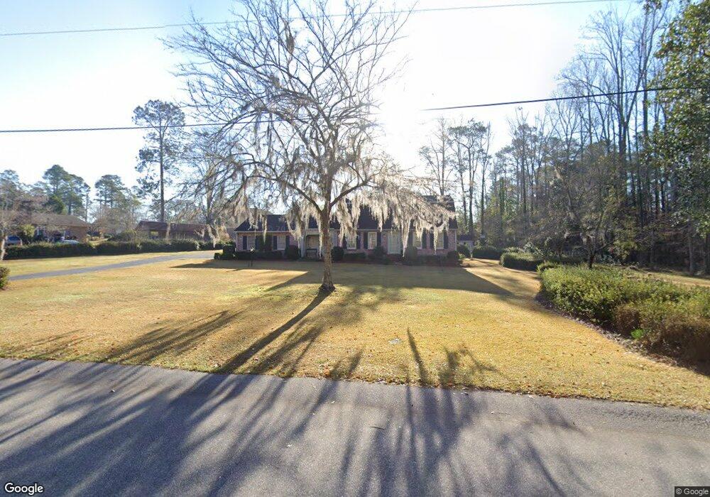
755 Rutledge Ave Orangeburg, SC 29115
Estimated Value: $85,000 - $132,000
3
Beds
1
Bath
1,965
Sq Ft
$53/Sq Ft
Est. Value
About This Home
This home is located at 755 Rutledge Ave, Orangeburg, SC 29115 and is currently estimated at $103,357, approximately $52 per square foot. 755 Rutledge Ave is a home located in Orangeburg County with nearby schools including Sheridan Elementary School, Sheridan Elementary, and William J. Clark Middle School.
Ownership History
Date
Name
Owned For
Owner Type
Purchase Details
Closed on
Apr 28, 2015
Sold by
Stroman Sabet
Bought by
Beaver Elizabeth Sloane and Beaver Megan Mckenzie
Current Estimated Value
Purchase Details
Closed on
Mar 31, 2014
Sold by
Estate Of Mark A Stroman and Stroman Sabet
Bought by
Beaver Elizabeth Sloane and Beaver Megan Mckenzie
Purchase Details
Closed on
Oct 8, 2004
Sold by
Stroman Jesse L and Stroman Richard F
Bought by
Millwood Development Partners Llc
Create a Home Valuation Report for This Property
The Home Valuation Report is an in-depth analysis detailing your home's value as well as a comparison with similar homes in the area
Home Values in the Area
Average Home Value in this Area
Purchase History
| Date | Buyer | Sale Price | Title Company |
|---|---|---|---|
| Beaver Elizabeth Sloane | -- | None Available | |
| Beaver Elizabeth Sloane | -- | -- | |
| Beaver Elizabeth Sloane | -- | -- | |
| Millwood Development Partners Llc | $188,000 | -- |
Source: Public Records
Tax History Compared to Growth
Tax History
| Year | Tax Paid | Tax Assessment Tax Assessment Total Assessment is a certain percentage of the fair market value that is determined by local assessors to be the total taxable value of land and additions on the property. | Land | Improvement |
|---|---|---|---|---|
| 2024 | $1,637 | $4,697 | $3,581 | $1,116 |
| 2023 | $1,352 | $4,411 | $3,247 | $1,164 |
| 2022 | $1,352 | $4,411 | $3,247 | $1,164 |
| 2021 | $1,345 | $4,411 | $3,247 | $1,164 |
| 2020 | $1,235 | $4,411 | $0 | $0 |
| 2019 | $1,193 | $4,411 | $0 | $0 |
| 2018 | $1,132 | $3,008 | $0 | $0 |
| 2017 | $1,114 | $3,008 | $0 | $0 |
| 2016 | $1,113 | $3,008 | $0 | $0 |
| 2015 | $1,371 | $3,008 | $0 | $0 |
| 2014 | $1,371 | $3,788 | $3,248 | $540 |
| 2013 | -- | $2,553 | $2,165 | $388 |
Source: Public Records
Map
Nearby Homes
- 1550 Riverbank Dr
- 1571 Green Valley St
- 1561 Green Valley St
- 481 Rutledge Ave
- 533 Gue Rd
- 391 Pinehill Rd
- 1219 Eastbrook Dr
- 309 Perryclear St
- 279 Perryclear St
- 2260 Middleton St
- 184 Scoville St
- 238 Club Acres Blvd
- 772 Hillsboro Rd
- 943 Spring Hill Ln
- 2018 Griffith Dr NW
- 990 Edisto Ave
- 2091 Griffith Dr NW
- 2133 Griffith Dr
- 1176 Moore Rd
- 1611 Sunset St
- 755 Rutledge Ave
- 1579 Pinehurst St
- 1579 Pinehurst St
- 1579 Pinehurst St
- 1589 Pinehurst St
- 1565 Pinehurst St
- 1578 Riverbank Dr
- 1545 Pinehurst St
- 681 Rutledge Ave
- 1580 Pinehurst St
- 1564 Pinehurst St
- 1564 Pinehurst St
- 1527 Pinehurst St
- 653 Rutledge Ave
- 1530 Riverbank Dr
- 1530 Riverbank Dr
- 1530 Riverbank Dr
- 670 Rutledge Ave
- 650 Rutledge Ave
- 1526 Pinehurst St