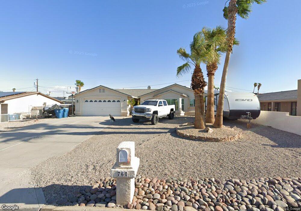
760 Thunderbolt Ave Lake Havasu City, AZ 86406
Estimated Value: $430,071 - $511,000
--
Bed
1
Bath
1,562
Sq Ft
$300/Sq Ft
Est. Value
About This Home
This home is located at 760 Thunderbolt Ave, Lake Havasu City, AZ 86406 and is currently estimated at $469,268, approximately $300 per square foot. 760 Thunderbolt Ave is a home located in Mohave County with nearby schools including Oro Grande Elementary School, Thunderbolt Middle School, and Lake Havasu High School.
Ownership History
Date
Name
Owned For
Owner Type
Purchase Details
Closed on
Dec 7, 2015
Sold by
Trejo Patrick
Bought by
Trejo Patrick
Current Estimated Value
Purchase Details
Closed on
Apr 27, 2007
Sold by
Groves Herbert D and Groves Peggy G D
Bought by
Groves Herbert D and Groves Peggy G D
Purchase Details
Closed on
Feb 8, 2007
Sold by
Groves Herbert D and Groves Peggy G D
Bought by
Groves Herbert D and Groves Peggy G D
Purchase Details
Closed on
Aug 18, 1999
Sold by
Groves Herbert D and Groves Peggy G D
Bought by
Groves Herbert D and Groves Peggy G D
Create a Home Valuation Report for This Property
The Home Valuation Report is an in-depth analysis detailing your home's value as well as a comparison with similar homes in the area
Home Values in the Area
Average Home Value in this Area
Purchase History
| Date | Buyer | Sale Price | Title Company |
|---|---|---|---|
| Trejo Patrick | -- | None Available | |
| Groves Herbert D | -- | None Available | |
| Groves Herbert D | -- | None Available | |
| Groves Herbert D | -- | -- |
Source: Public Records
Tax History Compared to Growth
Tax History
| Year | Tax Paid | Tax Assessment Tax Assessment Total Assessment is a certain percentage of the fair market value that is determined by local assessors to be the total taxable value of land and additions on the property. | Land | Improvement |
|---|---|---|---|---|
| 2026 | $28 | -- | -- | -- |
| 2025 | $1,408 | $41,436 | $0 | $0 |
| 2024 | $1,408 | $43,603 | $0 | $0 |
| 2023 | $1,408 | $36,222 | $0 | $0 |
| 2022 | $1,356 | $26,695 | $0 | $0 |
| 2021 | $1,550 | $25,472 | $0 | $0 |
| 2019 | $1,474 | $21,732 | $0 | $0 |
| 2018 | $1,426 | $20,185 | $0 | $0 |
| 2017 | $1,401 | $19,330 | $0 | $0 |
| 2016 | $1,243 | $17,265 | $0 | $0 |
| 2015 | $763 | $11,890 | $0 | $0 |
Source: Public Records
Map
Nearby Homes
- 3135 Cotati Dr
- 3150 Star Dr
- 3066 Star Dr
- 2970 War Eagle Dr
- 815 Rolling Hills Plaza N
- 532 Roanoke Dr
- 691 Rolling Hills Dr
- 3261 Thundercloud Dr
- 850 Thunderbolt Ave
- 700 Apache Dr
- 2910 Coconino Dr
- 786 Powder Dr
- 2890 Yuma Dr
- 3040 Gypsy Dr
- 680 Yosemite Dr
- 2820 Indian Springs Dr
- 2951 Saddleback Dr
- 2997 Edgewood Dr
- 3370 Thundercloud Dr
- 1051 Thunderbolt Ave
- 750 Thunderbolt Ave
- 3105 Star Dr
- 3125 Star Dr
- 3115 Star Dr
- 740 Thunderbolt Ave
- 761 Thunderbolt Ave
- 751 Thunderbolt Ave
- 3130 Cotati Dr
- 3304 Star Dr
- 3101 Star Dr
- 3140 Cotati Dr
- 3135 Star Dr
- 3145 Star Dr
- 730 Thunderbolt Ave
- 3146 Cotati
- 3130 Star Dr
- 731 Thunderbolt Ave
- 731 Thunderbolt Ave
- 3140 Star Dr
- 3155 Star Dr