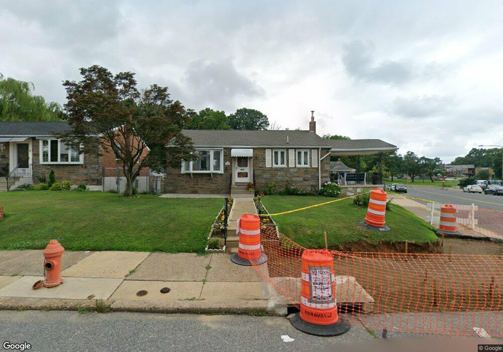
7601 Brocklehurst St Philadelphia, PA 19152
Rhawnhurst NeighborhoodEstimated Value: $360,000 - $412,000
--
Bed
--
Bath
1,597
Sq Ft
$243/Sq Ft
Est. Value
About This Home
This home is located at 7601 Brocklehurst St, Philadelphia, PA 19152 and is currently estimated at $387,823, approximately $242 per square foot. 7601 Brocklehurst St is a home located in Philadelphia County with nearby schools including Lincoln High School, Meehan Austin Middle School, and St. Matthew School.
Ownership History
Date
Name
Owned For
Owner Type
Purchase Details
Closed on
Nov 20, 2002
Sold by
Becker John H
Bought by
Kokuri Petro and Kokuri Marjana
Current Estimated Value
Home Financials for this Owner
Home Financials are based on the most recent Mortgage that was taken out on this home.
Original Mortgage
$117,000
Outstanding Balance
$49,547
Interest Rate
6.17%
Estimated Equity
$338,276
Purchase Details
Closed on
Jan 20, 1995
Sold by
Becker John H
Bought by
Becker John H
Create a Home Valuation Report for This Property
The Home Valuation Report is an in-depth analysis detailing your home's value as well as a comparison with similar homes in the area
Home Values in the Area
Average Home Value in this Area
Purchase History
| Date | Buyer | Sale Price | Title Company |
|---|---|---|---|
| Kokuri Petro | $207,000 | -- | |
| Becker John H | -- | -- |
Source: Public Records
Mortgage History
| Date | Status | Borrower | Loan Amount |
|---|---|---|---|
| Open | Kokuri Petro | $117,000 |
Source: Public Records
Tax History Compared to Growth
Tax History
| Year | Tax Paid | Tax Assessment Tax Assessment Total Assessment is a certain percentage of the fair market value that is determined by local assessors to be the total taxable value of land and additions on the property. | Land | Improvement |
|---|---|---|---|---|
| 2025 | $4,230 | $372,200 | $74,440 | $297,760 |
| 2024 | $4,230 | $372,200 | $74,440 | $297,760 |
| 2023 | $4,230 | $302,200 | $60,440 | $241,760 |
| 2022 | $3,600 | $257,200 | $60,440 | $196,760 |
| 2021 | $3,687 | $0 | $0 | $0 |
| 2020 | $3,687 | $0 | $0 | $0 |
| 2019 | $3,570 | $0 | $0 | $0 |
| 2018 | $2,606 | $0 | $0 | $0 |
| 2017 | $3,026 | $0 | $0 | $0 |
| 2016 | $2,606 | $0 | $0 | $0 |
| 2015 | $2,495 | $0 | $0 | $0 |
| 2014 | -- | $216,200 | $52,765 | $163,435 |
| 2012 | -- | $32,416 | $8,538 | $23,878 |
Source: Public Records
Map
Nearby Homes
- 7703 Brous Ave
- 7521 Calvert St
- 7525 Calvert St
- 7722 Fairfield St
- 7416 Revere St
- 7418 Revere St
- 3036 Nesper St
- 7914 Farnsworth St
- 3011 Teesdale St
- 7249 Rupert St
- 7246 Calvert St
- 3034 Teesdale St
- 7233 Barnard Ave
- 2755 Rhawn St
- 2803 Rhawn St
- 2345 Ripley St
- 2727 Rhawn St
- 2727 Rhawn St Unit 7AB
- 7815 Horrocks St
- 7213 Brous Ave
- 7603 Brocklehurst St
- 7602 Lexington Ave
- 7600 Lexington Ave
- 7605 Brocklehurst St
- 7604 Lexington Ave
- 7601 Brous Ave
- 7606 Lexington Ave
- 7607 Brocklehurst St
- 7600 Brous Ave
- 7608 Lexington Ave
- 7603 Brous Ave
- 7602 Brous Ave
- 7609 Brocklehurst St
- 7604 Brocklehurst St
- 7604 Brous Ave
- 7610 Lexington Ave
- 7605 Brous Ave
- 7611 Brocklehurst St
- 7606 Brocklehurst St
- 7601 Revere St