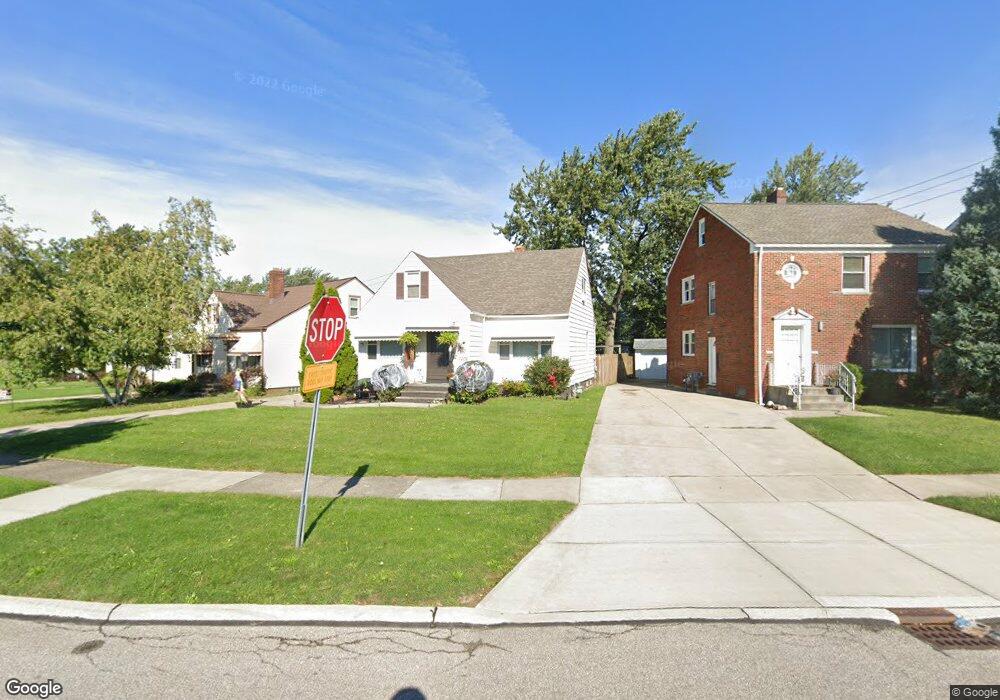
7602 Lanyard Dr Cleveland, OH 44129
Estimated Value: $208,000 - $216,000
4
Beds
3
Baths
1,236
Sq Ft
$171/Sq Ft
Est. Value
About This Home
This home is located at 7602 Lanyard Dr, Cleveland, OH 44129 and is currently estimated at $211,917, approximately $171 per square foot. 7602 Lanyard Dr is a home located in Cuyahoga County with nearby schools including Renwood Elementary School, Thoreau Park Elementary School, and Greenbriar Middle School.
Ownership History
Date
Name
Owned For
Owner Type
Purchase Details
Closed on
Apr 15, 2018
Sold by
Cristino Francine and Cristino Alex L
Bought by
Cristino Julia Alessandra and Cristino Alicia Marie
Current Estimated Value
Purchase Details
Closed on
Mar 10, 2003
Sold by
Verile Alice M
Bought by
Cristino Alex L and Cristino Francine
Home Financials for this Owner
Home Financials are based on the most recent Mortgage that was taken out on this home.
Original Mortgage
$80,000
Outstanding Balance
$34,693
Interest Rate
6%
Estimated Equity
$177,224
Purchase Details
Closed on
Dec 9, 1998
Sold by
Verlie Alice M
Bought by
Verlie Alice M
Purchase Details
Closed on
Jun 5, 1989
Sold by
Verlie Alice M
Bought by
Verlie Alice M
Purchase Details
Closed on
Aug 19, 1980
Sold by
Verlie Alice M
Bought by
Russo Roth and Elvy Colpa
Purchase Details
Closed on
Jan 1, 1975
Bought by
Verlie Alice M
Create a Home Valuation Report for This Property
The Home Valuation Report is an in-depth analysis detailing your home's value as well as a comparison with similar homes in the area
Home Values in the Area
Average Home Value in this Area
Purchase History
| Date | Buyer | Sale Price | Title Company |
|---|---|---|---|
| Cristino Julia Alessandra | -- | None Available | |
| Cristino Alex L | $82,500 | -- | |
| Verlie Alice M | -- | -- | |
| Verlie Alice M | $27,200 | -- | |
| Russo Roth | -- | -- | |
| Verlie Alice M | -- | -- | |
| Verlie Alice M | -- | -- |
Source: Public Records
Mortgage History
| Date | Status | Borrower | Loan Amount |
|---|---|---|---|
| Open | Cristino Alex L | $80,000 |
Source: Public Records
Tax History Compared to Growth
Tax History
| Year | Tax Paid | Tax Assessment Tax Assessment Total Assessment is a certain percentage of the fair market value that is determined by local assessors to be the total taxable value of land and additions on the property. | Land | Improvement |
|---|---|---|---|---|
| 2024 | $3,548 | $57,295 | $11,200 | $46,095 |
| 2023 | $3,110 | $43,160 | $9,910 | $33,250 |
| 2022 | $3,080 | $43,160 | $9,910 | $33,250 |
| 2021 | $3,167 | $43,160 | $9,910 | $33,250 |
| 2020 | $2,780 | $33,220 | $7,630 | $25,590 |
| 2019 | $2,663 | $94,900 | $21,800 | $73,100 |
| 2018 | $2,490 | $33,220 | $7,630 | $25,590 |
| 2017 | $2,464 | $28,320 | $6,550 | $21,770 |
| 2016 | $2,449 | $28,320 | $6,550 | $21,770 |
| 2015 | $3,712 | $28,320 | $6,550 | $21,770 |
| 2014 | $3,712 | $28,920 | $6,690 | $22,230 |
Source: Public Records
Map
Nearby Homes
- 6136 Ridge Rd
- 7503 Whittington Dr
- 6168 Manchester Rd
- 6111 Manchester Rd
- 6227 Ridge Rd
- 6096 Wareham Dr
- 6234 N Canterbury Rd
- 7014 Thornton Dr
- 8017 Wainstead Dr
- 7514 Spring Garden Rd
- 7115 Hampstead Ave
- 6298 Chestnut Hills Dr
- 6610 Renwood Dr
- 6708 Thornton Dr
- 8017 Ackley Rd
- 8514 Deerfield Dr
- 7615 Bertha Ave
- 6818 Hampstead Ave
- 6406 Sunderland Dr
- 6510 Belmere Dr
- 7606 Lanyard Dr
- 6128 Holburn Rd
- 7610 Lanyard Dr
- 6124 Holburn Rd
- 7614 Lanyard Dr
- 7603 Deerfield Dr
- 7605 Deerfield Dr
- 7605 Deerfield Dr Unit 2/UP
- 7523 Deerfield Dr
- 7519 Deerfield Dr
- 7611 Deerfield Dr
- 7618 Lanyard Dr
- 6143 Holburn Rd
- 7517 Lanyard Dr
- 7615 Deerfield Dr
- 7607 Deerfield Dr
- 7607 Deerfield Dr Unit DN
- 7615 Lanyard Dr
- 7704 Lanyard Dr
- 6147 Holburn Rd