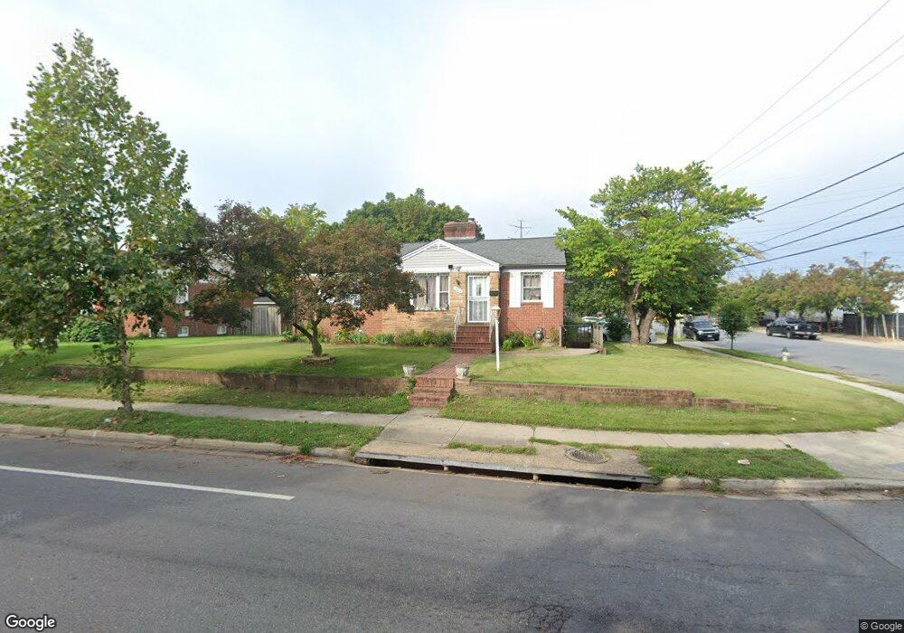
7610 23rd Ave Hyattsville, MD 20783
Lewisdale NeighborhoodEstimated Value: $402,000 - $532,000
--
Bed
1
Bath
1,590
Sq Ft
$300/Sq Ft
Est. Value
About This Home
This home is located at 7610 23rd Ave, Hyattsville, MD 20783 and is currently estimated at $476,617, approximately $299 per square foot. 7610 23rd Ave is a home located in Prince George's County with nearby schools including Lewisdale Elementary School, Nicholas Orem Middle School, and Northwestern High School.
Ownership History
Date
Name
Owned For
Owner Type
Purchase Details
Closed on
Dec 18, 2003
Sold by
Romero David I
Bought by
Romero David I and Romero Maria
Current Estimated Value
Purchase Details
Closed on
Apr 8, 2002
Sold by
Nickelson Dolores
Bought by
Romero David I
Purchase Details
Closed on
Aug 26, 1994
Sold by
Silva Maximiliano
Bought by
Nickelson Dolores
Home Financials for this Owner
Home Financials are based on the most recent Mortgage that was taken out on this home.
Original Mortgage
$155,000
Interest Rate
8.65%
Create a Home Valuation Report for This Property
The Home Valuation Report is an in-depth analysis detailing your home's value as well as a comparison with similar homes in the area
Home Values in the Area
Average Home Value in this Area
Purchase History
| Date | Buyer | Sale Price | Title Company |
|---|---|---|---|
| Romero David I | -- | -- | |
| Romero David I | $190,000 | -- | |
| Nickelson Dolores | $156,400 | -- |
Source: Public Records
Mortgage History
| Date | Status | Borrower | Loan Amount |
|---|---|---|---|
| Previous Owner | Nickelson Dolores | $155,000 |
Source: Public Records
Tax History Compared to Growth
Tax History
| Year | Tax Paid | Tax Assessment Tax Assessment Total Assessment is a certain percentage of the fair market value that is determined by local assessors to be the total taxable value of land and additions on the property. | Land | Improvement |
|---|---|---|---|---|
| 2025 | $4,853 | $455,933 | -- | -- |
| 2024 | $4,853 | $455,600 | $110,700 | $344,900 |
| 2023 | $4,593 | $420,433 | $0 | $0 |
| 2022 | $4,311 | $385,267 | $0 | $0 |
| 2021 | $4,047 | $350,100 | $100,300 | $249,800 |
| 2020 | $3,891 | $338,667 | $0 | $0 |
| 2019 | $3,728 | $327,233 | $0 | $0 |
| 2018 | $3,557 | $315,800 | $75,300 | $240,500 |
| 2017 | $3,399 | $272,600 | $0 | $0 |
| 2016 | -- | $229,400 | $0 | $0 |
| 2015 | $3,665 | $186,200 | $0 | $0 |
| 2014 | $3,665 | $186,200 | $0 | $0 |
Source: Public Records
Map
Nearby Homes
- 7975 Riggs Rd Unit 7975-12
- 7973 Riggs Rd Unit 8
- 7973 Riggs Rd Unit 2
- 7981 Riggs Rd Unit 2
- 7985 Riggs Rd Unit 1
- 7983 Riggs Rd Unit 3
- 7969 Riggs Rd Unit 9
- 7967 Riggs Rd Unit 7967-10
- 7916 Riggs Rd
- 1926 Lebanon St
- 7965 18th Ave
- 7917 18th Ave
- 7971 18th Ave
- 7401 18th Ave Unit 208
- 8110 19th Place
- 8109 Riggs Rd
- 1911 Merrimac Dr
- 2205 Calvert St
- 1802 Lebanon St
- 7402 211 18th Ave Unit 23
- 7608 23rd Ave
- 2271 Lewisdale Dr
- 2269 Lewisdale Dr
- 7613 23rd Ave
- 2266 Hannon St
- 7606 23rd Ave
- 2264 Hannon St
- 2267 Lewisdale Dr
- 7611 23rd Ave
- 2303 Lewisdale Dr
- 2277 University Blvd E
- 7701 23rd Ave
- 2262 Hannon St
- 7609 23rd Ave
- 2265 Lewisdale Dr
- 2305 Lewisdale Dr
- 7604 23rd Ave
- 7607 23rd Ave
- 2260 Hannon St
- 2263 Lewisdale Dr