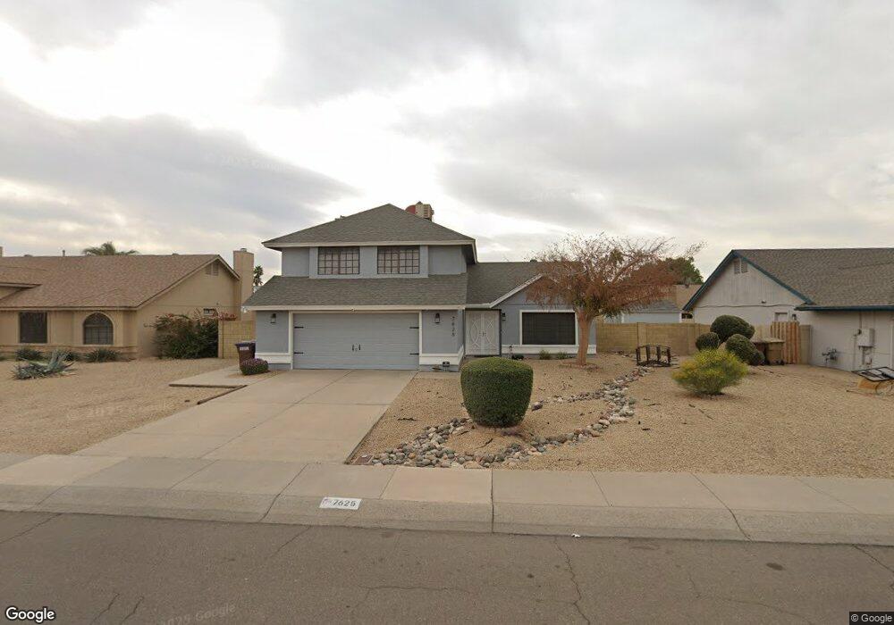
7625 W Cheryl Dr Peoria, AZ 85345
Estimated Value: $403,781 - $481,000
4
Beds
3
Baths
2,258
Sq Ft
$197/Sq Ft
Est. Value
About This Home
This home is located at 7625 W Cheryl Dr, Peoria, AZ 85345 and is currently estimated at $443,945, approximately $196 per square foot. 7625 W Cheryl Dr is a home located in Maricopa County with nearby schools including Santa Fe Elementary School, Peoria High School, and Academy of Math & Science - Peoria Advanced.
Ownership History
Date
Name
Owned For
Owner Type
Purchase Details
Closed on
May 19, 2021
Sold by
Schaefer Nancy A
Bought by
Taylor Kimberly
Current Estimated Value
Purchase Details
Closed on
Jun 24, 2011
Sold by
Bragg Nanette
Bought by
Combs Linda and Schaefer Nancy A
Home Financials for this Owner
Home Financials are based on the most recent Mortgage that was taken out on this home.
Original Mortgage
$58,580
Interest Rate
4.62%
Mortgage Type
FHA
Purchase Details
Closed on
Aug 5, 2005
Sold by
Myers George M
Bought by
Bragg Nanette
Home Financials for this Owner
Home Financials are based on the most recent Mortgage that was taken out on this home.
Original Mortgage
$234,600
Interest Rate
3.87%
Mortgage Type
Purchase Money Mortgage
Create a Home Valuation Report for This Property
The Home Valuation Report is an in-depth analysis detailing your home's value as well as a comparison with similar homes in the area
Home Values in the Area
Average Home Value in this Area
Purchase History
| Date | Buyer | Sale Price | Title Company |
|---|---|---|---|
| Taylor Kimberly | -- | None Listed On Document | |
| Combs Linda | $100,000 | Fidelity Natl Title Ins Co | |
| Bragg Nanette | $276,000 | Equity Title Agency Inc |
Source: Public Records
Mortgage History
| Date | Status | Borrower | Loan Amount |
|---|---|---|---|
| Previous Owner | Combs Linda | $58,580 | |
| Previous Owner | Bragg Nanette | $234,600 |
Source: Public Records
Tax History Compared to Growth
Tax History
| Year | Tax Paid | Tax Assessment Tax Assessment Total Assessment is a certain percentage of the fair market value that is determined by local assessors to be the total taxable value of land and additions on the property. | Land | Improvement |
|---|---|---|---|---|
| 2025 | $1,303 | $16,744 | -- | -- |
| 2024 | $1,284 | $15,947 | -- | -- |
| 2023 | $1,284 | $32,480 | $6,490 | $25,990 |
| 2022 | $1,257 | $25,100 | $5,020 | $20,080 |
| 2021 | $1,346 | $22,950 | $4,590 | $18,360 |
| 2020 | $1,359 | $21,200 | $4,240 | $16,960 |
| 2019 | $1,314 | $19,450 | $3,890 | $15,560 |
| 2018 | $1,271 | $18,570 | $3,710 | $14,860 |
| 2017 | $1,272 | $15,980 | $3,190 | $12,790 |
| 2016 | $1,259 | $15,550 | $3,110 | $12,440 |
| 2015 | $1,175 | $14,660 | $2,930 | $11,730 |
Source: Public Records
Map
Nearby Homes
- 7726 W Cheryl Dr
- 7508 W Beryl Ave
- 7810 W Peoria Ave Unit 166
- 7810 W Peoria Ave Unit 74
- 7810 W Peoria Ave Unit 121
- 7810 W Peoria Ave Unit 98
- 7810 W Peoria Ave Unit 152
- 7810 W Peoria Ave Unit 85
- 7810 W Peoria Ave Unit 79
- 7810 W Peoria Ave Unit 174
- 7336 W Cheryl Dr
- 10955 N 79th Ave Unit 147
- 10955 N 79th Ave Unit 60
- 10955 N 79th Ave Unit 113
- 10955 N 79th Ave Unit 163
- 10955 N 79th Ave Unit 179
- 10955 N 79th Ave Unit 40
- 116XX N 80th Ave Unit 16
- 11817 N 80th Ave Unit 2
- 7302 W Peoria Ave Unit 115
- 7619 W Cheryl Dr
- 7631 W Cheryl Dr
- 7626 W Brown St
- 7632 W Brown St
- 7620 W Brown St
- 7613 W Cheryl Dr
- 7637 W Cheryl Dr
- 7626 W Cheryl Dr
- 7632 W Cheryl Dr
- 7620 W Cheryl Dr
- 7614 W Brown St
- 7638 W Brown St
- 7614 W Cheryl Dr
- 7638 W Cheryl Dr
- 7607 W Cheryl Dr Unit *See*
- 7607 W Cheryl Dr
- 7643 W Cheryl Dr
- 7608 W Brown St
- 7644 W Brown St
- 7625 W Brown St