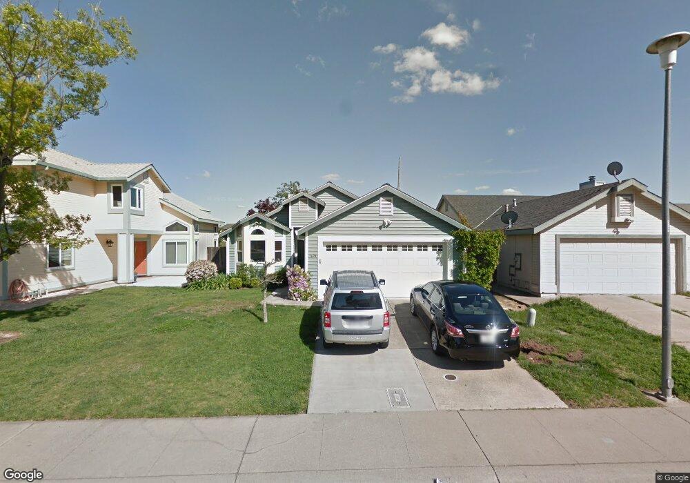
7674 Bluebrook Way Sacramento, CA 95823
Estimated Value: $235,000 - $422,000
3
Beds
2
Baths
1,382
Sq Ft
$262/Sq Ft
Est. Value
About This Home
This home is located at 7674 Bluebrook Way, Sacramento, CA 95823 and is currently estimated at $362,243, approximately $262 per square foot. 7674 Bluebrook Way is a home located in Sacramento County with nearby schools including Union House Elementary School, Samuel Jackman Middle School, and Valley High School.
Ownership History
Date
Name
Owned For
Owner Type
Purchase Details
Closed on
Aug 21, 2009
Sold by
Okasaki Mark Hiroshi and Okasaki Mark H
Bought by
Okasaki Mark H and Okasaki Jane M
Current Estimated Value
Purchase Details
Closed on
Oct 12, 1998
Sold by
Munekawa Okasaki Mark Hirochi and Munekawa Jane Michiko
Bought by
Okasaki Mark Hiroshi and Okasaki Jane Michiko
Home Financials for this Owner
Home Financials are based on the most recent Mortgage that was taken out on this home.
Original Mortgage
$106,400
Interest Rate
6.79%
Create a Home Valuation Report for This Property
The Home Valuation Report is an in-depth analysis detailing your home's value as well as a comparison with similar homes in the area
Home Values in the Area
Average Home Value in this Area
Purchase History
| Date | Buyer | Sale Price | Title Company |
|---|---|---|---|
| Okasaki Mark H | -- | None Available | |
| Okasaki Mark Hiroshi | -- | Placer Title Company |
Source: Public Records
Mortgage History
| Date | Status | Borrower | Loan Amount |
|---|---|---|---|
| Closed | Okasaki Mark Hiroshi | $106,400 |
Source: Public Records
Tax History Compared to Growth
Tax History
| Year | Tax Paid | Tax Assessment Tax Assessment Total Assessment is a certain percentage of the fair market value that is determined by local assessors to be the total taxable value of land and additions on the property. | Land | Improvement |
|---|---|---|---|---|
| 2025 | $2,777 | $213,777 | $53,032 | $160,745 |
| 2024 | $2,777 | $209,587 | $51,993 | $157,594 |
| 2023 | $2,705 | $205,478 | $50,974 | $154,504 |
| 2022 | $2,675 | $201,450 | $49,975 | $151,475 |
| 2021 | $2,635 | $197,501 | $48,996 | $148,505 |
| 2020 | $2,594 | $195,477 | $48,494 | $146,983 |
| 2019 | $2,543 | $191,645 | $47,544 | $144,101 |
| 2018 | $2,473 | $187,888 | $46,612 | $141,276 |
| 2017 | $2,422 | $184,205 | $45,699 | $138,506 |
| 2016 | $2,227 | $180,594 | $44,803 | $135,791 |
| 2015 | $2,171 | $177,883 | $44,131 | $133,752 |
| 2014 | $2,130 | $174,399 | $43,267 | $131,132 |
Source: Public Records
Map
Nearby Homes
- 192 Creekside Cir
- 197 Creekside Cir
- 3765 Samos Way
- 4102 Weymouth Ln
- 4095 Weymouth Ln
- 3950 Mack Rd Unit 66
- 3950 Mack Rd Unit 182
- 3950 Mack Rd Unit 129
- 3950 Mack Rd Unit 169
- 7521 Sun Willow Ln
- 410 Sun Shower Cir
- 7570 Burgoyne Ln
- 7718 Laurie Way
- 3361 Jola Cir
- 3985 Limestone Way
- 240 Summer Stroll Cir
- 7682 Detroit Blvd
- 7507 Mandy Dr
- 7759 Detroit Blvd
- 7843 Deer Creek Dr
- 7678 Bluebrook Way
- 7670 Bluebrook Way
- 7666 Bluebrook Way
- 7682 Bluebrook Way
- 3930 Samos Way
- 7662 Bluebrook Way
- 3920 Samos Way
- 7658 Bluebrook Way
- 7669 Bluebrook Way
- 3955 Samos Way
- 7686 Bluebrook Way
- 3910 Samos Way
- 3945 Samos Way
- 7673 Bluebrook Way
- 7654 Bluebrook Way
- 7679 Bluebrook Way
- 3935 Samos Way
- 3900 Samos Way
- 7690 Bluebrook Way
- 3960 Cleardale Way