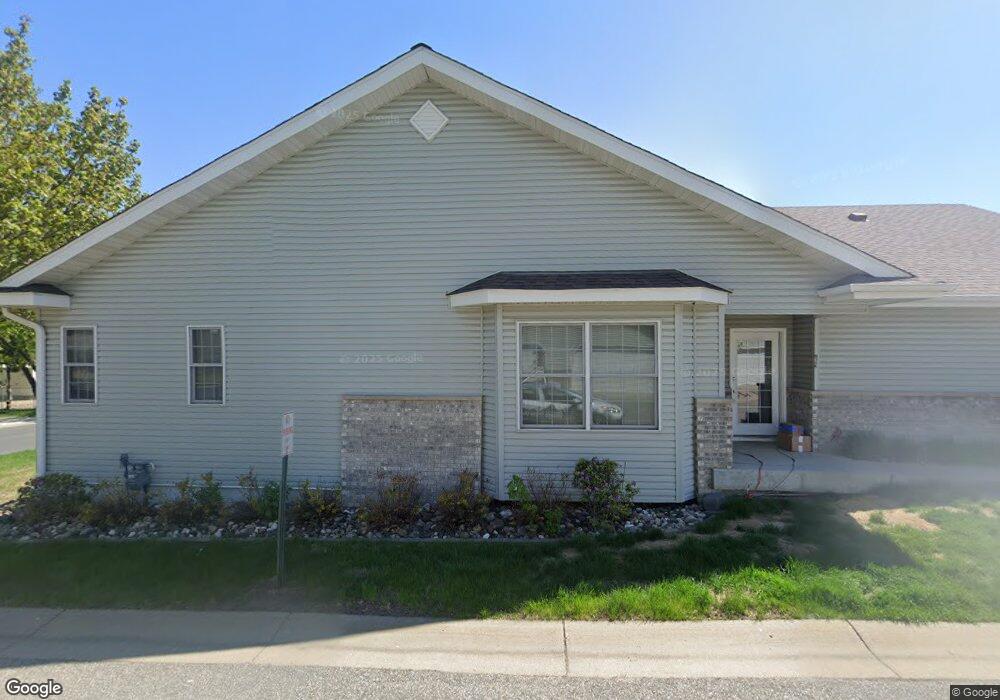
769 Rockford Ave E Delano, MN 55328
Estimated Value: $276,000 - $337,000
3
Beds
2
Baths
1,900
Sq Ft
$160/Sq Ft
Est. Value
About This Home
This home is located at 769 Rockford Ave E, Delano, MN 55328 and is currently estimated at $304,901, approximately $160 per square foot. 769 Rockford Ave E is a home located in Wright County with nearby schools including Delano Elementary School, Delano Middle School, and Delano Senior High School.
Ownership History
Date
Name
Owned For
Owner Type
Purchase Details
Closed on
Dec 27, 2024
Sold by
Diorio Brandon W
Bought by
Oleary Jessica
Current Estimated Value
Home Financials for this Owner
Home Financials are based on the most recent Mortgage that was taken out on this home.
Original Mortgage
$278,875
Outstanding Balance
$276,678
Interest Rate
6.78%
Mortgage Type
New Conventional
Estimated Equity
$28,223
Purchase Details
Closed on
Feb 23, 2023
Sold by
Pfeifer Property Management Llc A Minn
Bought by
Diorio Brandon
Home Financials for this Owner
Home Financials are based on the most recent Mortgage that was taken out on this home.
Original Mortgage
$254,000
Interest Rate
6.33%
Mortgage Type
New Conventional
Purchase Details
Closed on
Sep 21, 2012
Sold by
Citizens Alliance Bank
Bought by
Pfeifer Kent F
Purchase Details
Closed on
Mar 19, 2004
Sold by
Unavailable
Bought by
Mmmp Inc
Create a Home Valuation Report for This Property
The Home Valuation Report is an in-depth analysis detailing your home's value as well as a comparison with similar homes in the area
Home Values in the Area
Average Home Value in this Area
Purchase History
| Date | Buyer | Sale Price | Title Company |
|---|---|---|---|
| Oleary Jessica | $287,500 | Central Land Title | |
| Diorio Brandon | $255,000 | -- | |
| Pfeifer Kent F | $90,000 | -- | |
| Mmmp Inc | $229,400 | -- |
Source: Public Records
Mortgage History
| Date | Status | Borrower | Loan Amount |
|---|---|---|---|
| Open | Oleary Jessica | $278,875 | |
| Previous Owner | Diorio Brandon | $254,000 |
Source: Public Records
Tax History Compared to Growth
Tax History
| Year | Tax Paid | Tax Assessment Tax Assessment Total Assessment is a certain percentage of the fair market value that is determined by local assessors to be the total taxable value of land and additions on the property. | Land | Improvement |
|---|---|---|---|---|
| 2025 | $2,636 | $251,200 | $34,500 | $216,700 |
| 2024 | $2,752 | $239,500 | $31,000 | $208,500 |
| 2023 | $2,726 | $237,400 | $31,000 | $206,400 |
| 2022 | $2,738 | $215,200 | $31,000 | $184,200 |
| 2021 | $2,576 | $188,800 | $21,000 | $167,800 |
| 2020 | $2,562 | $175,800 | $16,000 | $159,800 |
| 2019 | $2,344 | $167,200 | $0 | $0 |
| 2018 | $2,244 | $148,100 | $0 | $0 |
| 2017 | $2,022 | $140,800 | $0 | $0 |
| 2016 | $1,944 | $0 | $0 | $0 |
| 2015 | $1,524 | $0 | $0 | $0 |
| 2014 | -- | $0 | $0 | $0 |
Source: Public Records
Map
Nearby Homes
- 932 Crossing Way
- 257 6th St NW
- 428 Saint Peter Ave E
- 1234 Willowbrook Cir
- 108 Shadywood Ln
- 1257 Willowbrook Cir
- 120 2nd St N
- 327 4th St N
- 316 2nd St N
- xxxx Lincoln St
- 1216 Northwood Dr
- 9560 Us Highway 12
- 679 Marsh Dr
- 9414 U S 12
- 1401 Woods Creek Dr
- 986 Eastwood Cir
- 217 2nd St SW
- 1157 Woods Creek Dr
- 916 Big Woods Dr
- 1170 Woods Creek Dr S
- 771 Rockford Ave E
- 773 Rockford Ave E
- 775 Rockford Ave E
- 777 Rockford Ave E
- 755 Rockford Ave E
- 757 Rockford Ave E
- 759 Rockford Ave E
- 779 Rockford Ave E
- 761 Rockford Ave E
- 763 Rockford Ave E
- 781 Rockford Ave E
- 783 Rockford Ave E
- 785 Rockford Ave E
- 787 Rockford Ave E
- 765 Rockford Ave E
- 802 Rockford Ave E
- 789 Rockford Ave E
- 791 Rockford Ave E
- 767 Rockford Ave E
- 793 Rockford Ave E