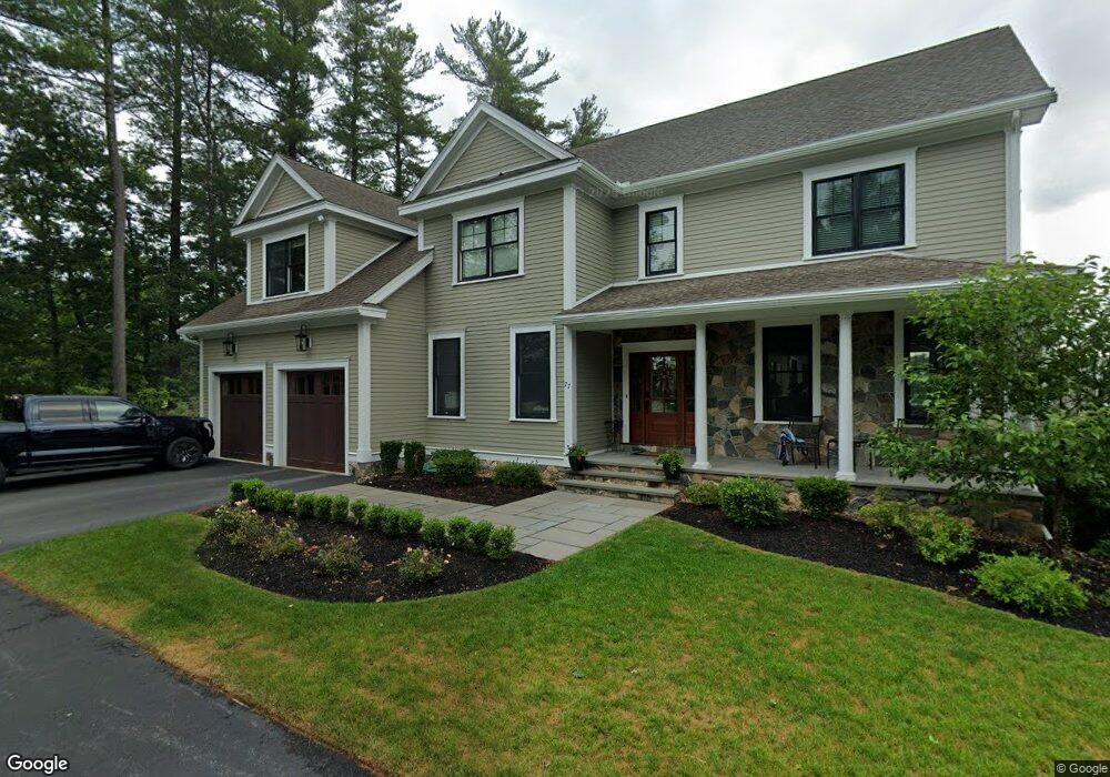
77 Endmoor Rd Westford, MA 01886
Estimated Value: $1,286,000 - $1,609,644
4
Beds
5
Baths
3,752
Sq Ft
$383/Sq Ft
Est. Value
About This Home
This home is located at 77 Endmoor Rd, Westford, MA 01886 and is currently estimated at $1,435,161, approximately $382 per square foot. 77 Endmoor Rd is a home located in Middlesex County with nearby schools including Nabnasset Elementary, Abbot Elementary School, and Stony Brook School.
Ownership History
Date
Name
Owned For
Owner Type
Purchase Details
Closed on
Aug 20, 2018
Sold by
Mjj Holdings Llc
Bought by
Guthrie David A and Guthrie Kelly A
Current Estimated Value
Home Financials for this Owner
Home Financials are based on the most recent Mortgage that was taken out on this home.
Original Mortgage
$760,000
Outstanding Balance
$660,029
Interest Rate
4.5%
Mortgage Type
Stand Alone Refi Refinance Of Original Loan
Estimated Equity
$775,132
Create a Home Valuation Report for This Property
The Home Valuation Report is an in-depth analysis detailing your home's value as well as a comparison with similar homes in the area
Home Values in the Area
Average Home Value in this Area
Purchase History
| Date | Buyer | Sale Price | Title Company |
|---|---|---|---|
| Guthrie David A | -- | -- |
Source: Public Records
Mortgage History
| Date | Status | Borrower | Loan Amount |
|---|---|---|---|
| Open | Guthrie David A | $760,000 |
Source: Public Records
Tax History Compared to Growth
Tax History
| Year | Tax Paid | Tax Assessment Tax Assessment Total Assessment is a certain percentage of the fair market value that is determined by local assessors to be the total taxable value of land and additions on the property. | Land | Improvement |
|---|---|---|---|---|
| 2025 | $20,694 | $1,536,300 | $451,600 | $1,084,700 |
| 2024 | $20,191 | $1,466,300 | $430,100 | $1,036,200 |
| 2023 | $19,359 | $1,311,600 | $409,700 | $901,900 |
| 2022 | $19,370 | $1,201,600 | $347,000 | $854,600 |
| 2021 | $17,672 | $1,062,000 | $347,000 | $715,000 |
| 2020 | $19,976 | $1,063,500 | $347,000 | $716,500 |
| 2019 | $6,689 | $403,900 | $347,000 | $56,900 |
| 2018 | $6,174 | $381,600 | $305,000 | $76,600 |
| 2017 | $4,210 | $395,200 | $325,400 | $69,800 |
| 2016 | $6,021 | $369,400 | $306,800 | $62,600 |
| 2015 | -- | $346,700 | $266,400 | $80,300 |
| 2014 | $5,579 | $336,100 | $255,800 | $80,300 |
Source: Public Records
Map
Nearby Homes
- 55 Lawson Rd
- 3 Loon Way
- 8 Loon Way
- 9 Loon Way
- 427 Groton Rd
- 5 Fawn Rd
- 2 Alder Point Unit 2
- 36 Elm Rd
- 16 Shipley Cir
- 3 Blue Heron Dr
- 10 Gassett Rd
- 17 York Ave
- 1 Appian Way
- 6 Lady Constance Way
- 6 Lady Constance Way Unit 21
- 4 Lady Constance Way Unit 20
- Copley Plan at Wendell Place
- Williamstown Plan at Wendell Place
- 2 Lady Constance Way Unit 19
- 2 Wendell Place Unit 1
- 75 Endmoor Rd
- 73 Endmoor Rd
- 71 Endmoor Rd
- 70 Endmoor Rd
- 69 Endmoor Rd
- 67 Endmoor Rd
- 68 Endmoor Rd
- 65 Endmoor Rd
- 63 Endmoor Rd
- 61 Endmoor Rd
- 57 Endmoor Rd
- 2 Lake Shore Dr S
- 0 Lake Shore Dr S
- 60 Lawson Rd
- 4 Lake Shore Dr S Unit 6
- 4 Lake Shore Dr S
- 54 Newport Dr
- 56 Newport Dr
- 58 Lawson Rd
- 1 Lake Shore Dr S