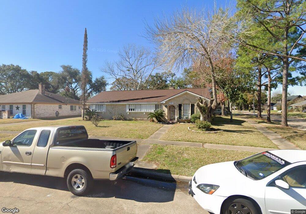
7702 Kendalia Dr Houston, TX 77036
Chinatown NeighborhoodEstimated Value: $304,196 - $325,000
3
Beds
2
Baths
1,826
Sq Ft
$173/Sq Ft
Est. Value
About This Home
This home is located at 7702 Kendalia Dr, Houston, TX 77036 and is currently estimated at $316,799, approximately $173 per square foot. 7702 Kendalia Dr is a home located in Harris County with nearby schools including Ed White Elementary School, Sugar Grove Academy, and Sharpstown High School.
Ownership History
Date
Name
Owned For
Owner Type
Purchase Details
Closed on
Jan 30, 2007
Sold by
Rapalo Jose and Rapalo Manuela
Bought by
Baez Hilario
Current Estimated Value
Home Financials for this Owner
Home Financials are based on the most recent Mortgage that was taken out on this home.
Original Mortgage
$25,730
Outstanding Balance
$15,437
Interest Rate
6.19%
Mortgage Type
Stand Alone Second
Estimated Equity
$301,362
Purchase Details
Closed on
Feb 4, 2000
Sold by
Lee Li Lee Chen and Lee Robert Hsi Chou
Bought by
Rapalo Jose and Rapalo Manuela
Home Financials for this Owner
Home Financials are based on the most recent Mortgage that was taken out on this home.
Original Mortgage
$70,400
Interest Rate
11.85%
Create a Home Valuation Report for This Property
The Home Valuation Report is an in-depth analysis detailing your home's value as well as a comparison with similar homes in the area
Home Values in the Area
Average Home Value in this Area
Purchase History
| Date | Buyer | Sale Price | Title Company |
|---|---|---|---|
| Baez Hilario | -- | Access National Title Co | |
| Rapalo Jose | -- | Stewart Title |
Source: Public Records
Mortgage History
| Date | Status | Borrower | Loan Amount |
|---|---|---|---|
| Open | Baez Hilario | $25,730 | |
| Open | Baez Hilario | $102,890 | |
| Previous Owner | Rapalo Jose | $70,400 | |
| Closed | Rapalo Jose | $13,200 |
Source: Public Records
Tax History Compared to Growth
Tax History
| Year | Tax Paid | Tax Assessment Tax Assessment Total Assessment is a certain percentage of the fair market value that is determined by local assessors to be the total taxable value of land and additions on the property. | Land | Improvement |
|---|---|---|---|---|
| 2025 | $748 | $274,141 | $104,032 | $170,109 |
| 2024 | $748 | $272,158 | $104,032 | $168,126 |
| 2023 | $748 | $289,467 | $104,032 | $185,435 |
| 2022 | $4,975 | $242,148 | $60,685 | $181,463 |
| 2021 | $4,619 | $198,197 | $52,016 | $146,181 |
| 2020 | $5,367 | $214,552 | $52,016 | $162,536 |
| 2019 | $5,601 | $214,552 | $52,016 | $162,536 |
| 2018 | $3,756 | $199,468 | $52,016 | $147,452 |
| 2017 | $4,767 | $199,468 | $52,016 | $147,452 |
| 2016 | $4,334 | $180,227 | $52,016 | $128,211 |
| 2015 | $2,697 | $151,036 | $52,016 | $99,020 |
| 2014 | $2,697 | $151,036 | $52,016 | $99,020 |
Source: Public Records
Map
Nearby Homes
- 9215 Sharpcrest St
- 9506 Hendon Ln
- 9234 Westwood Village Dr Unit 17
- 7939 Kendalia Dr
- 9345 Westwood Village Dr Unit 30
- 9393 Westwood Village Dr Unit 64
- 9238 Stroud Dr
- 8923 Hendon Ln
- 9901 Sharpcrest St Unit K3
- 9901 Sharpcrest St Unit M6
- 9901 Sharpcrest St Unit F3
- 9901 Sharpcrest St Unit B3
- 9901 Sharpcrest St Unit 8
- 9006 Roos Rd
- 8902 Langdon Ln
- 9002 Grape St
- 8818 Roos Rd
- 7303 Augustine Dr
- 8918 Grape St
- 8826 Tanager St
- 7706 Kendalia Dr
- 7703 Colony St
- 7707 Colony St
- 7707 Colony St
- 7710 Kendalia Dr
- 7711 Colony St
- 9306 Hendon Ln
- 9310 Hendon Ln
- 7703 Kendalia Dr
- 9302 Hendon Ln
- 9314 Hendon Ln
- 7707 Kendalia Dr
- 7715 Colony St
- 7714 Kendalia Dr
- 9214 Hendon Ln
- 9402 Hendon Ln
- 7711 Kendalia Dr
- 7719 Colony St
- 9210 Hendon Ln
- 9307 Sharpcrest St