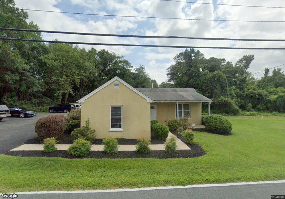
771 Old Donaldson Ave Severn, MD 21144
Estimated Value: $255,000 - $365,000
1
Bed
1
Bath
721
Sq Ft
$431/Sq Ft
Est. Value
About This Home
This home is located at 771 Old Donaldson Ave, Severn, MD 21144 and is currently estimated at $310,897, approximately $431 per square foot. 771 Old Donaldson Ave is a home located in Anne Arundel County with nearby schools including Severn Elementary School, Old Mill Middle School North, and Old Mill High School.
Ownership History
Date
Name
Owned For
Owner Type
Purchase Details
Closed on
Sep 29, 2010
Sold by
Boyer Charles W
Bought by
Opm Property Mgmnt Llc
Current Estimated Value
Home Financials for this Owner
Home Financials are based on the most recent Mortgage that was taken out on this home.
Original Mortgage
$86,400
Outstanding Balance
$57,592
Interest Rate
4.55%
Mortgage Type
Purchase Money Mortgage
Estimated Equity
$253,305
Purchase Details
Closed on
Jun 22, 1994
Sold by
Harp Emily G
Bought by
Boyer Charles W
Create a Home Valuation Report for This Property
The Home Valuation Report is an in-depth analysis detailing your home's value as well as a comparison with similar homes in the area
Home Values in the Area
Average Home Value in this Area
Purchase History
| Date | Buyer | Sale Price | Title Company |
|---|---|---|---|
| Opm Property Mgmnt Llc | $109,250 | -- | |
| Boyer Charles W | $56,000 | -- |
Source: Public Records
Mortgage History
| Date | Status | Borrower | Loan Amount |
|---|---|---|---|
| Open | Opm Property Mgmnt Llc | $86,400 |
Source: Public Records
Tax History Compared to Growth
Tax History
| Year | Tax Paid | Tax Assessment Tax Assessment Total Assessment is a certain percentage of the fair market value that is determined by local assessors to be the total taxable value of land and additions on the property. | Land | Improvement |
|---|---|---|---|---|
| 2025 | $3,530 | $282,600 | $216,400 | $66,200 |
| 2024 | $3,530 | $262,233 | $0 | $0 |
| 2023 | $2,641 | $241,867 | $0 | $0 |
| 2022 | $2,873 | $221,500 | $166,400 | $55,100 |
| 2021 | $0 | $219,267 | $0 | $0 |
| 2020 | $2,787 | $217,033 | $0 | $0 |
| 2019 | $2,766 | $214,800 | $166,400 | $48,400 |
| 2018 | $2,115 | $208,533 | $0 | $0 |
| 2017 | $2,359 | $202,267 | $0 | $0 |
| 2016 | -- | $196,000 | $0 | $0 |
| 2015 | -- | $187,300 | $0 | $0 |
| 2014 | -- | $178,600 | $0 | $0 |
Source: Public Records
Map
Nearby Homes
- 7860 Telegraph Rd
- 7875 Telegraph Rd
- 7811 Wolf Run Ln
- 7844 Clark Station Rd
- 7966 Foster Ave
- 1402 Valley Creek Rd
- 1012 Morgan Station Dr
- 7959 Telegraph Rd Unit 34
- 7616 W B & A Rd
- 7711 Phelps Farm Ln
- 207 Otis Dr
- 1010 Tuscany Ln
- 1002B Elbridge Way
- 911 S Wieker Rd
- 1207 Thompson Ave
- 900 S Wieker Rd
- 1212 Scattered Pines Ct
- 1454 Graham Farm Cir
- 1434 Fairbanks Dr
- 564 Eason Dr
- 7871 Telegraph Rd
- 7863 Telegraph Rd
- 763 Donaldson Ave
- 7810 Faulkner Rd
- 7859 Telegraph Rd
- 7803 Faulkner Rd
- 7814 Faulkner Rd
- 755 Old Donaldson Ave
- 7870 Telegraph Rd
- 7881 Telegraph Rd
- 7813 Faulkner Rd
- 753 Donaldson Ave
- 7816 Faulkner Rd
- 7851 Telegraph Rd
- 805 Reece Rd
- 750 Old Donaldson Ave
- 7885 Telegraph Rd
- 7810 Horwath Ln
- 7810 Clark Station Rd
- 7815 Faulkner Rd