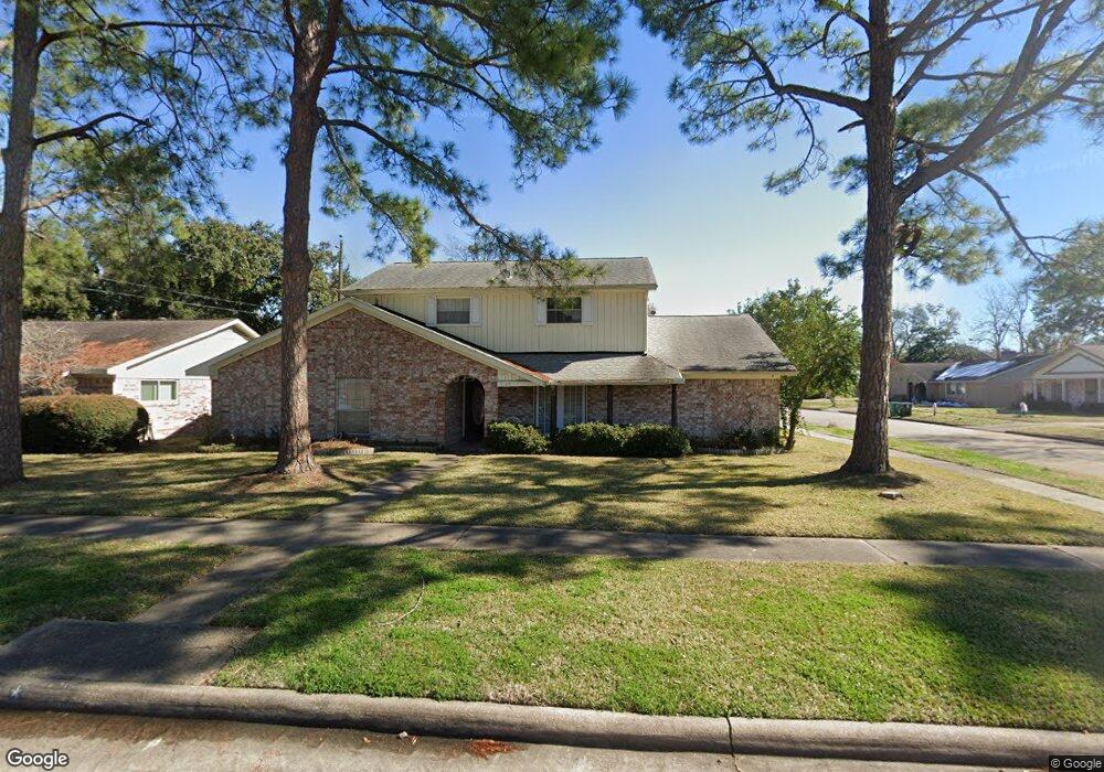
7723 Kendalia Dr Houston, TX 77036
Chinatown NeighborhoodEstimated Value: $317,000 - $358,000
5
Beds
4
Baths
2,765
Sq Ft
$122/Sq Ft
Est. Value
About This Home
This home is located at 7723 Kendalia Dr, Houston, TX 77036 and is currently estimated at $337,332, approximately $122 per square foot. 7723 Kendalia Dr is a home located in Harris County with nearby schools including Ed White Elementary School, Sugar Grove Academy, and Sharpstown High School.
Ownership History
Date
Name
Owned For
Owner Type
Purchase Details
Closed on
Jun 11, 2015
Sold by
Chavira Joann and Chavira Charles P
Bought by
Wang Alan
Current Estimated Value
Purchase Details
Closed on
Dec 20, 2004
Sold by
Carter James C
Bought by
Chavira Joann and Chavira Charles P
Home Financials for this Owner
Home Financials are based on the most recent Mortgage that was taken out on this home.
Original Mortgage
$115,000
Interest Rate
5.78%
Mortgage Type
Purchase Money Mortgage
Purchase Details
Closed on
Mar 15, 2000
Sold by
Sayre Thomas E and Sayre Mildred Sue
Bought by
Carter James C
Home Financials for this Owner
Home Financials are based on the most recent Mortgage that was taken out on this home.
Original Mortgage
$111,685
Interest Rate
8.23%
Create a Home Valuation Report for This Property
The Home Valuation Report is an in-depth analysis detailing your home's value as well as a comparison with similar homes in the area
Home Values in the Area
Average Home Value in this Area
Purchase History
| Date | Buyer | Sale Price | Title Company |
|---|---|---|---|
| Wang Alan | -- | None Available | |
| Chavira Joann | -- | Alamo Title | |
| Carter James C | -- | Texas American Title Company |
Source: Public Records
Mortgage History
| Date | Status | Borrower | Loan Amount |
|---|---|---|---|
| Previous Owner | Chavira Joann | $115,000 | |
| Previous Owner | Carter James C | $111,685 |
Source: Public Records
Tax History Compared to Growth
Tax History
| Year | Tax Paid | Tax Assessment Tax Assessment Total Assessment is a certain percentage of the fair market value that is determined by local assessors to be the total taxable value of land and additions on the property. | Land | Improvement |
|---|---|---|---|---|
| 2025 | $4,238 | $302,346 | $100,800 | $201,546 |
| 2024 | $4,238 | $304,529 | $100,800 | $203,729 |
| 2023 | $4,238 | $351,677 | $100,800 | $250,877 |
| 2022 | $6,034 | $305,295 | $58,800 | $246,495 |
| 2021 | $5,603 | $240,395 | $50,400 | $189,995 |
| 2020 | $6,776 | $324,550 | $50,400 | $274,150 |
| 2019 | $6,428 | $324,550 | $50,400 | $274,150 |
| 2018 | $4,252 | $270,408 | $50,400 | $220,008 |
| 2017 | $5,308 | $294,501 | $50,400 | $244,101 |
| 2016 | $4,826 | $185,000 | $50,400 | $134,600 |
| 2015 | $5,513 | $214,442 | $50,400 | $164,042 |
| 2014 | $5,513 | $214,442 | $50,400 | $164,042 |
Source: Public Records
Map
Nearby Homes
- 7939 Kendalia Dr
- 9234 Westwood Village Dr Unit 17
- 9215 Sharpcrest St
- 9345 Westwood Village Dr Unit 30
- 9506 Hendon Ln
- 9393 Westwood Village Dr Unit 64
- 8923 Hendon Ln
- 9238 Stroud Dr
- 8902 Langdon Ln
- 9901 Sharpcrest St Unit K3
- 9901 Sharpcrest St Unit M6
- 9901 Sharpcrest St Unit F3
- 9901 Sharpcrest St Unit B3
- 9901 Sharpcrest St Unit 8
- 9006 Roos Rd
- 9002 Grape St
- 8918 Grape St
- 8326 Jorine Dr Unit 8326
- 8826 Tanager St
- 8334 Jorine Dr Unit 8733
- 7719 Kendalia Dr
- 7718 Lacy Hill Dr
- 7715 Kendalia Dr
- 7714 Lacy Hill Dr
- 9215 Langdon Ln
- 9211 Langdon Ln
- 7722 Kendalia Dr
- 7718 Kendalia Dr
- 7710 Lacy Hill Dr
- 9207 Langdon Ln
- 7711 Kendalia Dr
- 9303 Langdon Ln
- 7714 Kendalia Dr
- 7883 Kendalia Dr
- 7706 Lacy Hill Dr
- 9307 Langdon Ln
- 7885 Kendalia Dr
- 7707 Kendalia Dr
- 9203 Langdon Ln
- 7710 Kendalia Dr