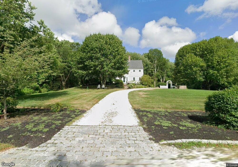
777 Bay Rd Duxbury, MA 02332
Estimated Value: $1,942,000 - $3,005,000
4
Beds
5
Baths
4,366
Sq Ft
$576/Sq Ft
Est. Value
About This Home
This home is located at 777 Bay Rd, Duxbury, MA 02332 and is currently estimated at $2,516,910, approximately $576 per square foot. 777 Bay Rd is a home located in Plymouth County with nearby schools including Chandler Elementary School, Alden School, and Duxbury Middle School.
Ownership History
Date
Name
Owned For
Owner Type
Purchase Details
Closed on
Jul 7, 2025
Sold by
Schroeder Stephen H and Shaughnessy Mary E
Bought by
777 Bay Rd Rt and Schroeder
Current Estimated Value
Purchase Details
Closed on
Sep 30, 2005
Sold by
Davidson Robert B and Davidson T
Bought by
Schroeder Stephen H and Shaughnessy Mary E
Purchase Details
Closed on
Oct 22, 1993
Sold by
Oceanview Rt and Murphy Edward C
Bought by
Davidson Robert A and Davidson Alison
Home Financials for this Owner
Home Financials are based on the most recent Mortgage that was taken out on this home.
Original Mortgage
$432,900
Interest Rate
6.73%
Mortgage Type
Purchase Money Mortgage
Create a Home Valuation Report for This Property
The Home Valuation Report is an in-depth analysis detailing your home's value as well as a comparison with similar homes in the area
Home Values in the Area
Average Home Value in this Area
Purchase History
| Date | Buyer | Sale Price | Title Company |
|---|---|---|---|
| 777 Bay Rd Rt | -- | -- | |
| Schroeder Stephen H | $1,485,000 | -- | |
| Schroeder Stephen H | $1,485,000 | -- | |
| Davidson Robert A | $481,107 | -- | |
| Davidson Robert A | $481,107 | -- |
Source: Public Records
Mortgage History
| Date | Status | Borrower | Loan Amount |
|---|---|---|---|
| Previous Owner | Davidson Robert A | $1,400,000 | |
| Previous Owner | Davidson Robert A | $250,000 | |
| Previous Owner | Davidson Robert A | $432,900 |
Source: Public Records
Tax History Compared to Growth
Tax History
| Year | Tax Paid | Tax Assessment Tax Assessment Total Assessment is a certain percentage of the fair market value that is determined by local assessors to be the total taxable value of land and additions on the property. | Land | Improvement |
|---|---|---|---|---|
| 2025 | $20,180 | $1,990,100 | $1,069,100 | $921,000 |
| 2024 | $19,259 | $1,914,400 | $987,500 | $926,900 |
| 2023 | $19,154 | $1,791,800 | $1,083,500 | $708,300 |
| 2022 | $20,224 | $1,575,100 | $914,200 | $660,900 |
| 2021 | $20,317 | $1,403,100 | $826,800 | $576,300 |
| 2020 | $19,666 | $1,341,500 | $739,000 | $602,500 |
| 2019 | $19,454 | $1,325,200 | $729,900 | $595,300 |
| 2018 | $18,383 | $1,212,600 | $638,700 | $573,900 |
| 2017 | $16,808 | $1,083,700 | $541,100 | $542,600 |
| 2016 | $16,334 | $1,050,400 | $507,800 | $542,600 |
| 2015 | $16,474 | $1,056,000 | $507,800 | $548,200 |
Source: Public Records
Map
Nearby Homes
- 735 Bay Rd
- 80 Parks St Unit 5
- 80 Parks St Unit 6
- 3 Jones River Dr
- 40 Bay Farm Rd Unit 40
- 35 River St
- 53 Bay Farm Rd Unit 53
- 6 Priscilla Rd
- 18 Atwood St
- 24 Tremont St
- 19 Flint Locke Dr
- 7 Chestnut St
- 5 Page Ave
- 24 Summer St Unit A
- 1 Tarkiln Rd
- 59 Priscilla Ave
- Lot 17-1 Howland's Ln
- 10 Summerhouse Ln
- 117 Soule Ave
- 37 Tarkiln Rd
- 727 Bay Rd
- 721 Bay Rd
- 121 Parks St
- 107 Loring St
- 703 Bay Rd
- 21 Parks St Unit 21
- 704 Bay Rd
- 111 Loring St
- 70 Parks St Unit 21
- 70 Parks St Unit 20
- 70 Parks St Unit 19
- 70 Parks St Unit 18
- 70 Parks St Unit 17
- 70 Parks St Unit 16
- 70 Parks St Unit 15
- 70 Parks St Unit 14
- 70 Parks St Unit 13
- 70 Parks St Unit 12
- 70 Parks St Unit 11
- 70 Parks St Unit 9