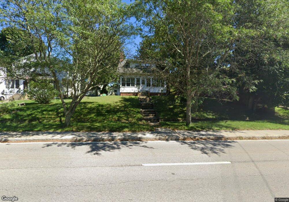
78 Bullocks Point Ave Riverside, RI 02915
Riverside NeighborhoodEstimated Value: $412,000 - $574,000
3
Beds
1
Bath
1,795
Sq Ft
$256/Sq Ft
Est. Value
About This Home
This home is located at 78 Bullocks Point Ave, Riverside, RI 02915 and is currently estimated at $459,981, approximately $256 per square foot. 78 Bullocks Point Ave is a home located in Providence County with nearby schools including East Providence High School, St Mary Academy-Bay View, and The Gordon School.
Ownership History
Date
Name
Owned For
Owner Type
Purchase Details
Closed on
Dec 17, 2012
Sold by
Saul Debra A
Bought by
Checrallah Steven J
Current Estimated Value
Home Financials for this Owner
Home Financials are based on the most recent Mortgage that was taken out on this home.
Original Mortgage
$68,000
Interest Rate
3.44%
Mortgage Type
New Conventional
Create a Home Valuation Report for This Property
The Home Valuation Report is an in-depth analysis detailing your home's value as well as a comparison with similar homes in the area
Home Values in the Area
Average Home Value in this Area
Purchase History
| Date | Buyer | Sale Price | Title Company |
|---|---|---|---|
| Checrallah Steven J | $60,000 | -- |
Source: Public Records
Mortgage History
| Date | Status | Borrower | Loan Amount |
|---|---|---|---|
| Closed | Checrallah Steven J | $68,000 | |
| Previous Owner | Checrallah Steven J | $105,000 |
Source: Public Records
Tax History Compared to Growth
Tax History
| Year | Tax Paid | Tax Assessment Tax Assessment Total Assessment is a certain percentage of the fair market value that is determined by local assessors to be the total taxable value of land and additions on the property. | Land | Improvement |
|---|---|---|---|---|
| 2025 | $4,930 | $377,200 | $108,000 | $269,200 |
| 2024 | $4,363 | $284,600 | $90,000 | $194,600 |
| 2023 | $4,201 | $284,600 | $90,000 | $194,600 |
| 2022 | $4,239 | $193,900 | $61,600 | $132,300 |
| 2021 | $4,169 | $193,900 | $57,000 | $136,900 |
| 2020 | $3,992 | $193,900 | $57,000 | $136,900 |
| 2019 | $3,882 | $193,900 | $57,000 | $136,900 |
| 2018 | $4,031 | $176,200 | $61,700 | $114,500 |
| 2017 | $3,942 | $176,200 | $61,700 | $114,500 |
| 2016 | $3,922 | $176,200 | $61,700 | $114,500 |
| 2015 | $3,874 | $168,800 | $60,200 | $108,600 |
| 2014 | $3,874 | $168,800 | $60,200 | $108,600 |
Source: Public Records
Map
Nearby Homes
- 1 Fales St
- 43 Bullocks Point Ave Unit 4C
- 25 Bullocks Point Ave Unit 5C
- 31 Bullocks Point Ave Unit 2A
- 151 Willett Ave Unit 2
- 151 Willett Ave Unit 5
- 6 Fuller Ave
- 81 Sprague Ave
- 25 Arnold St
- 3421 Pawtucket Ave
- 17 Oak Ave
- 57 Harris St
- 33 Pine St Unit 35
- 1 Holly St
- 129 Cedar Ave
- 93 Narragansett Ave
- 87 Bluff St
- 536 Willett Ave
- 1 Sabin St
- 72 Stowe Ave
- 74 Bullocks Point Ave
- 3615 Pawtucket Ave
- 66 Bullocks Point Ave
- 68 Bullocks Point Ave Unit 70
- 3609 Pawtucket Ave
- 62 Bullocks Point Ave
- 3605 Pawtucket Ave
- 58 Bullocks Point Ave
- 3614 Pawtucket Ave
- 3608 Pawtucket Ave
- 3624 1/2 Pawtucket Ave
- 3601 Pawtucket Ave
- 3620 Pawtucket Ave
- 3624 Pawtucket Ave
- 65 Bullocks Point Ave
- 3600 Pawtucket Ave
- 54 Bullocks Point Ave
- 3626 Pawtucket Ave
- 3595 Pawtucket Ave
- 59 Bullocks Point Ave