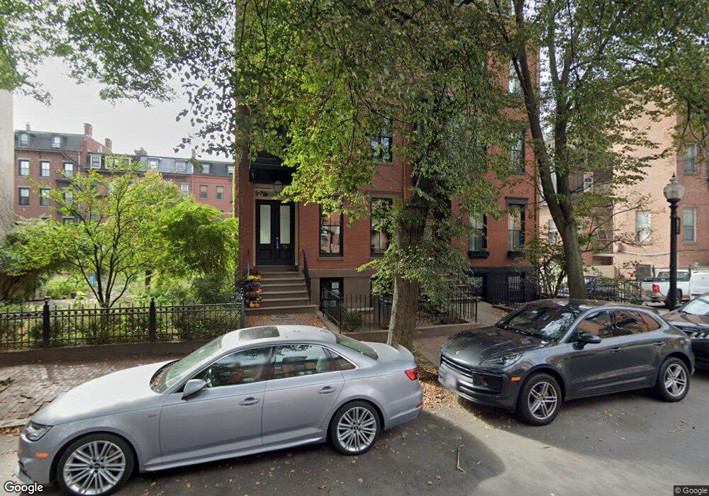
78 Rutland St Unit 3 Boston, MA 02118
South End NeighborhoodEstimated Value: $1,672,816 - $2,231,000
2
Beds
1
Bath
1,365
Sq Ft
$1,336/Sq Ft
Est. Value
About This Home
This home is located at 78 Rutland St Unit 3, Boston, MA 02118 and is currently estimated at $1,823,704, approximately $1,336 per square foot. 78 Rutland St Unit 3 is a home located in Suffolk County with nearby schools including Edward M. Kennedy Academy for Health Careers, Kingsley Montessori School, and Cathedral High School.
Ownership History
Date
Name
Owned For
Owner Type
Purchase Details
Closed on
Nov 17, 2020
Sold by
Gross Daniel L
Bought by
Wild Stephanie and Wild Benjamin
Current Estimated Value
Home Financials for this Owner
Home Financials are based on the most recent Mortgage that was taken out on this home.
Original Mortgage
$1,200,000
Outstanding Balance
$1,061,968
Interest Rate
2.5%
Mortgage Type
Purchase Money Mortgage
Estimated Equity
$761,736
Purchase Details
Closed on
Feb 25, 2016
Sold by
Gallo Peter P
Bought by
Gross Daniel L
Home Financials for this Owner
Home Financials are based on the most recent Mortgage that was taken out on this home.
Original Mortgage
$1,200,000
Interest Rate
3.92%
Mortgage Type
Purchase Money Mortgage
Purchase Details
Closed on
May 29, 2015
Sold by
Shannon Brad and Shannon Elisa
Bought by
Gallo Peter P
Home Financials for this Owner
Home Financials are based on the most recent Mortgage that was taken out on this home.
Original Mortgage
$1,060,000
Interest Rate
3.65%
Mortgage Type
Purchase Money Mortgage
Purchase Details
Closed on
Aug 23, 2006
Sold by
Shannon Brad
Bought by
Shannon Brad and Shannon Elisa
Home Financials for this Owner
Home Financials are based on the most recent Mortgage that was taken out on this home.
Original Mortgage
$570,000
Interest Rate
6.83%
Mortgage Type
Purchase Money Mortgage
Purchase Details
Closed on
Feb 21, 2003
Sold by
Bahnatka Edward J
Bought by
Hall-Jones Jerry and Harbour Alicia S
Home Financials for this Owner
Home Financials are based on the most recent Mortgage that was taken out on this home.
Original Mortgage
$449,600
Interest Rate
5.98%
Mortgage Type
Purchase Money Mortgage
Purchase Details
Closed on
Jul 17, 2000
Sold by
Shiner George H and Brown-Shimer Sheryl
Bought by
Bahnatka Edward J
Purchase Details
Closed on
Apr 27, 1990
Sold by
Lucke Deborah K
Bought by
Shimer George H
Purchase Details
Closed on
May 21, 1987
Sold by
Parrish James E
Bought by
Lucke Deborah K
Create a Home Valuation Report for This Property
The Home Valuation Report is an in-depth analysis detailing your home's value as well as a comparison with similar homes in the area
Home Values in the Area
Average Home Value in this Area
Purchase History
| Date | Buyer | Sale Price | Title Company |
|---|---|---|---|
| Wild Stephanie | $2,000,000 | None Available | |
| Gross Daniel L | $1,825,000 | -- | |
| Gallo Peter P | $975,150 | -- | |
| Shannon Brad | -- | -- | |
| Shannon Brad | $719,610 | -- | |
| Hall-Jones Jerry | $562,000 | -- | |
| Bahnatka Edward J | $489,000 | -- | |
| Shimer George H | $221,000 | -- | |
| Lucke Deborah K | $219,000 | -- |
Source: Public Records
Mortgage History
| Date | Status | Borrower | Loan Amount |
|---|---|---|---|
| Open | Wild Stephanie | $1,200,000 | |
| Previous Owner | Gross Daniel L | $1,200,000 | |
| Previous Owner | Gallo Peter P | $1,060,000 | |
| Previous Owner | Lucke Deborah K | $523,750 | |
| Previous Owner | Lucke Deborah K | $27,000 | |
| Previous Owner | Shannon Brad | $570,000 | |
| Previous Owner | Lucke Deborah K | $449,600 |
Source: Public Records
Tax History Compared to Growth
Tax History
| Year | Tax Paid | Tax Assessment Tax Assessment Total Assessment is a certain percentage of the fair market value that is determined by local assessors to be the total taxable value of land and additions on the property. | Land | Improvement |
|---|---|---|---|---|
| 2025 | $15,217 | $1,314,100 | $0 | $1,314,100 |
| 2024 | $13,900 | $1,275,200 | $0 | $1,275,200 |
| 2023 | $13,045 | $1,214,600 | $0 | $1,214,600 |
| 2022 | $13,086 | $1,202,800 | $0 | $1,202,800 |
| 2021 | $12,582 | $1,179,200 | $0 | $1,179,200 |
| 2020 | $12,166 | $1,152,100 | $0 | $1,152,100 |
| 2019 | $11,787 | $1,118,300 | $0 | $1,118,300 |
| 2018 | $11,051 | $1,054,500 | $0 | $1,054,500 |
| 2017 | $10,636 | $1,004,300 | $0 | $1,004,300 |
| 2016 | $10,219 | $929,000 | $0 | $929,000 |
| 2015 | $10,192 | $841,600 | $0 | $841,600 |
| 2014 | -- | $763,800 | $0 | $763,800 |
Source: Public Records
Map
Nearby Homes
- 125 W Concord St Unit 1
- 116 W Concord St Unit PH
- 35-43 Rutland St
- 67 Worcester St Unit 1
- 43 Worcester St Unit 1
- 71 Rutland St Unit 4
- 75 Rutland St Unit 1
- 476 Shawmut Ave Unit 3
- 99 + 101 W Springfield St
- 2 Cumston St
- 43 W Newton St Unit 1-10
- 548 Massachusetts Ave Unit 3
- 668 Tremont St Unit 3
- 8 Rutland Square Unit 2
- 8 Concord Square Unit 1
- 530 Massachusetts Ave Unit 2
- 12 Concord Square Unit 1
- 15 Concord Square Unit A
- 1666 Washington St Unit 2
- 504 Massachusetts Ave Unit 3
- 80 Rutland St Unit 3
- 80 Rutland St Unit 1
- 80 Rutland St
- 80 Rutland St Unit 2
- 80 Rutland St Unit A
- 78 Rutland St Unit 2
- 78 Rutland St Unit 1
- 78 Rutland St Unit 2,78
- 78 Rutland St Unit 78
- 696 Tremont St Unit 2
- 696 Tremont St
- 696 Tremont St Unit 3
- 696 Tremont St Unit 696A
- 694 Tremont St
- 694 Tremont St Unit 8
- 694 Tremont St Unit 694A
- 694 Tremont St Unit 6
- 698 Tremont St Unit 2,698
- 72 Rutland St Unit 4
- 72 Rutland St Unit 3