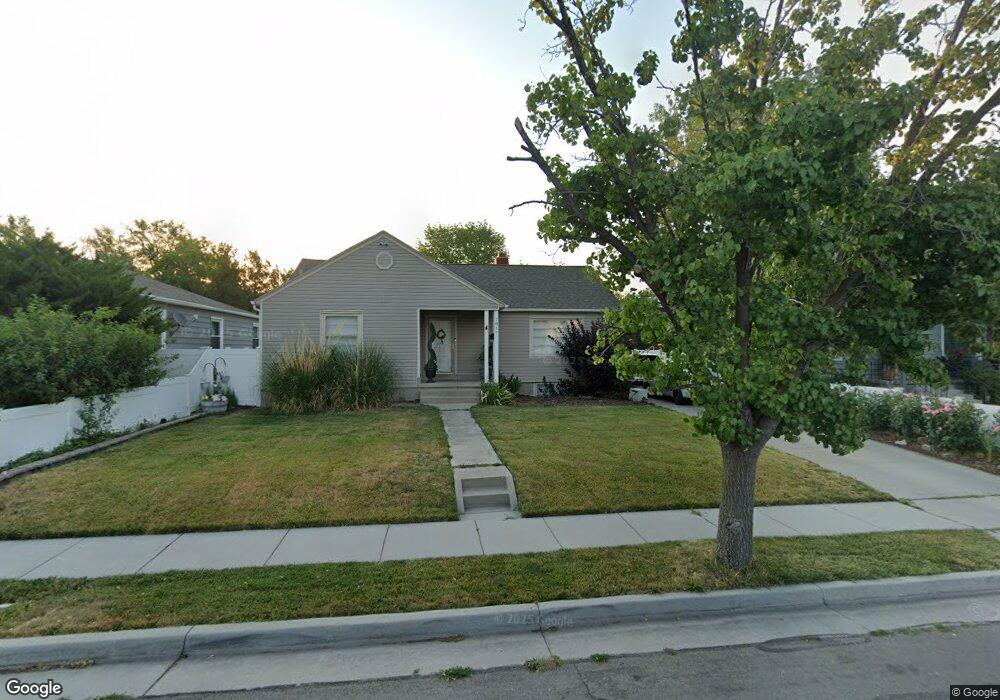
7817 Grant St Midvale, UT 84047
Estimated Value: $444,000 - $530,000
4
Beds
2
Baths
1,050
Sq Ft
$463/Sq Ft
Est. Value
About This Home
This home is located at 7817 Grant St, Midvale, UT 84047 and is currently estimated at $485,939, approximately $462 per square foot. 7817 Grant St is a home located in Salt Lake County with nearby schools including Midvale Elementary School, Midvale Middle School, and Hillcrest High School.
Ownership History
Date
Name
Owned For
Owner Type
Purchase Details
Closed on
Mar 14, 2018
Sold by
Bolin Melanie and Payne Melanie V
Bought by
Pestana Rafael Picoli
Current Estimated Value
Home Financials for this Owner
Home Financials are based on the most recent Mortgage that was taken out on this home.
Original Mortgage
$237,500
Outstanding Balance
$202,741
Interest Rate
4.22%
Mortgage Type
New Conventional
Estimated Equity
$283,198
Purchase Details
Closed on
Sep 6, 2017
Sold by
Payne Melanie and Payne Melanie V
Bought by
Payne Melanie V and Melanie V Payne Family Trust
Purchase Details
Closed on
Mar 29, 2017
Sold by
Payne Melanie
Bought by
Payne Melanie
Purchase Details
Closed on
Dec 5, 2012
Sold by
Tafoya Paul A and Pace Angie
Bought by
Bolin Melanie and Payne Dirk Gail
Home Financials for this Owner
Home Financials are based on the most recent Mortgage that was taken out on this home.
Original Mortgage
$155,039
Interest Rate
3.25%
Mortgage Type
FHA
Create a Home Valuation Report for This Property
The Home Valuation Report is an in-depth analysis detailing your home's value as well as a comparison with similar homes in the area
Home Values in the Area
Average Home Value in this Area
Purchase History
| Date | Buyer | Sale Price | Title Company |
|---|---|---|---|
| Pestana Rafael Picoli | -- | Sutherland Title | |
| Payne Melanie V | -- | None Available | |
| Payne Melanie | -- | None Available | |
| Bolin Melanie | -- | Unity Title Llc |
Source: Public Records
Mortgage History
| Date | Status | Borrower | Loan Amount |
|---|---|---|---|
| Open | Pestana Rafael Picoli | $237,500 | |
| Previous Owner | Bolin Melanie | $155,039 |
Source: Public Records
Tax History Compared to Growth
Tax History
| Year | Tax Paid | Tax Assessment Tax Assessment Total Assessment is a certain percentage of the fair market value that is determined by local assessors to be the total taxable value of land and additions on the property. | Land | Improvement |
|---|---|---|---|---|
| 2025 | $2,268 | $403,900 | $134,700 | $269,200 |
| 2024 | $2,268 | $386,900 | $127,500 | $259,400 |
| 2023 | $2,217 | $375,600 | $121,200 | $254,400 |
| 2022 | $2,355 | $389,500 | $118,800 | $270,700 |
| 2021 | $2,145 | $304,400 | $108,900 | $195,500 |
| 2020 | $1,881 | $253,000 | $79,200 | $173,800 |
| 2019 | $1,729 | $226,900 | $74,300 | $152,600 |
| 2018 | $1,661 | $221,200 | $74,300 | $146,900 |
| 2017 | $1,658 | $212,900 | $74,300 | $138,600 |
| 2016 | $1,634 | $203,800 | $74,300 | $129,500 |
| 2015 | $1,539 | $189,100 | $74,300 | $114,800 |
| 2014 | $1,387 | $166,600 | $69,800 | $96,800 |
Source: Public Records
Map
Nearby Homes
- 197 W Center St
- 7899 S Grant St
- 7703 S Grant St
- 7825 S Pioneer St
- 7994 Roosevelt St
- 7659 S Lincoln St
- 8033 S Monroe St
- 269 W Wasatch St
- 7598 S Jefferson St
- 7588 S Jefferson St
- 257 Cornell Dr
- 139 W Columbia Dr
- 150 W 7500 S Unit 55
- 125 E 7660 St S Unit 102
- 121 E 7660 St S Unit 101
- 120 E 7615 St S Unit 103
- 133 E 7615 S
- 7427 Elm St
- 7471 S Spruce St
- 135 E Station St
- 7817 S Grant St
- 7809 Grant St
- 7825 Grant St
- 7825 S Grant St
- 7833 Grant St
- 7822 S Roosevelt St
- 7822 Roosevelt St
- 7812 Roosevelt St
- 7812 S Roosevelt St
- 7801 Grant St
- 7830 Roosevelt St
- 7830 S Roosevelt St
- 7841 Grant St
- 7841 S Grant St
- 7816 Grant St
- 7838 Roosevelt St
- 7838 S Roosevelt St
- 7824 Grant St
- 7824 S Grant St
- 7798 Roosevelt St