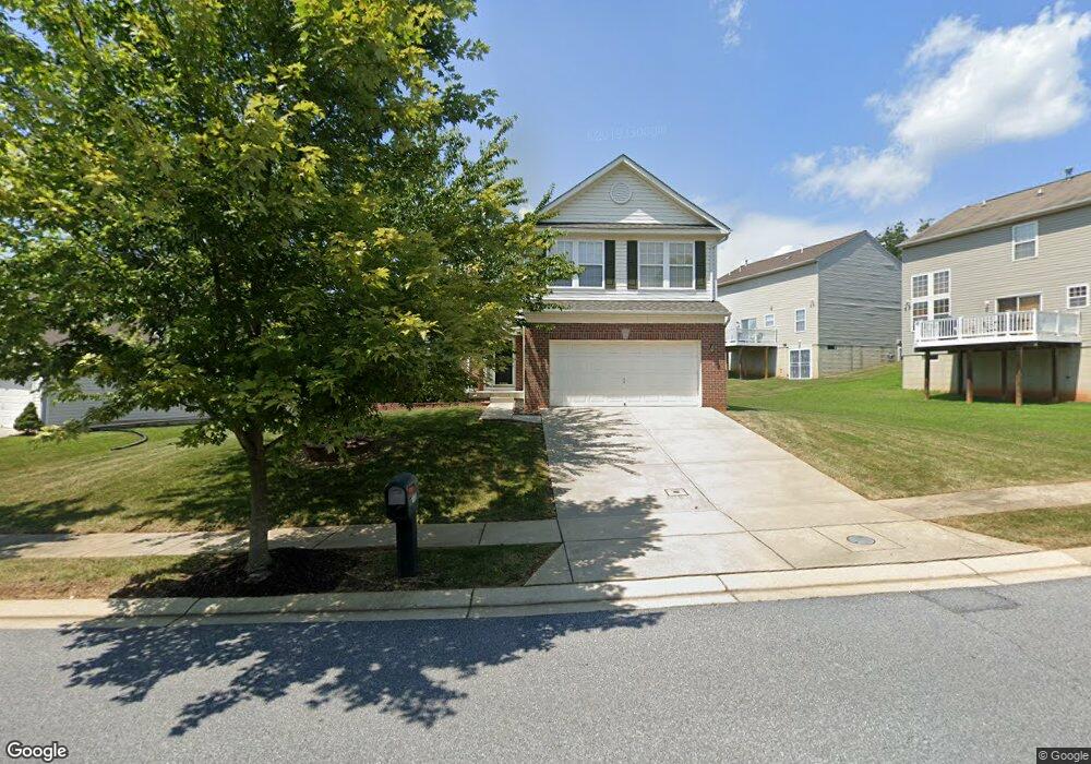
7818 Big Buck Dr Windsor Mill, MD 21244
Estimated Value: $441,000 - $550,000
--
Bed
4
Baths
2,253
Sq Ft
$223/Sq Ft
Est. Value
About This Home
This home is located at 7818 Big Buck Dr, Windsor Mill, MD 21244 and is currently estimated at $501,728, approximately $222 per square foot. 7818 Big Buck Dr is a home located in Baltimore County with nearby schools including Winfield Elementary School, Windsor Mill Middle School, and Milford Mill Academy.
Ownership History
Date
Name
Owned For
Owner Type
Purchase Details
Closed on
Apr 1, 2005
Sold by
Thompson Patricia L
Bought by
Taylor Donna L and Taylor Beverly A
Current Estimated Value
Home Financials for this Owner
Home Financials are based on the most recent Mortgage that was taken out on this home.
Original Mortgage
$279,200
Outstanding Balance
$143,985
Interest Rate
5.77%
Mortgage Type
New Conventional
Estimated Equity
$357,743
Purchase Details
Closed on
Dec 5, 2001
Sold by
Ryland Group Inc
Bought by
Thompson Patricia L
Create a Home Valuation Report for This Property
The Home Valuation Report is an in-depth analysis detailing your home's value as well as a comparison with similar homes in the area
Home Values in the Area
Average Home Value in this Area
Purchase History
| Date | Buyer | Sale Price | Title Company |
|---|---|---|---|
| Taylor Donna L | $349,000 | -- | |
| Thompson Patricia L | $240,229 | -- |
Source: Public Records
Mortgage History
| Date | Status | Borrower | Loan Amount |
|---|---|---|---|
| Open | Taylor Donna L | $279,200 | |
| Closed | Taylor Donna L | $69,800 |
Source: Public Records
Tax History Compared to Growth
Tax History
| Year | Tax Paid | Tax Assessment Tax Assessment Total Assessment is a certain percentage of the fair market value that is determined by local assessors to be the total taxable value of land and additions on the property. | Land | Improvement |
|---|---|---|---|---|
| 2025 | $5,236 | $399,900 | -- | -- |
| 2024 | $5,236 | $364,500 | $84,800 | $279,700 |
| 2023 | $2,563 | $356,200 | $0 | $0 |
| 2022 | $4,875 | $347,900 | $0 | $0 |
| 2021 | $4,659 | $339,600 | $84,800 | $254,800 |
| 2020 | $4,659 | $332,533 | $0 | $0 |
| 2019 | $4,672 | $325,467 | $0 | $0 |
| 2018 | $4,393 | $318,400 | $84,800 | $233,600 |
| 2017 | $4,367 | $305,767 | $0 | $0 |
| 2016 | $3,991 | $293,133 | $0 | $0 |
| 2015 | $3,991 | $280,500 | $0 | $0 |
| 2014 | $3,991 | $280,500 | $0 | $0 |
Source: Public Records
Map
Nearby Homes
- 16 Rhonda Ct
- 8402 Maymeadow Ct
- 3402 Courtleigh Dr
- 3126 Rices Ln
- 3414 Milford Mill Rd
- 3512 Saint James Rd
- 0 Rices Ln
- 8422 Merryview Dr
- 3507 Ellen
- 3312 Lauri Rd
- 7906 Montwood Rd
- 8400 Liberty Rd
- 3538 Milford Mill Rd
- 3510 Rockdale Ct
- 3115 Ripple Rd
- 8305 Windsor Mill Rd
- 3646 Clifmar Rd
- 3608 Kenmar Rd
- 12 Rollwin Rd
- 8403 Downey Dale Dr
- 7820 Big Buck Dr
- 7801 Doe Ridge Dr
- 7803 Doe Ridge Dr
- 7805 Doe Ridge Dr
- 7822 Big Buck Dr
- 7821 Big Buck Dr
- 7807 Doe Ridge Dr
- 7819 Big Buck Dr
- 7817 Big Buck Dr
- 3105 Mayfield Ave
- 7815 Big Buck Dr
- 3103 Mayfield Ave
- 7802 Doe Ridge Dr
- 7800 Doe Ridge Dr
- 7809 Doe Ridge Dr
- 7804 Doe Ridge Dr
- 7825 Big Buck Dr
- 7813 Big Buck Dr
- 3101 Mayfield Ave
- 7806 Doe Ridge Dr