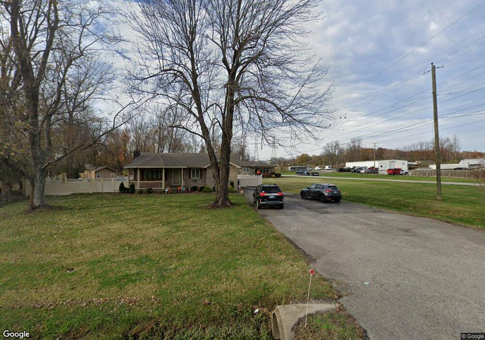
7832 Saint Andrews Church Rd Louisville, KY 40214
Pleasure Ridge Park NeighborhoodEstimated Value: $221,974 - $282,000
--
Bed
2
Baths
1,215
Sq Ft
$207/Sq Ft
Est. Value
About This Home
This home is located at 7832 Saint Andrews Church Rd, Louisville, KY 40214 and is currently estimated at $251,744, approximately $207 per square foot. 7832 Saint Andrews Church Rd is a home located in Jefferson County with nearby schools including Trunnell Elementary School, Stonestreet Elementary School, and Kenwood Elementary School.
Ownership History
Date
Name
Owned For
Owner Type
Purchase Details
Closed on
Dec 4, 2013
Sold by
Brown Noltemeyer & Mattingly Llc
Bought by
Green Richard C
Current Estimated Value
Purchase Details
Closed on
Feb 14, 2011
Sold by
Martin Flooring Companys Inc
Bought by
Durham Robert L and Durham Joetta A
Home Financials for this Owner
Home Financials are based on the most recent Mortgage that was taken out on this home.
Original Mortgage
$120,000
Interest Rate
4.66%
Mortgage Type
New Conventional
Create a Home Valuation Report for This Property
The Home Valuation Report is an in-depth analysis detailing your home's value as well as a comparison with similar homes in the area
Home Values in the Area
Average Home Value in this Area
Purchase History
| Date | Buyer | Sale Price | Title Company |
|---|---|---|---|
| Green Richard C | $65,000 | None Available | |
| Durham Robert L | $150,000 | None Available |
Source: Public Records
Mortgage History
| Date | Status | Borrower | Loan Amount |
|---|---|---|---|
| Previous Owner | Durham Robert L | $120,000 |
Source: Public Records
Tax History Compared to Growth
Tax History
| Year | Tax Paid | Tax Assessment Tax Assessment Total Assessment is a certain percentage of the fair market value that is determined by local assessors to be the total taxable value of land and additions on the property. | Land | Improvement |
|---|---|---|---|---|
| 2024 | -- | $174,310 | $55,800 | $118,510 |
| 2023 | $2,088 | $174,310 | $55,800 | $118,510 |
| 2022 | $2,095 | $174,310 | $55,800 | $118,510 |
| 2021 | $2,247 | $174,310 | $55,800 | $118,510 |
| 2020 | $1,795 | $155,130 | $48,250 | $106,880 |
| 2019 | $1,759 | $155,130 | $48,250 | $106,880 |
| 2018 | $1,738 | $155,130 | $48,250 | $106,880 |
| 2017 | $1,628 | $155,130 | $48,250 | $106,880 |
| 2013 | $1,500 | $150,000 | $25,000 | $125,000 |
Source: Public Records
Map
Nearby Homes
- 7107 Birnamwood Dr
- 164 Mills Dr
- 3503 Dorset Rd
- 3015 Groveview Ct
- 3003 Treeview Ct
- 3031 Fordhaven Rd
- 7700 Saint Andrews Church Rd
- 3423 Westhill Cir
- 3412 Westhill Cir
- 3417 Westhill Cir
- 4016 Blanton Ln
- 1702 Kurz Way
- 5119 Christie Ave
- 7508 Pimlico Dr
- 1904 Donald Dr
- 7904 Princess Wood Ct
- 7911 Princess Wood Ct
- 5102 Nancy Ave
- 8004 Wooded Ridge Dr
- 1719 Meyers Ln
- 7840 Saint Andrews Church Rd
- 7844 Saint Andrews Church Rd
- 7846 Saint Andrews Church Rd
- 7640 Saint Andrews Church Rd
- 7839 Saint Andrews Church Rd
- 7447 Saint Andrews Church Rd
- 7515 Saint Andrews Church Rd
- 7847 Saint Andrews Church Rd
- 7851 Saint Andrews Church Rd
- 3602 Birnamwood Ct
- 7856 Saint Andrews Church Rd
- 3600 Baymeadow Dr
- 7855 Saint Andrews Church Rd
- 3602 Baymeadow Dr
- 3600 Birnamwood Ct
- 7100 Saint Anthonys Church Rd
- 7100 Saint Anthony Church Rd
- 7100 St Anthony''S Church Rd
- 3604 Baymeadow Dr
- 7115 Birnamwood Dr