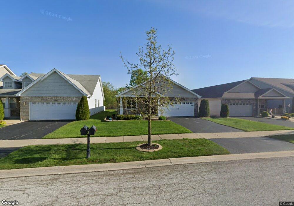
7894 W 101st Place Crown Point, IN 46307
Saint John NeighborhoodEstimated Value: $350,663 - $382,000
2
Beds
2
Baths
1,821
Sq Ft
$202/Sq Ft
Est. Value
About This Home
This home is located at 7894 W 101st Place, Crown Point, IN 46307 and is currently estimated at $367,416, approximately $201 per square foot. 7894 W 101st Place is a home located in Lake County with nearby schools including Timothy Ball Elementary School, Robert Taft Middle School, and Crown Point High School.
Ownership History
Date
Name
Owned For
Owner Type
Purchase Details
Closed on
Nov 1, 2007
Sold by
Blb St John Llc
Bought by
Jabaay Sidney A and Jabaay Carol A
Current Estimated Value
Home Financials for this Owner
Home Financials are based on the most recent Mortgage that was taken out on this home.
Original Mortgage
$50,000
Interest Rate
6.44%
Mortgage Type
Purchase Money Mortgage
Create a Home Valuation Report for This Property
The Home Valuation Report is an in-depth analysis detailing your home's value as well as a comparison with similar homes in the area
Home Values in the Area
Average Home Value in this Area
Purchase History
| Date | Buyer | Sale Price | Title Company |
|---|---|---|---|
| Jabaay Sidney A | -- | Chicago Title Insurance Co |
Source: Public Records
Mortgage History
| Date | Status | Borrower | Loan Amount |
|---|---|---|---|
| Closed | Jabaay Sidney A | $50,000 |
Source: Public Records
Tax History Compared to Growth
Tax History
| Year | Tax Paid | Tax Assessment Tax Assessment Total Assessment is a certain percentage of the fair market value that is determined by local assessors to be the total taxable value of land and additions on the property. | Land | Improvement |
|---|---|---|---|---|
| 2024 | $7,864 | $322,000 | $43,900 | $278,100 |
| 2023 | $3,372 | $307,300 | $43,900 | $263,400 |
| 2022 | $3,242 | $291,200 | $43,900 | $247,300 |
| 2021 | $3,024 | $272,000 | $43,900 | $228,100 |
| 2020 | $3,053 | $274,600 | $43,900 | $230,700 |
| 2019 | $2,984 | $264,600 | $43,900 | $220,700 |
| 2018 | $3,302 | $256,000 | $43,900 | $212,100 |
| 2017 | $3,205 | $245,100 | $43,900 | $201,200 |
| 2016 | $2,832 | $220,800 | $43,900 | $176,900 |
| 2014 | $2,519 | $211,200 | $43,900 | $167,300 |
| 2013 | $2,493 | $207,600 | $43,900 | $163,700 |
Source: Public Records
Map
Nearby Homes
- 10123 Azalea Dr
- 10160 Privet Dr
- 10181 Azalea Dr
- 10052 Pearwood Dr
- 8324 Willow Haven Dr
- 10347 Blaine St
- 10380 Blaine St
- 10365 Blaine St
- 10375 Blaine St
- 10375 Blaine St
- 10453 Privet Dr
- 10414 Whitney Place
- 7883 W105th Ave
- Dover Plan at The Gates of St. John
- Chatham Plan at The Gates of St. John
- FAIRFIELD Plan at The Gates of St. John
- Coventry Plan at The Gates of St. John
- MEADOW Plan at The Gates of St. John
- Holcombe Plan at The Gates of St. John
- HENLEY Plan at The Gates of St. John
- 7872 W 101st Place
- 7926 W 101st Place
- 7854 W 101st Place
- 7836 W 101st Place
- 7934 W 101st Place
- 7816 W 101st Place
- 10130 Privet Dr
- 7956 W 101st Ave
- 7956 W 101st Place
- 10122 Azalea Dr
- 10135 Azalea Dr
- 10137 Azalea Dr
- 10128 Azalea Dr
- 10111 Cline Ave
- 10146 Privet Dr
- 10145 Azalea Dr
- 10132 Azalea Dr
- 10150 Privet Dr
- 10121 Privet Dr
- 10125 Privet Dr