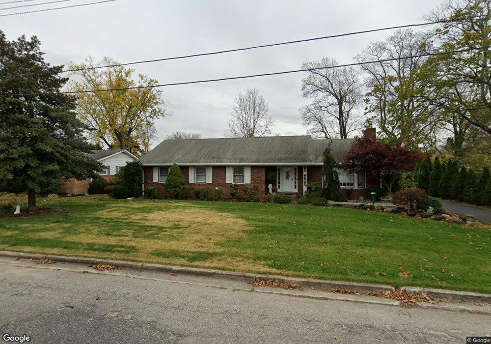
79 Boxwood Dr Vineland, NJ 08361
Estimated Value: $334,000 - $365,000
--
Bed
--
Bath
1,814
Sq Ft
$192/Sq Ft
Est. Value
About This Home
This home is located at 79 Boxwood Dr, Vineland, NJ 08361 and is currently estimated at $348,347, approximately $192 per square foot. 79 Boxwood Dr is a home located in Cumberland County with nearby schools including Pauline J. Petway Elementary School, Johnstone School, and Veterans Memorial Intermediate School.
Ownership History
Date
Name
Owned For
Owner Type
Purchase Details
Closed on
Aug 29, 2000
Sold by
Voltaggio Anna P
Bought by
Stonestreet Erika J
Current Estimated Value
Home Financials for this Owner
Home Financials are based on the most recent Mortgage that was taken out on this home.
Original Mortgage
$60,000
Outstanding Balance
$21,961
Interest Rate
8.16%
Estimated Equity
$326,386
Create a Home Valuation Report for This Property
The Home Valuation Report is an in-depth analysis detailing your home's value as well as a comparison with similar homes in the area
Home Values in the Area
Average Home Value in this Area
Purchase History
| Date | Buyer | Sale Price | Title Company |
|---|---|---|---|
| Stonestreet Erika J | $125,000 | -- |
Source: Public Records
Mortgage History
| Date | Status | Borrower | Loan Amount |
|---|---|---|---|
| Open | Stonestreet Erika J | $60,000 |
Source: Public Records
Tax History Compared to Growth
Tax History
| Year | Tax Paid | Tax Assessment Tax Assessment Total Assessment is a certain percentage of the fair market value that is determined by local assessors to be the total taxable value of land and additions on the property. | Land | Improvement |
|---|---|---|---|---|
| 2025 | $5,043 | $158,400 | $31,600 | $126,800 |
| 2024 | $5,043 | $158,400 | $31,600 | $126,800 |
| 2023 | $5,010 | $158,400 | $31,600 | $126,800 |
| 2022 | $4,861 | $158,400 | $31,600 | $126,800 |
| 2021 | $4,546 | $158,400 | $31,600 | $126,800 |
| 2020 | $4,636 | $158,400 | $31,600 | $126,800 |
| 2019 | $4,573 | $158,400 | $31,600 | $126,800 |
| 2018 | $4,453 | $158,400 | $31,600 | $126,800 |
| 2017 | $4,229 | $158,400 | $31,600 | $126,800 |
| 2016 | $4,080 | $158,400 | $31,600 | $126,800 |
| 2015 | $3,930 | $158,400 | $31,600 | $126,800 |
| 2014 | $3,716 | $158,400 | $31,600 | $126,800 |
Source: Public Records
Map
Nearby Homes
- 101 Oaklawn Terrace
- 208 Oaklawn Terrace
- 211 Oaklawn Terrace
- 2227 E Landis Ave
- 307 N Spring Rd
- 135 S Spring Rd
- 2201 Ida Ln
- 667 Alps Place
- 29 N Brewster Rd
- 208 S Brewster Rd
- 2139 E Chestnut Ave Unit 27
- 1173 New Pear St
- 191 Redcrest St
- 1825 Washington Ave
- 866 Chapel Dr
- 733 Sharon Ct
- 664 Brentwood Dr
- 254 Lawrence St
- 4 Elmwood Ave
- 746 Sharon Ct
- 97 Boxwood Dr
- 70 Oaklawn Terrace
- 86 Boxwood Dr
- 66 Boxwood Dr
- 106 Oaklawn Terrace
- 50 Oaklawn Terrace
- 106 Boxwood Dr
- 46 Boxwood Dr
- 2076 E Landis Ave
- 120 Oaklawn Terrace
- 65 N Spring Rd
- 135 Boxwood Dr
- 105 N Spring Rd
- 134 Oaklawn Terrace
- 63 Oaklawn Terrace
- 2046 E Landis Ave
- 2114 E Landis Ave
- 2114 E Landis Ave Unit 10
- 2114 E Landis Ave Unit 9
- 2114 E Landis Ave Unit 8