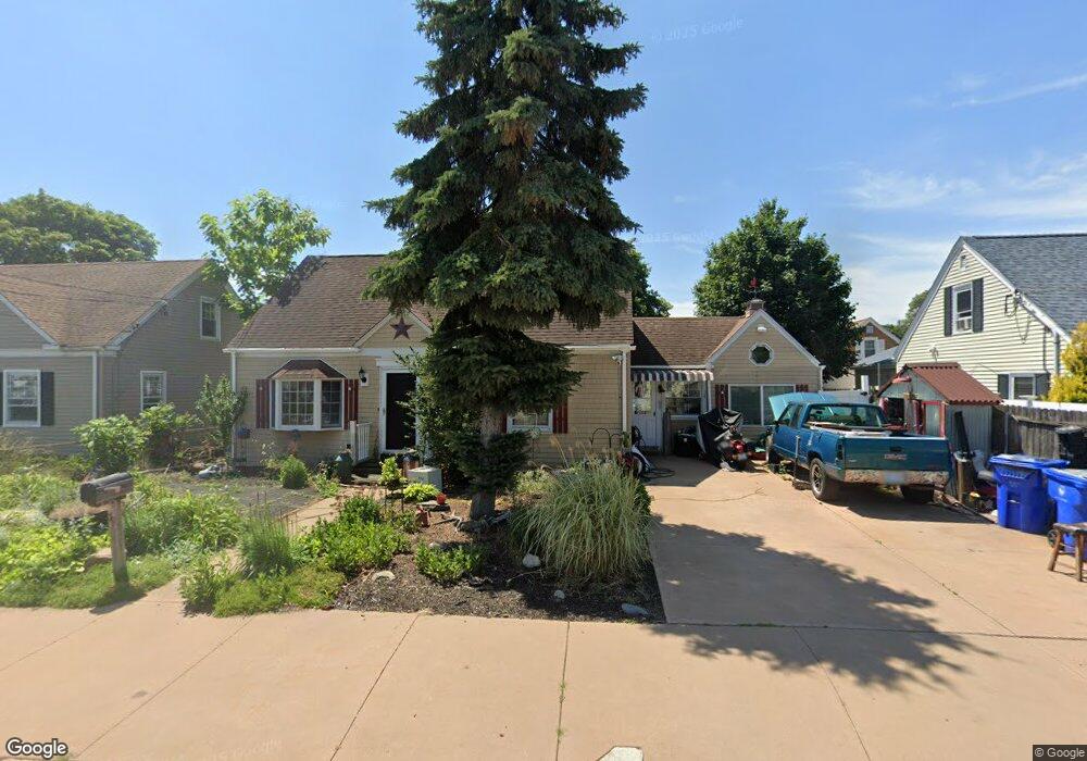
79 Stearns St Pawtucket, RI 02861
Darlington NeighborhoodEstimated Value: $400,108 - $414,000
3
Beds
2
Baths
1,384
Sq Ft
$293/Sq Ft
Est. Value
About This Home
This home is located at 79 Stearns St, Pawtucket, RI 02861 and is currently estimated at $405,527, approximately $293 per square foot. 79 Stearns St is a home located in Providence County with nearby schools including St Cecilia School and Dayspring Christian Academy.
Ownership History
Date
Name
Owned For
Owner Type
Purchase Details
Closed on
Jan 13, 2011
Sold by
Dupre Thomas N and Dupre Jo Anna M
Bought by
Dupre Ft
Current Estimated Value
Purchase Details
Closed on
Sep 17, 2002
Sold by
Ciallella Benjamin and Bertrand Sylvia
Bought by
Dupre Thomas N and Dupre Jo Ann M
Create a Home Valuation Report for This Property
The Home Valuation Report is an in-depth analysis detailing your home's value as well as a comparison with similar homes in the area
Home Values in the Area
Average Home Value in this Area
Purchase History
| Date | Buyer | Sale Price | Title Company |
|---|---|---|---|
| Dupre Ft | -- | -- | |
| Dupre Thomas N | $140,000 | -- |
Source: Public Records
Mortgage History
| Date | Status | Borrower | Loan Amount |
|---|---|---|---|
| Open | Dupre Thomas N | $7,914 | |
| Previous Owner | Dupre Thomas N | $8,353 | |
| Previous Owner | Dupre Thomas N | $15,749 |
Source: Public Records
Tax History Compared to Growth
Tax History
| Year | Tax Paid | Tax Assessment Tax Assessment Total Assessment is a certain percentage of the fair market value that is determined by local assessors to be the total taxable value of land and additions on the property. | Land | Improvement |
|---|---|---|---|---|
| 2025 | $4,062 | $308,900 | $121,600 | $187,300 |
| 2024 | $3,812 | $308,900 | $121,600 | $187,300 |
| 2023 | $3,933 | $232,200 | $76,100 | $156,100 |
| 2022 | $3,850 | $232,200 | $76,100 | $156,100 |
| 2021 | $3,850 | $232,200 | $76,100 | $156,100 |
| 2020 | $3,660 | $175,200 | $60,100 | $115,100 |
| 2019 | $3,660 | $175,200 | $60,100 | $115,100 |
| 2018 | $3,857 | $191,600 | $60,100 | $131,500 |
| 2017 | $3,765 | $165,700 | $48,900 | $116,800 |
| 2016 | $3,627 | $165,700 | $48,900 | $116,800 |
| 2015 | $3,627 | $165,700 | $48,900 | $116,800 |
| 2014 | $3,461 | $150,100 | $48,900 | $101,200 |
Source: Public Records
Map
Nearby Homes
- 50 Stearns St
- 44 Stanley St
- 139 Tweed St
- 207 Benefit St
- 68 Slade St
- 97 Wendell St
- 0 Chaplin St
- 83 Chaplin St
- 118 Chaplin St
- 548 Kenyon Ave Unit 25
- 548 Kenyon Ave Unit 27
- 548 Kenyon Ave Unit 45
- 179 Columbine Ave
- 39 Chaplin St
- 19 Lodi St
- 180 Darlingdale Ave
- 65 Cedarbrook Rd
- 31 Norris Ave
- 57 Cedarbrook Rd
- 27 Aiken St