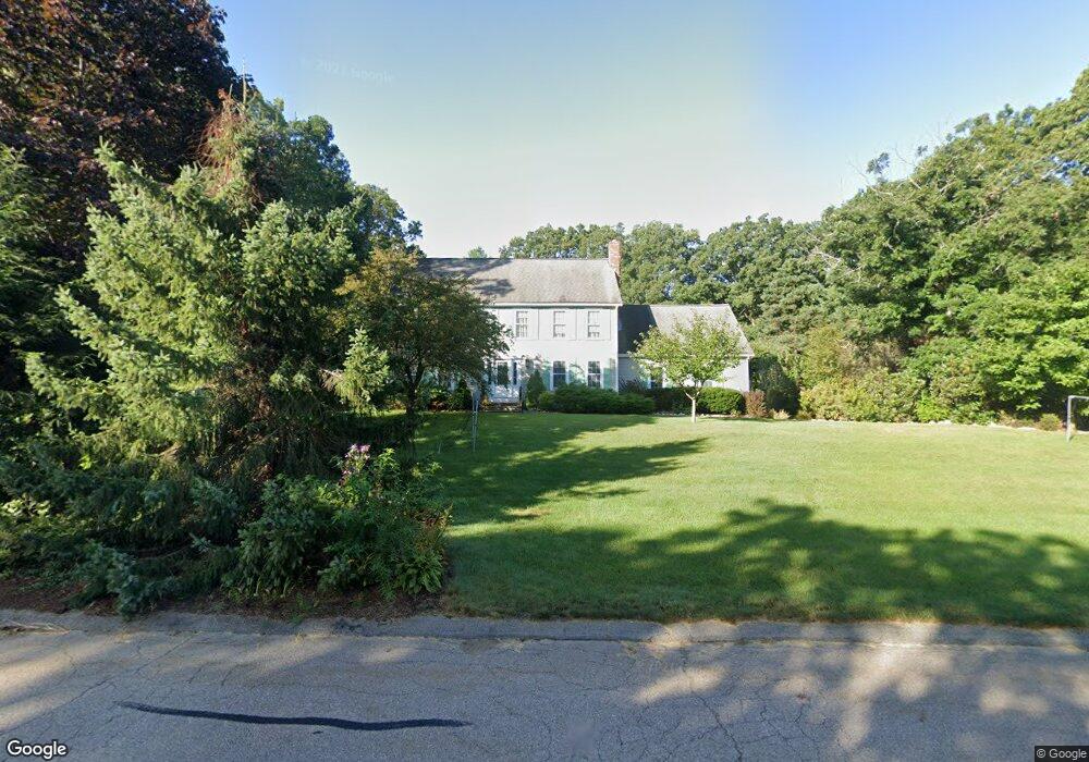
8 Bretts Farm Rd Norfolk, MA 02056
Estimated Value: $848,600 - $974,000
4
Beds
3
Baths
2,500
Sq Ft
$365/Sq Ft
Est. Value
About This Home
This home is located at 8 Bretts Farm Rd, Norfolk, MA 02056 and is currently estimated at $913,650, approximately $365 per square foot. 8 Bretts Farm Rd is a home located in Norfolk County with nearby schools including H. Olive Day School and Freeman-Kennedy School.
Ownership History
Date
Name
Owned For
Owner Type
Purchase Details
Closed on
Jul 17, 2009
Sold by
Smyth Daniel and Smyth Elizabeth
Bought by
Mcnulty Matthew D and Mcnulty Marta
Current Estimated Value
Purchase Details
Closed on
Jul 16, 1992
Sold by
Low Rose G
Bought by
Smyth Daniel and Smyth Elizabeth
Purchase Details
Closed on
Jul 13, 1988
Sold by
Oakridge Constr Co
Bought by
Low Rose G
Create a Home Valuation Report for This Property
The Home Valuation Report is an in-depth analysis detailing your home's value as well as a comparison with similar homes in the area
Home Values in the Area
Average Home Value in this Area
Purchase History
| Date | Buyer | Sale Price | Title Company |
|---|---|---|---|
| Mcnulty Matthew D | $500,000 | -- | |
| Smyth Daniel | $280,000 | -- | |
| Low Rose G | $303,000 | -- |
Source: Public Records
Mortgage History
| Date | Status | Borrower | Loan Amount |
|---|---|---|---|
| Open | Low Rose G | $388,800 | |
| Closed | Low Rose G | $395,000 |
Source: Public Records
Tax History Compared to Growth
Tax History
| Year | Tax Paid | Tax Assessment Tax Assessment Total Assessment is a certain percentage of the fair market value that is determined by local assessors to be the total taxable value of land and additions on the property. | Land | Improvement |
|---|---|---|---|---|
| 2025 | $11,356 | $711,100 | $243,100 | $468,000 |
| 2024 | $11,014 | $707,400 | $243,100 | $464,300 |
| 2023 | $10,598 | $645,800 | $243,100 | $402,700 |
| 2022 | $9,908 | $544,400 | $227,700 | $316,700 |
| 2021 | $9,571 | $532,000 | $221,100 | $310,900 |
| 2020 | $9,708 | $520,800 | $201,200 | $319,600 |
| 2019 | $9,354 | $511,400 | $201,200 | $310,200 |
| 2018 | $8,993 | $483,000 | $201,200 | $281,800 |
| 2017 | $8,866 | $486,600 | $201,200 | $285,400 |
| 2016 | $8,827 | $488,200 | $208,900 | $279,300 |
| 2015 | $8,646 | $489,600 | $196,300 | $293,300 |
| 2014 | $8,298 | $476,100 | $196,300 | $279,800 |
Source: Public Records
Map
Nearby Homes
- 11 Elliot Mills Unit 11
- 12 Waites Crossing Way
- 11 Waites Crossing
- 20 Waites Crossing
- 19 Waites Crossing
- 9 Waites Crossing
- 13 Waites Crossing
- 50 Reed Fulton Ave Unit Lot 61
- 45 Joshua Rd
- 14 Essex St
- 0 Toils End Rd
- 45 King St
- 324 Pleasant St
- 23 Fredrickson Rd
- 570 Franklin St
- 3 Sparrow Rd
- 266 Pleasant St
- 246 Forest Grove Ave
- 67 Milliken Ave Unit 22
- 1 Uncas Ave
- 6 Bretts Farm Rd
- 10 Bretts Farm Rd
- 7 Bretts Farm Rd
- 9 Bretts Farm Rd
- 5 Bretts Farm Rd
- 12 Bretts Farm Rd
- 4 Bretts Farm Rd
- 47 Wampanoag Dr
- 3 Bretts Farm Rd
- 15 Bretts Farm Rd
- 43 Wampanoag Dr
- 14 Concetta Way
- 16 Bretts Farm Rd
- 18 Concetta Way
- 39 Wampanoag Dr
- 55 Wampanoag Dr
- 17 Bretts Farm Rd
- 42 Wampanoag Dr
- 2 Bretts Farm Rd
- 34 Lawrence St