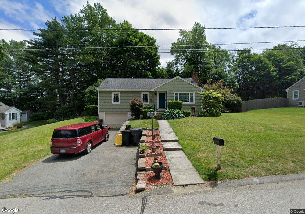
8 Sunset Ln North Grafton, MA 01536
Estimated Value: $502,000 - $511,000
3
Beds
2
Baths
1,238
Sq Ft
$408/Sq Ft
Est. Value
About This Home
This home is located at 8 Sunset Ln, North Grafton, MA 01536 and is currently estimated at $505,680, approximately $408 per square foot. 8 Sunset Ln is a home located in Worcester County with nearby schools including Grafton High School, Silver Spruce Montessori School, and St Stephen Elementary School.
Ownership History
Date
Name
Owned For
Owner Type
Purchase Details
Closed on
May 31, 2007
Sold by
Pederson Joanne M
Bought by
Wnukowski Justin D
Current Estimated Value
Home Financials for this Owner
Home Financials are based on the most recent Mortgage that was taken out on this home.
Original Mortgage
$238,400
Outstanding Balance
$146,270
Interest Rate
6.24%
Mortgage Type
Purchase Money Mortgage
Estimated Equity
$359,410
Purchase Details
Closed on
Jun 29, 1993
Sold by
Szkutak Robert and Szkutak Diane
Bought by
Pederson Paul F and Pederson Joanne
Create a Home Valuation Report for This Property
The Home Valuation Report is an in-depth analysis detailing your home's value as well as a comparison with similar homes in the area
Home Values in the Area
Average Home Value in this Area
Purchase History
| Date | Buyer | Sale Price | Title Company |
|---|---|---|---|
| Wnukowski Justin D | $298,000 | -- | |
| Wnukowski Justin D | $298,000 | -- | |
| Wnukowski Justin D | $298,000 | -- | |
| Pederson Paul F | $114,500 | -- | |
| Pederson Paul F | $114,500 | -- |
Source: Public Records
Mortgage History
| Date | Status | Borrower | Loan Amount |
|---|---|---|---|
| Open | Wnukowski Justin D | $238,400 | |
| Closed | Wnukowski Justin D | $238,400 | |
| Previous Owner | Pederson Paul F | $50,000 | |
| Previous Owner | Pederson Paul F | $137,150 |
Source: Public Records
Tax History Compared to Growth
Tax History
| Year | Tax Paid | Tax Assessment Tax Assessment Total Assessment is a certain percentage of the fair market value that is determined by local assessors to be the total taxable value of land and additions on the property. | Land | Improvement |
|---|---|---|---|---|
| 2025 | $5,955 | $427,200 | $173,000 | $254,200 |
| 2024 | $5,754 | $402,100 | $164,800 | $237,300 |
| 2023 | $5,613 | $357,300 | $164,800 | $192,500 |
| 2022 | $5,300 | $314,000 | $141,500 | $172,500 |
| 2021 | $5,130 | $298,600 | $128,600 | $170,000 |
| 2020 | $4,892 | $296,500 | $128,600 | $167,900 |
| 2019 | $4,671 | $280,400 | $124,900 | $155,500 |
| 2018 | $4,781 | $288,200 | $124,200 | $164,000 |
| 2017 | $4,607 | $280,900 | $116,900 | $164,000 |
| 2016 | $4,065 | $242,700 | $93,900 | $148,800 |
| 2015 | $4,244 | $257,200 | $92,800 | $164,400 |
| 2014 | $3,946 | $258,600 | $109,600 | $149,000 |
Source: Public Records
Map
Nearby Homes
- 11 Hovey Pond Dr Unit 11
- 194 Worcester St
- 22 Beverly Rd
- 14 Northgate Ct Unit 14
- 17 Hingham Rd
- 30 Falmouth Dr
- 4 Westboro Rd
- 44 Meadow Ln
- 0 East St
- 76 Samuel Dr
- 15 Windle Ave
- 21 Lordvale Blvd Unit 406
- 1 Hastings Ave
- 69 Cortland Grove Dr Unit 69
- 5 Lincoln Ln Unit 5
- 4 Winslow Ln Unit 1410
- 51 Cortland Grove Dr Unit 51
- 28 Lincoln Ln
- 46 John Dr Unit 46
- 3 Abby Rd
- 10 Sunset Ln
- 1 Shore Dr
- 9 Lakeview Dr
- 19 Hovey Pond Dr
- 1 Hovey Pond Dr
- 19 Hovey Pond Dr Unit 110
- 19 Hovey Pond Dr Unit 19
- 1 Hovey Pond Dr Unit 1
- 17 Hovey Pond Dr
- 15 Hovey Pond Dr
- 13 Hovey Pond Dr
- 15 Hovey Pond Dr Unit 108
- 13 Hovey Pond Dr Unit 13
- 12 Sunset Ln
- 4 Sunset Ln
- 7 Lakeview Dr
- 22 Hovey Pond Dr
- 18 Hovey Pond Dr
- 10 Hovey Pond Dr
- 4 Hovey Pond Dr