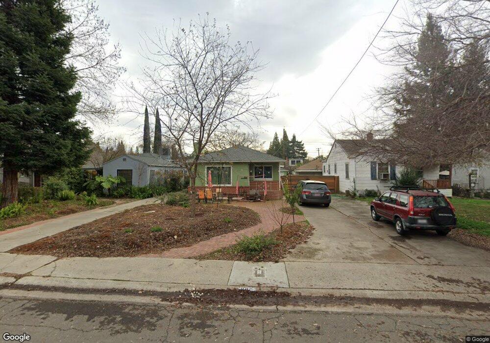
800 8th Ave Sacramento, CA 95818
Upper Land Park NeighborhoodEstimated Value: $773,737 - $904,000
3
Beds
1
Bath
--
Sq Ft
3,049
Sq Ft Lot
About This Home
This home is located at 800 8th Ave, Sacramento, CA 95818 and is currently estimated at $848,934. 800 8th Ave is a home located in Sacramento County with nearby schools including Crocker/Riverside Elementary School, California Middle, and C. K. McClatchy High.
Ownership History
Date
Name
Owned For
Owner Type
Purchase Details
Closed on
May 11, 2015
Sold by
Fong Robert K and The James Fong & Emilie Fong 2
Bought by
Wanke Molander Anna F and Wanke Hermann Louis
Current Estimated Value
Home Financials for this Owner
Home Financials are based on the most recent Mortgage that was taken out on this home.
Original Mortgage
$484,014
Interest Rate
3.64%
Mortgage Type
VA
Purchase Details
Closed on
Sep 14, 2000
Sold by
Fong James K Sr & Emilie W & Tr
Bought by
Fong James K and Fong Emilie W
Create a Home Valuation Report for This Property
The Home Valuation Report is an in-depth analysis detailing your home's value as well as a comparison with similar homes in the area
Home Values in the Area
Average Home Value in this Area
Purchase History
| Date | Buyer | Sale Price | Title Company |
|---|---|---|---|
| Wanke Molander Anna F | $475,000 | Stewart | |
| Fong James K | -- | -- |
Source: Public Records
Mortgage History
| Date | Status | Borrower | Loan Amount |
|---|---|---|---|
| Previous Owner | Wanke Molander Anna F | $484,014 |
Source: Public Records
Tax History Compared to Growth
Tax History
| Year | Tax Paid | Tax Assessment Tax Assessment Total Assessment is a certain percentage of the fair market value that is determined by local assessors to be the total taxable value of land and additions on the property. | Land | Improvement |
|---|---|---|---|---|
| 2025 | $6,774 | $570,809 | $198,302 | $372,507 |
| 2024 | $6,774 | $559,617 | $194,414 | $365,203 |
| 2023 | $6,616 | $548,645 | $190,602 | $358,043 |
| 2022 | $6,506 | $537,888 | $186,865 | $351,023 |
| 2021 | $6,200 | $527,342 | $183,201 | $344,141 |
| 2020 | $6,253 | $521,936 | $181,323 | $340,613 |
| 2019 | $6,121 | $511,703 | $177,768 | $333,935 |
| 2018 | $5,963 | $501,671 | $174,283 | $327,388 |
| 2017 | $5,883 | $491,835 | $170,866 | $320,969 |
| 2016 | $5,759 | $482,192 | $167,516 | $314,676 |
| 2015 | $970 | $62,928 | $11,603 | $51,325 |
| 2014 | $872 | $61,706 | $11,378 | $50,328 |
Source: Public Records
Map
Nearby Homes
- 849 8th Ave
- 710 7th Ave
- 1032 10th Ave
- 3098 Riverside Blvd
- 625 Robertson Way
- 2750 Moonflower St
- 2726 Moonflower St
- 613 Swanston Dr
- 2825 Elderberry St
- The Argo Plan at The Estates at Newport
- The Baltic Plan at The Estates at Newport
- The Caspian Plan at The Estates at Newport
- The Dawson Plan at The Estates at Newport
- 1432 Teneighth Way
- 749 3rd Ave Unit 3
- 1259 Milano Dr Unit 2
- 1268 Milano Dr Unit 6
- 808 Fremont Way
- 1300 Milano Dr Unit 7
- 1323 Milano Dr Unit 2