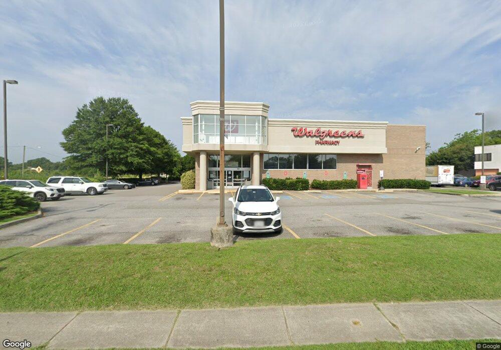
801 Independence Blvd Virginia Beach, VA 23455
Bayside Neighborhood
--
Bed
--
Bath
13,990
Sq Ft
1.09
Acres
About This Home
This home is located at 801 Independence Blvd, Virginia Beach, VA 23455. 801 Independence Blvd is a home located in Virginia Beach City with nearby schools including Pembroke Meadows Elementary School, Independence Middle School, and Bayside High School.
Ownership History
Date
Name
Owned For
Owner Type
Purchase Details
Closed on
Dec 10, 2020
Sold by
Cs Loan Pool Iii Llc
Bought by
Ciiv Pool Llc
Purchase Details
Closed on
Oct 28, 2016
Sold by
Cornerstone Llc A Delaware Limited Liabi
Bought by
Cs Loan Pool Iii Llc A Delaware Limited
Purchase Details
Closed on
Jan 22, 2002
Sold by
Walgreen Co
Bought by
Cornerstone Leased Drug Store
Home Financials for this Owner
Home Financials are based on the most recent Mortgage that was taken out on this home.
Original Mortgage
$2,626,785
Interest Rate
7.13%
Mortgage Type
Construction
Create a Home Valuation Report for This Property
The Home Valuation Report is an in-depth analysis detailing your home's value as well as a comparison with similar homes in the area
Home Values in the Area
Average Home Value in this Area
Purchase History
| Date | Buyer | Sale Price | Title Company |
|---|---|---|---|
| Ciiv Pool Llc | $2,829,354 | Stewart Title | |
| Ciiv Pool Llc | $2,829,354 | Stewart Title Guaranty Co | |
| Cs Loan Pool Iii Llc A Delaware Limited | -- | None Available | |
| Cornerstone Leased Drug Store | $2,654,660 | -- |
Source: Public Records
Mortgage History
| Date | Status | Borrower | Loan Amount |
|---|---|---|---|
| Previous Owner | Cornerstone Leased Drug Store | $2,626,785 |
Source: Public Records
Tax History Compared to Growth
Tax History
| Year | Tax Paid | Tax Assessment Tax Assessment Total Assessment is a certain percentage of the fair market value that is determined by local assessors to be the total taxable value of land and additions on the property. | Land | Improvement |
|---|---|---|---|---|
| 2025 | $32,094 | $3,298,200 | $1,278,300 | $2,019,900 |
| 2024 | $32,094 | $3,308,700 | $1,278,300 | $2,030,400 |
| 2023 | $32,193 | $3,251,800 | $1,278,300 | $1,973,500 |
| 2022 | $30,897 | $3,120,900 | $1,278,300 | $1,842,600 |
| 2021 | $31,033 | $3,134,600 | $1,278,300 | $1,856,300 |
| 2020 | $32,173 | $3,162,000 | $1,278,300 | $1,883,700 |
| 2019 | $32,312 | $3,157,600 | $1,278,300 | $1,879,300 |
| 2018 | $31,655 | $3,157,600 | $1,278,300 | $1,879,300 |
| 2017 | $32,197 | $3,211,700 | $1,278,300 | $1,933,400 |
| 2016 | $31,707 | $3,202,700 | $1,278,300 | $1,924,400 |
| 2015 | $30,261 | $3,056,700 | $1,122,500 | $1,934,200 |
| 2014 | $27,514 | $3,061,600 | $1,122,500 | $1,939,100 |
Source: Public Records
Map
Nearby Homes
- 828 Gable Way
- 4505 Saint John Ct
- 1001 Ferry Plantation Rd
- 1005 Ferry Plantation Rd
- 1029 Ferry Plantation Rd
- 772 Meade Ln
- 4607 Merrimac Ln
- 4833 Linshaw Ln
- 1121 Witchgate Ct
- 904 Ewell Rd
- 793 Crepe Myrtle Ln
- 704 Jericho Rd
- 4513 S Hessian Rd
- 1020 Miles Standish Rd
- 513 Cheswick Arch
- 921 Aragona Blvd
- 4504 Old English Cir
- 1052 Miles Standish Rd
- 841 Brinson Ln
- 749 Holladay Ln
- 737 Independence Blvd
- 717 Independence Blvd
- 816 Independence Blvd
- 4528 Notre Dame Ct
- 4524 Notre Dame Ct
- 800 Independence Blvd
- 4520 Notre Dame Ct
- 4516 Notre Dame Ct
- 4512 Notre Dame Ct
- 4508 Notre Dame Ct
- 4504 Notre Dame Ct
- 4500 Notre Dame Ct
- 4701 Whistler Ln Unit X2092
- 748 Independence Blvd
- 713 Independence Blvd
- 4646 N Witchduck Rd
- 4529 Notre Dame Ct
- 4705 Whistler Ln Unit X2093
- 863 Cathedral Dr
- 4525 Notre Dame Ct