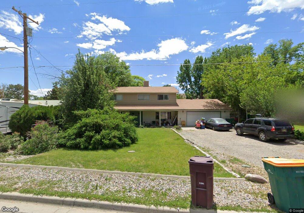
801 Shady Ln Farmington, NM 87401
Estimated Value: $326,747 - $379,000
--
Bed
--
Bath
1,872
Sq Ft
$189/Sq Ft
Est. Value
About This Home
This home is located at 801 Shady Ln, Farmington, NM 87401 and is currently estimated at $352,937, approximately $188 per square foot. 801 Shady Ln is a home located in San Juan County with nearby schools including Apache Elementary School, Tibbetts Middle School, and Farmington High School.
Ownership History
Date
Name
Owned For
Owner Type
Purchase Details
Closed on
Mar 2, 2012
Sold by
Cronk Mark A and Cronk Jonna Carol
Bought by
Cronk Mark A and Cronk Jonna C
Current Estimated Value
Home Financials for this Owner
Home Financials are based on the most recent Mortgage that was taken out on this home.
Original Mortgage
$154,000
Outstanding Balance
$106,691
Interest Rate
4.05%
Mortgage Type
New Conventional
Estimated Equity
$246,246
Purchase Details
Closed on
Jul 13, 2007
Sold by
Vickers David R and Vickers Michelle L
Bought by
Cronk Mark A and Cronk Jonna
Home Financials for this Owner
Home Financials are based on the most recent Mortgage that was taken out on this home.
Original Mortgage
$164,000
Interest Rate
6.71%
Mortgage Type
New Conventional
Create a Home Valuation Report for This Property
The Home Valuation Report is an in-depth analysis detailing your home's value as well as a comparison with similar homes in the area
Home Values in the Area
Average Home Value in this Area
Purchase History
| Date | Buyer | Sale Price | Title Company |
|---|---|---|---|
| Cronk Mark A | -- | None Available | |
| Cronk Mark A | -- | None Available |
Source: Public Records
Mortgage History
| Date | Status | Borrower | Loan Amount |
|---|---|---|---|
| Open | Cronk Mark A | $154,000 | |
| Closed | Cronk Mark A | $164,000 |
Source: Public Records
Tax History Compared to Growth
Tax History
| Year | Tax Paid | Tax Assessment Tax Assessment Total Assessment is a certain percentage of the fair market value that is determined by local assessors to be the total taxable value of land and additions on the property. | Land | Improvement |
|---|---|---|---|---|
| 2024 | $1,800 | $77,705 | $0 | $0 |
| 2023 | $1,800 | $75,442 | $0 | $0 |
| 2022 | $1,713 | $73,245 | $0 | $0 |
| 2021 | $1,648 | $71,112 | $0 | $0 |
| 2020 | $1,611 | $69,721 | $0 | $0 |
| 2019 | $1,596 | $69,449 | $0 | $0 |
| 2018 | $1,594 | $71,224 | $0 | $0 |
| 2017 | $1,588 | $70,947 | $0 | $0 |
| 2016 | $1,574 | $70,947 | $0 | $0 |
| 2015 | $1,548 | $70,947 | $0 | $0 |
| 2014 | $1,547 | $71,139 | $0 | $0 |
Source: Public Records
Map
Nearby Homes
- 636 Ridge Lea Ct
- 1805 Brenwood Dr
- 2412 Pheasant Place
- LOT 4 XX W 24th St
- 212 W Sunset Place
- 2413 N Municipal Dr
- XX Brookside Dr
- 195 McDonald Rd
- 1011 N Auburn Ave
- 200 W 24th St
- 212 W 25th St
- 1013 N Orchard Dr
- 2900 Northwood Dr
- 3104 N Western Ave
- 3108 N Mesa Dr
- 2906 Northwood Dr
- 3003 Northwood Cir
- XX W Apache St
- 1108 N Dustin Ave
- 414 W Comanche St