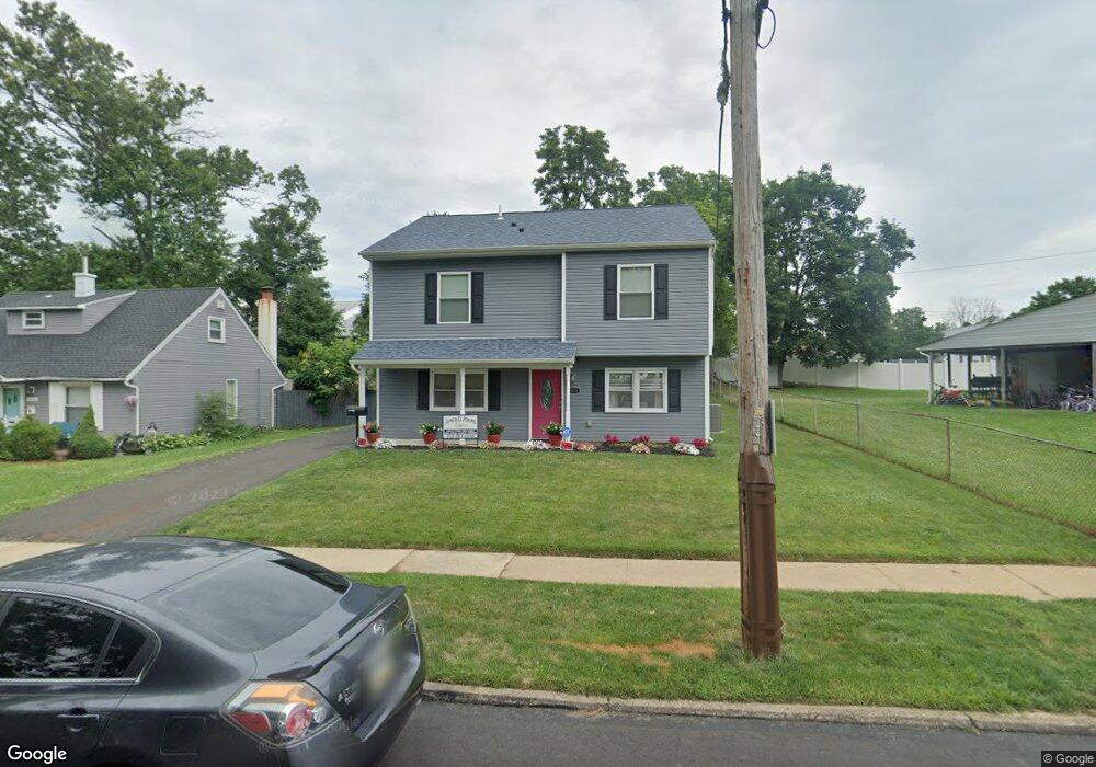
802 Rennard Ln Morrisville, PA 19067
Estimated Value: $303,000 - $409,523
3
Beds
3
Baths
1,747
Sq Ft
$208/Sq Ft
Est. Value
About This Home
This home is located at 802 Rennard Ln, Morrisville, PA 19067 and is currently estimated at $364,131, approximately $208 per square foot. 802 Rennard Ln is a home located in Bucks County with nearby schools including Grandview Elementary School, Morrisville High School, and Foundation Academy Charter School.
Ownership History
Date
Name
Owned For
Owner Type
Purchase Details
Closed on
Oct 29, 2018
Sold by
Murray David
Bought by
Murray David and Murray Carletha Debra
Current Estimated Value
Home Financials for this Owner
Home Financials are based on the most recent Mortgage that was taken out on this home.
Original Mortgage
$268,046
Outstanding Balance
$238,923
Interest Rate
5.5%
Mortgage Type
FHA
Estimated Equity
$125,208
Purchase Details
Closed on
Jan 23, 2004
Sold by
Murray David and Murray Rudeane D
Bought by
Murray David
Home Financials for this Owner
Home Financials are based on the most recent Mortgage that was taken out on this home.
Original Mortgage
$116,000
Interest Rate
5.82%
Mortgage Type
New Conventional
Purchase Details
Closed on
Dec 20, 2000
Sold by
Salvatore Charles J
Bought by
Salvatore Charles J
Create a Home Valuation Report for This Property
The Home Valuation Report is an in-depth analysis detailing your home's value as well as a comparison with similar homes in the area
Home Values in the Area
Average Home Value in this Area
Purchase History
| Date | Buyer | Sale Price | Title Company |
|---|---|---|---|
| Murray David | -- | Core Abstract | |
| Murray David | -- | -- | |
| Salvatore Charles J | -- | -- |
Source: Public Records
Mortgage History
| Date | Status | Borrower | Loan Amount |
|---|---|---|---|
| Open | Murray David | $268,046 | |
| Closed | Murray David | $116,000 |
Source: Public Records
Tax History Compared to Growth
Tax History
| Year | Tax Paid | Tax Assessment Tax Assessment Total Assessment is a certain percentage of the fair market value that is determined by local assessors to be the total taxable value of land and additions on the property. | Land | Improvement |
|---|---|---|---|---|
| 2025 | $6,777 | $21,050 | $4,120 | $16,930 |
| 2024 | $6,777 | $21,050 | $4,120 | $16,930 |
| 2023 | $6,715 | $21,050 | $4,120 | $16,930 |
| 2022 | $6,568 | $21,050 | $4,120 | $16,930 |
| 2021 | $6,279 | $21,050 | $4,120 | $16,930 |
| 2020 | $6,149 | $21,050 | $4,120 | $16,930 |
| 2019 | $4,338 | $15,600 | $4,120 | $11,480 |
| 2018 | $4,247 | $15,600 | $4,120 | $11,480 |
| 2017 | $4,238 | $15,600 | $4,120 | $11,480 |
| 2016 | $4,246 | $15,600 | $4,120 | $11,480 |
| 2015 | -- | $15,600 | $4,120 | $11,480 |
| 2014 | -- | $15,600 | $4,120 | $11,480 |
Source: Public Records
Map
Nearby Homes
- 688 Carlisle Dr
- 21 Lynns Ct
- 505 Carmela Way
- 320 Melvin Ave N
- 9 Lynns Ct
- 227 W Ferry Rd
- 6 Carolina Ave
- 494 Keating Dr
- 606 Prospect Ave
- 118 Althea Ave
- 531 Prospect Ave
- 603 Jefferson Ave
- 0 Walnut Ln
- 365 Jefferson Ave
- 1200 Yardley Morrisville Rd
- 331 N Lafayette Ave
- 423 Barclay Ave
- 1016 Evergreen Rd
- 413 Alden Ave
- 404 Alden Ave
- 804 Rennard Ln
- 589 Carlisle Dr
- 591 Carlisle Dr
- 806 Rennard Ln
- 585 Carlisle Dr
- 584 Wilk Dr
- 593 Carlisle Dr
- 808 Rennard Ln
- 583 Carlisle Dr
- 582 Wilk Dr
- 588 Carlisle Dr
- 586 Carlisle Dr
- 810 Rennard Ln
- 15 Carlisle Cir
- 590 Carlisle Dr
- 584 Carlisle Dr
- 585 Wilk Dr
- 592 Carlisle Dr
- 13 Carlisle Cir
- 581 Carlisle Dr