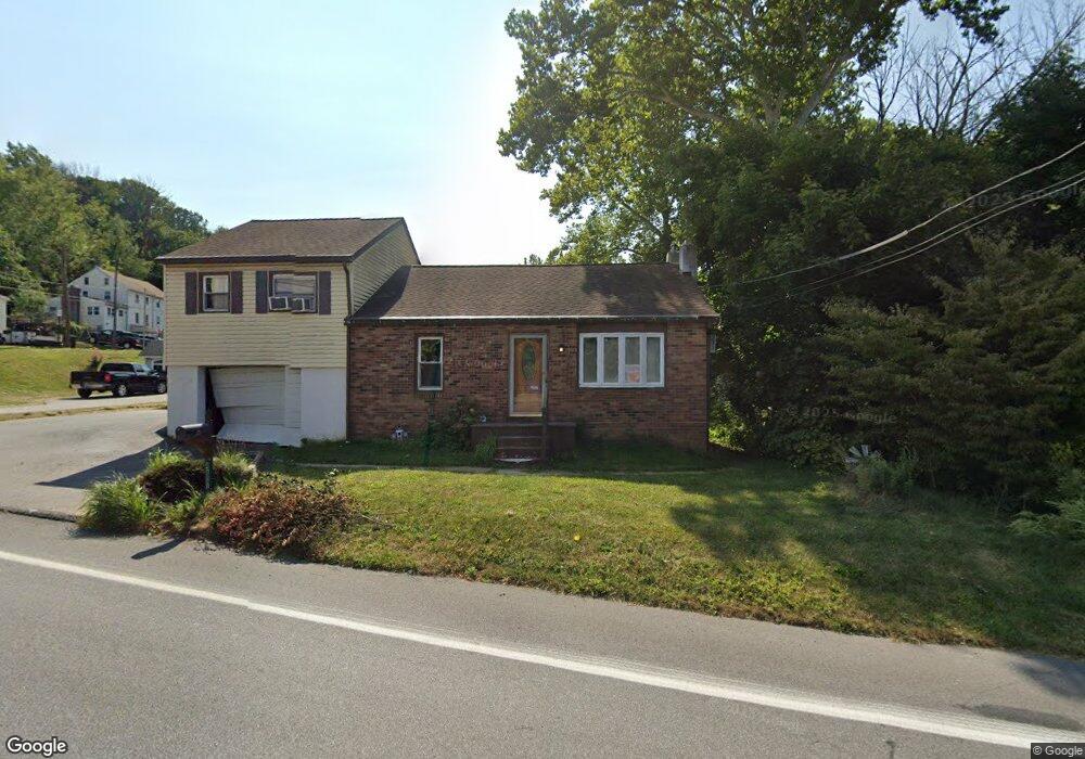
804 Birney Hwy Aston, PA 19014
Estimated Value: $354,502 - $400,000
3
Beds
2
Baths
1,570
Sq Ft
$241/Sq Ft
Est. Value
About This Home
This home is located at 804 Birney Hwy, Aston, PA 19014 and is currently estimated at $377,626, approximately $240 per square foot. 804 Birney Hwy is a home located in Delaware County with nearby schools including The Christian Academy.
Ownership History
Date
Name
Owned For
Owner Type
Purchase Details
Closed on
Jul 27, 2017
Sold by
Cannon Dennis H and Cannon Carol A
Bought by
Powell Robert
Current Estimated Value
Home Financials for this Owner
Home Financials are based on the most recent Mortgage that was taken out on this home.
Original Mortgage
$208,550
Outstanding Balance
$173,642
Interest Rate
3.88%
Mortgage Type
New Conventional
Estimated Equity
$203,984
Purchase Details
Closed on
Apr 28, 1966
Bought by
Cannon Dennis H and Cannon Carol A
Create a Home Valuation Report for This Property
The Home Valuation Report is an in-depth analysis detailing your home's value as well as a comparison with similar homes in the area
Home Values in the Area
Average Home Value in this Area
Purchase History
| Date | Buyer | Sale Price | Title Company |
|---|---|---|---|
| Powell Robert | $215,000 | None Available | |
| Cannon Dennis H | $13,900 | -- |
Source: Public Records
Mortgage History
| Date | Status | Borrower | Loan Amount |
|---|---|---|---|
| Open | Powell Robert | $208,550 |
Source: Public Records
Tax History Compared to Growth
Tax History
| Year | Tax Paid | Tax Assessment Tax Assessment Total Assessment is a certain percentage of the fair market value that is determined by local assessors to be the total taxable value of land and additions on the property. | Land | Improvement |
|---|---|---|---|---|
| 2025 | $5,143 | $198,210 | $50,590 | $147,620 |
| 2024 | $5,143 | $198,210 | $50,590 | $147,620 |
| 2023 | $4,913 | $198,210 | $50,590 | $147,620 |
| 2022 | $4,737 | $198,210 | $50,590 | $147,620 |
| 2021 | $7,311 | $198,210 | $50,590 | $147,620 |
| 2020 | $4,519 | $110,640 | $31,170 | $79,470 |
| 2019 | $4,432 | $110,640 | $31,170 | $79,470 |
| 2018 | $4,244 | $110,640 | $0 | $0 |
| 2017 | $4,154 | $110,640 | $0 | $0 |
| 2016 | $607 | $110,640 | $0 | $0 |
| 2015 | $620 | $110,640 | $0 | $0 |
| 2014 | $620 | $110,640 | $0 | $0 |
Source: Public Records
Map
Nearby Homes
- 21 Hoag Ln
- 21 Eusden Dr
- 220 Spring Valley Way
- 505 Schick Rd
- 305 Crozerville Rd
- 21 Cathy Ln
- 214 Bishop Dr
- 213 Bishop Dr
- 48 Bishop Dr
- 198 Bishop Dr
- 103 Valleybrook Rd
- 108 Grace Ln
- 3 Rolling Heights Ln
- 887 Red Hill Rd
- 2370 Crestview Ln
- 216 Park Dr
- 268 Miley Rd Unit 268
- 8 Travelo Ln
- 2300 Overlook Dr
- 184 Fifth Ave
- 804 Birney Hwy
- 4641 Aston Mills Rd
- 4230 Aston Mills Rd
- 4080 Mount Rd
- 2 Hoag Ln
- 807 Maple Ln
- 4 Hoag Ln
- 803 Maple Ln
- 6 Hoag Ln
- 8 Hoag Ln
- 4081 Mount Rd
- 806 Maple Ln
- 10 Hoag Ln
- 0 Maple Ln Unit 1000376293
- 0 Maple Ln Unit 1007328092
- 0 Maple Ln Unit 1006961380
- 0 Maple Ln Unit 7092825
- 0 Maple Ln Unit 5861269
- 0 Maple Ln Unit 6075494
- 0 Maple Ln Unit 6316091