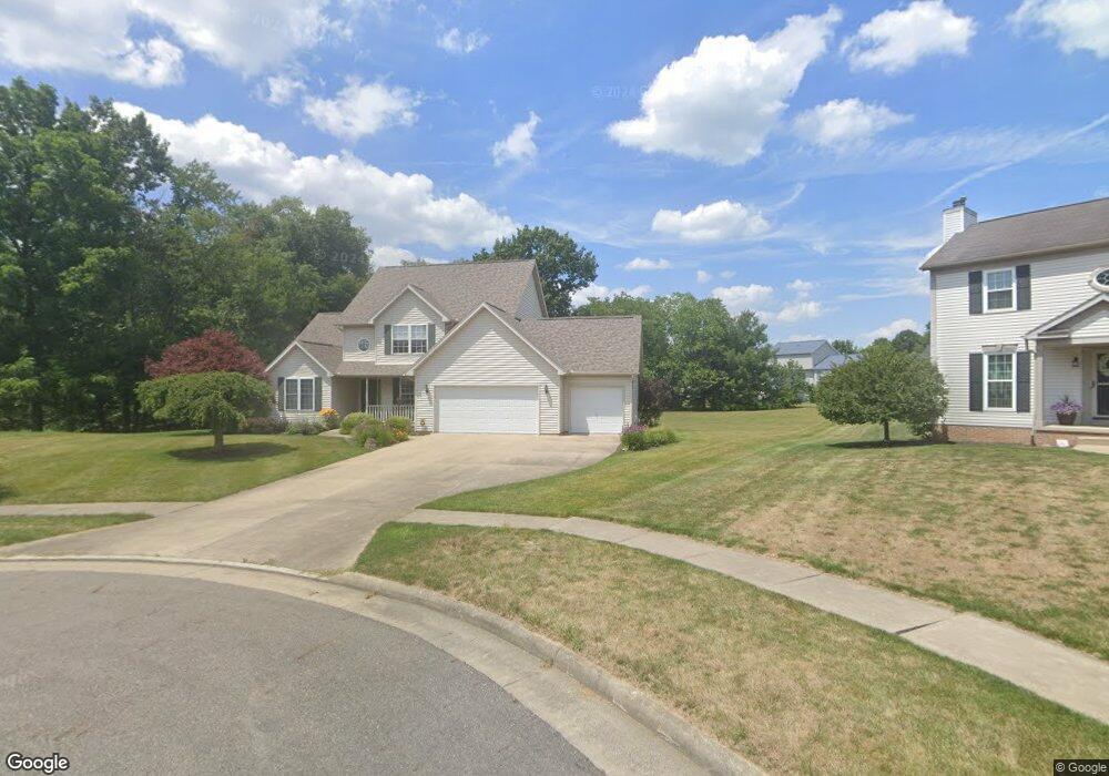
805 Crosswyck Cir Louisville, OH 44641
Estimated Value: $324,000 - $410,000
3
Beds
3
Baths
2,667
Sq Ft
$138/Sq Ft
Est. Value
About This Home
This home is located at 805 Crosswyck Cir, Louisville, OH 44641 and is currently estimated at $367,234, approximately $137 per square foot. 805 Crosswyck Cir is a home located in Stark County with nearby schools including Louisville High School and St. Thomas Aquinas High School & Middle School.
Ownership History
Date
Name
Owned For
Owner Type
Purchase Details
Closed on
Apr 19, 2005
Sold by
Lawrentz David K and Lawrentz Darla K
Bought by
Lawrentz David K and Lawrentz Darla K
Current Estimated Value
Purchase Details
Closed on
Aug 31, 1999
Sold by
Mckinley Development Company
Bought by
Lawrentz David K and Lawrentz Darla K
Home Financials for this Owner
Home Financials are based on the most recent Mortgage that was taken out on this home.
Original Mortgage
$167,700
Interest Rate
7%
Mortgage Type
Construction
Create a Home Valuation Report for This Property
The Home Valuation Report is an in-depth analysis detailing your home's value as well as a comparison with similar homes in the area
Home Values in the Area
Average Home Value in this Area
Purchase History
| Date | Buyer | Sale Price | Title Company |
|---|---|---|---|
| Lawrentz David K | -- | -- | |
| Lawrentz David K | $39,500 | -- |
Source: Public Records
Mortgage History
| Date | Status | Borrower | Loan Amount |
|---|---|---|---|
| Previous Owner | Lawrentz David K | $167,700 |
Source: Public Records
Tax History Compared to Growth
Tax History
| Year | Tax Paid | Tax Assessment Tax Assessment Total Assessment is a certain percentage of the fair market value that is determined by local assessors to be the total taxable value of land and additions on the property. | Land | Improvement |
|---|---|---|---|---|
| 2025 | -- | $131,360 | $37,840 | $93,520 |
| 2024 | -- | $131,360 | $37,840 | $93,520 |
| 2023 | $3,701 | $95,310 | $24,890 | $70,420 |
| 2022 | $3,726 | $95,310 | $24,890 | $70,420 |
| 2021 | $3,736 | $95,310 | $24,890 | $70,420 |
| 2020 | $3,043 | $85,330 | $22,400 | $62,930 |
| 2019 | $3,056 | $88,480 | $22,400 | $66,080 |
| 2018 | $3,169 | $88,480 | $22,400 | $66,080 |
| 2017 | $2,829 | $77,430 | $17,580 | $59,850 |
| 2016 | $2,887 | $77,430 | $17,580 | $59,850 |
| 2015 | $2,896 | $77,430 | $17,580 | $59,850 |
| 2014 | $781 | $70,080 | $15,900 | $54,180 |
| 2013 | $1,395 | $70,080 | $15,900 | $54,180 |
Source: Public Records
Map
Nearby Homes
- 910 Crosswyck Cir
- 1170 Winding Ridge Ave
- 316 E Reno Dr
- 428 Honeycrisp Dr NE
- 3047 Mcintosh Dr NE
- 432 Honeycrisp Dr NE
- 2962 Mcintosh Dr NE
- 2963 Mcintosh Dr NE
- 430 Honeycrisp Dr NE
- 2957 Mcintosh Dr NE
- 5474 Ravenna Ave
- 325 Lincoln Ave
- 0 Michigan Blvd
- 524 Glenbar St
- 300 Kennedy St
- 614 Reno Dr
- 0 Glenbar St
- 0 Brookridge Ave
- 308 Superior St
- 3580 Brookridge Ave Lot 15
- 811 Crosswyck Cir
- 800 Crosswyck Cir
- 824 E Reno Dr
- 819 Crosswyck Cir
- 812 E Reno Dr
- 802 E Reno Dr
- 806 Crosswyck Cir
- 814 Crosswyck Cir
- 905 Crosswyck Cir
- 722 E Reno Dr
- 902 Crosswyck Cir
- 1004 E Reno Dr
- 714 E Reno Dr
- 917 Crosswyck Cir
- 911 E Reno Dr
- 903 Reno Dr
- 704 E Reno Dr
- 1222 Falling Brook Cir
- 825 E Reno Dr
- 923 E Reno Dr